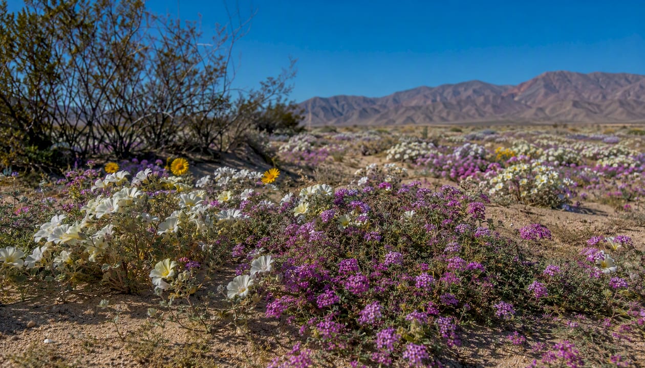
Yes, Anza Borrego wildflowers are putting on a real show right now. Following regional winter storms, California State Parks confirmed a moderate-to-strong bloom across Anza-Borrego Desert State Park in 2026, with localized displays that range from spectacular to quiet depending on exactly where you stand. The desert doesn’t bloom uniformly — it blooms in patches, and knowing which patches to hit makes all the difference.
Your top spots to visit right now:
- Henderson Canyon Road — dense sand verbena and dune evening primrose; arrive before 9 AM or after 4 PM for the primrose
- Di Giorgio Road — reliable desert sunflower and verbena carpets along a paved, easy-access route
- Palm Canyon trailhead (Borrego Springs) — good mix of species within a short walk; accessible parking
- Culp Valley — quieter, higher elevation, and often blooming when lower elevations have already peaked
Before you leave home, do these three things:
- Check the Anza-Borrego Foundation’s live wildflower map for volunteer-scout updates posted within the last 48 hours
- Pull up Borregowildflowers for species-by-location notes and road conditions
- Download an offline map tile for the park — cell signal drops fast once you leave Borrego Springs
Key Takeaways
The single most important thing to know: Anza-Borrego wildflower displays in 2026 are real and worth visiting, but they are localized, not park-wide, so checking a live report within 48 hours of your visit is non-negotiable.
| Point | Details |
|---|---|
| Check live sources first | Use the ABF wildflower map and BorregoWildflowers.org within 48 hours of your visit for current conditions. |
| Best road to start with | Henderson Canyon Road consistently delivers dense sand verbena and dune evening primrose; arrive before 9 AM. |
| Bloom timing is rain-dependent | Peak season ranges from mid-February to mid-March in most years, but annual moisture and temperature patterns determine exact timing and duration. |
| Protect what you came to see | Stay on roads and pullouts; stepping into flower fields damages the plants and seeds for future seasons. |
| Socalsights desert guides | The Socalsights daycation page offers ready-made Southern California desert itineraries for every visitor type. |
Table of Contents
- How to check live Anza Borrego wildflower bloom status
- Maps to use before and during your visit
- Best spots for viewing Anza Borrego desert flowers
- Common species to expect and when they bloom
- How to visit responsibly and stay safe
- Sample itineraries from Borrego Springs
- Why bloom timing varies and how long displays last
- How to follow community reports and contribute your own observations
- Sources
How to check live Anza Borrego wildflower bloom status
Not all bloom reports are created equal. A social media post from three weeks ago tells you almost nothing about what’s flowering today, because a single warm week can push a peak display into rapid decline. You want date-stamped, location-specific reports from people who were actually there.
Here are the sources worth trusting, ranked by how current and specific they tend to be:
Anza-Borrego Foundation (ABF): The ABF wildflower page is the gold standard. Volunteer flower scouts submit field notes with dates, GPS-referenced locations, and species lists. The interactive map layer shows pins for recent sightings, and the Foundation updates it regularly during peak season. Cross-referencing two or three scout reports from the same week gives you a reliable picture.
BorregoWildflowers.org: This site publishes ongoing bloom reports with species-by-location breakdowns and road-condition notes. It’s particularly useful for figuring out which roads are passable after rain and which specific washes are showing color.
tchester.org bloom reports: Paul Chester’s 2025–2026 bloom report archive documents trip-by-trip observations with species counts. Early-2026 reports logged dozens to nearly two hundred species in bloom across individual hikes, which illustrates just how much site-level variation exists within the same park on the same day.
iNaturalist: Filter observations by location (Anza-Borrego Desert State Park) and date range (last 7–14 days) to see what’s been photographed and identified recently. The map layer shows exactly where each observation was recorded.
California State Parks: The parks.ca.gov wildflower page posts park-level bloom status and links to official maps. It’s broader than the ABF or BorregoWildflowers reports but useful for a quick sanity check.
One thing worth understanding: microclimates inside Anza-Borrego vary dramatically. A canyon on the park’s west side might be at peak while a wash five miles east is already past. Park interpreters and botanists caution against expecting a uniform, park-wide superbloom — even in a strong year, the displays are localized. Real-time local reports beat any seasonal generalization.
Pro Tip: Set a bookmark for the ABF wildflower page and check it the morning you plan to leave. Scout updates posted within 24–48 hours are far more reliable than anything published a week prior, especially once temperatures start climbing in March.
Maps to use before and during your visit
Getting lost in Anza-Borrego is easier than it sounds. The park covers over 600,000 acres, cell signal is patchy at best outside Borrego Springs, and some of the best flower roads are unsigned dirt washes. Load your maps before you go.
Getting the right maps:
- ABF Interactive Wildflower Map — Go to the Anza-Borrego Foundation wildflower page and open the interactive map. It shows volunteer-reported bloom locations as pins with dates and species notes. Zoom in on Henderson Canyon Road and Di Giorgio Road first.
- ABDNHA Printable Flower Map — The Anza-Borrego Desert Natural History Association (ABDNHA) publishes a downloadable PDF flower map at abdnha.org. Print it before you leave. It shows named roads, washes, and key pullouts — invaluable when your phone dies.
- iNaturalist Map Layer — On the iNaturalist app or website, search “Anza-Borrego Desert State Park,” switch to the map view, and filter by date (last 14 days). Each pin represents a photographed, identified observation. Tap any pin to see the species, date, and exact coordinates.
- Google Maps or Gaia GPS offline tiles — Before leaving home, download offline map tiles for the Borrego Springs area. Gaia GPS is especially useful for backcountry roads because it includes USGS topo layers and lets you drop custom waypoints.
Offline navigation tips:
- Screenshot the GPS coordinates for key pullouts (Henderson Canyon Road flower fields, Di Giorgio Road at S22, Fish Creek Wash entrance) and save them to your phone’s notes app
- Note which roads require high clearance — some washes are only accessible in dry conditions
- Tell someone your planned route before heading into remote areas; the park has limited ranger coverage on backcountry roads
Safety note: Roads like Fish Creek Wash and Split Mountain can flood quickly after rain and may be impassable for standard vehicles. Always check road conditions through the BorregoWildflowers.org report or the park visitor center before driving into washes.
Best spots for viewing Anza Borrego desert flowers
Every location below has its own personality. Some are easy paved-road drives you can do in flip-flops; others reward the extra effort with fewer crowds and more unusual species. Here’s what to expect at each one.
Henderson Canyon Road Flower Fields
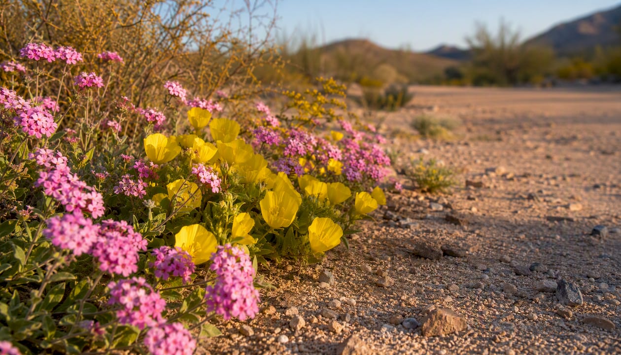
This is the most reliably photogenic spot in the park during a good bloom year. Henderson Canyon Road hosts dense stands of desert sand verbena, dune evening primrose, and desert sunflower, often carpeting the sandy flats on both sides of the road. The road is paved and accessible to all vehicles. Arrive before 9 AM to catch the dune evening primrose fully open — it closes in the heat of midday. Parking is along the road shoulder; weekends fill up fast, so a weekday morning visit is worth the effort.
Di Giorgio Road
Running south off Highway 78, Di Giorgio Road offers another reliable concentration of sand verbena and desert sunflower. The surface is paved and flat, making it one of the most accessible routes for families and visitors with limited mobility. Pullouts along the road let you step out and photograph without hiking. This road tends to be slightly less crowded than Henderson Canyon on peak weekends.
Palm Canyon trailhead (Borrego Springs)
The Palm Canyon trailhead sits just outside Borrego Springs and gives you a mix of desert floor species within the first half-mile of the trail. You’ll find brittlebush, desert sunflower, and occasional lupines near the trailhead parking area. The trail itself is moderate (roughly 3 miles round trip to the palm grove), but the flower viewing starts immediately. Wheelchair-accessible viewing is available near the parking area and along the first flat section of the trail.
Pro Tip: The trailhead parking lot fills by 8 AM on busy weekends. If you arrive after 9 AM on a Saturday, park along the road and walk in — it adds maybe five minutes and saves a lot of frustration.
Culp Valley
At roughly 3,400 feet elevation, Culp Valley blooms later than the desert floor and often shows color when lower elevations have already peaked. Expect phacelia, lupines, and desert apricot. The road to Culp Valley is paved (S22/Montezuma Grade), and there’s a small primitive campground. It’s a genuinely quieter alternative when Henderson Canyon is packed.
Fish Creek Wash
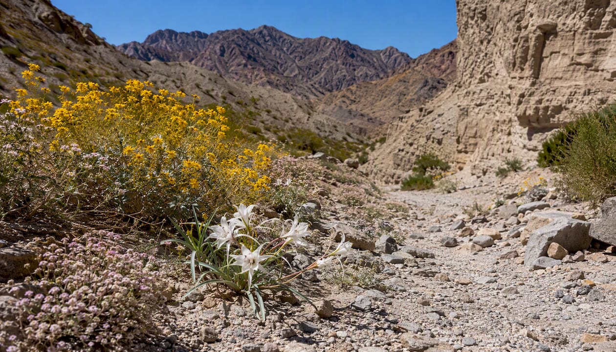
Fish Creek is a high-clearance, four-wheel-drive route through a dramatic canyon. During a strong bloom year, the wash floor can show desert lilies, sand verbena, and brittlebush. The payoff is real, but so is the commitment: the road is a sandy, rocky wash that requires a capable vehicle and should not be attempted after rain. Check road conditions before you go.
Montezuma Grade and Split Mountain
Driving up Montezuma Grade (S22) on the way to or from Culp Valley gives you sweeping views of the desert floor below, often carpeted in yellow and purple during peak bloom. Split Mountain Road (off Highway 78 near Ocotillo Wells) leads into a geological wonderland with wildflowers in the wash and canyon walls. Both routes are scenic drives worth building into a two-day itinerary.
Ocotillo Wells and Imperial Sand Dunes area
The Ocotillo Wells State Vehicular Recreation Area sits on the park’s eastern edge and shows a different character than the main park. Dune evening primrose and sand verbena thrive in the sandy substrate here. The area is also popular with off-road vehicles, so expect noise and activity on weekends. Early weekday mornings are the quietest.
- Wheelchair access: Di Giorgio Road pullouts, Henderson Canyon Road shoulder, and the Palm Canyon trailhead flat section offer the most accessible viewing without hiking
- Crowd tip: Weekday visits between Tuesday and Thursday consistently see lighter traffic than Saturday and Sunday, especially during peak bloom weeks
Common species to expect and when they bloom
Knowing what you’re looking at makes the whole experience richer. Here’s a quick rundown of the species you’re most likely to encounter, along with rough bloom windows and ID cues.
| Species | Color | Typical Bloom Window | Quick ID Tip |
|---|---|---|---|
| Desert sand verbena (Abronia villosa) | Purple/pink | February–April | Low-growing, sticky stems; clusters of small tubular flowers |
| Dune evening primrose (Oenothera deltoides) | White | February–April | Large white flowers; open in cool hours, close midday |
| Desert sunflower (Geraea canescens) | Bright yellow | February–May | Tall, upright; classic sunflower shape with rough leaves |
| Desert lily (Hesperocallis undulata) | White | February–April | Tall stalk; wavy-edged leaves; fragrant |
| Brittlebush (Encelia farinosa) | Yellow | February–May | Silvery-gray leaves; yellow daisy-like flowers on bare stems |
| Parish’s poppy (Eschscholzia parishii) | Yellow-orange | March–May | Smaller than California poppy; feathery blue-green leaves |
| Lupine (Lupinus spp.) | Purple/blue | February–April | Palmate leaves; pea-flower spikes |
| Ocotillo (Fouquieria splendens) | Red-orange | March–June | Tall spiny canes; bright red flower clusters at tips |
A few things worth knowing about timing and behavior:
- Dune evening primrose is a night bloomer. The flowers open in the cool of evening and early morning, then close as temperatures rise. Photographers and observers should plan early or late visits to catch them fully open.
- Desert lily tends to bloom earlier in the season and can be missed if you visit in late March or April during a warm year.
- Ocotillo blooms later than most annuals and often shows red flower clusters well into spring, even when the annual carpet has faded.
- Brittlebush is one of the most forgiving species — it blooms reliably across a wide range of conditions and is often the last thing still showing color.
For field identification, the iNaturalist app’s camera-based ID feature works well for common desert species. The Jepson eFlora (online) and the Audubon Society Field Guide to California are solid references for deeper ID work.
The 2025–2026 season illustrated just how much site-level variation exists: individual trip reports documented dozens to nearly two hundred species in bloom on single hikes, depending on location and timing within the season.
How to visit responsibly and stay safe
The desert looks tough, but it’s genuinely fragile. A single footstep through a patch of sand verbena can crush dozens of seedlings. Here’s how to enjoy the flowers without wrecking them for the next person — or the next decade.
Essential safety checklist:
- Water: Carry at least one gallon per person per day. The desert is dry and deceptively warm, even in February and March.
- Sun protection: Sunscreen, a wide-brim hat, and UV-blocking sunglasses. Desert sun reflects off sand and hits harder than you expect.
- Footwear: Closed-toe shoes for any trail or wash walking. Sandals are fine for paved-road viewing.
- Navigation: Download offline maps before leaving Borrego Springs. Don’t rely on cell signal in the backcountry.
- First aid kit: Basic kit plus blister care. Cholla cactus spines are a real hazard on desert trails.
Leave No Trace rules for wildflower viewing:
- Stay on established roads, trails, and designated pullouts. Stepping into flower fields to get a better photo kills the plants you came to see.
- Never pick flowers. It’s illegal in the state park and removes seeds that would otherwise germinate next season.
- Pack out all trash, including food scraps. Ravens and coyotes associate human food with humans, which creates problems for both.
- If you’re photographing, use a telephoto lens rather than walking into a display to get close.
Vehicle and road notes:
- Paved roads (Henderson Canyon, Di Giorgio, S22/Montezuma Grade) are accessible to all vehicles.
- Sandy washes (Fish Creek, parts of Ocotillo Wells) require high clearance and ideally four-wheel drive.
- After significant rain, washes can flood and remain impassable for 24–48 hours. Check conditions before driving into any wash.
- Park in designated pullouts or on the road shoulder where it’s wide enough. Driving off-road to park damages vegetation.
Regulatory notes: Drones require a permit in California State Parks and are generally not allowed over sensitive natural areas. Pets must be on a leash at all times and are not permitted on most backcountry trails. Collecting plants, rocks, or animals is prohibited.
Sample itineraries from Borrego Springs
Whether you have one day or two, here’s a practical framework to work from. Adjust based on the current bloom report before you leave.
One-day drive-and-walk itinerary:
- 6:30 AM: Leave Borrego Springs heading west on Henderson Canyon Road. Catch dune evening primrose fully open in the cool morning air. Spend 45–60 minutes here.
- 8:00 AM: Drive south to Di Giorgio Road. Walk the road shoulder for desert sunflower and verbena. Easy, flat, no hiking required.
- 9:30 AM: Head to Palm Canyon trailhead. Walk the first mile of the trail for brittlebush, lupines, and desert sunflower. Return before midday heat.
- 11:30 AM: Lunch in Borrego Springs (Christmas Circle area has a few options).
- 1:00 PM: Drive S22 up Montezuma Grade for sweeping views of the desert floor. Stop at Culp Valley if you want a quieter, higher-elevation alternative.
- 3:30 PM: Return to Henderson Canyon Road for late-afternoon light and a second look at the primrose as it reopens.
Two-day option:
- Day 1: Follow the one-day itinerary above, then camp at Borrego Palm Canyon Campground or stay in Borrego Springs.
- Day 2 morning: Drive to Fish Creek Wash (high-clearance vehicle required) for desert lilies and a less-visited canyon experience. Check road conditions the night before.
- Day 2 afternoon: Head to Ocotillo Wells for dune evening primrose in sandy substrate. Look for ranger-led programs at the visitor center — the park occasionally schedules wildflower walks during peak season.
Pro Tip: Fuel up in Borrego Springs before heading to Fish Creek or Ocotillo Wells. Gas stations are sparse east of town, and you don’t want to be calculating range on a remote wash road.
For families and limited-mobility visitors: Di Giorgio Road and the Henderson Canyon Road shoulder are the most accessible options. Both are paved, flat, and require no hiking. The Palm Canyon trailhead parking area also offers good viewing without committing to the full trail.
Why bloom timing varies and how long displays last
The flowers don’t read the calendar. They respond to rain, temperature, and seed bank conditions that shift every year — sometimes every week. Understanding the basic mechanics helps you set realistic expectations.
Wildflower season in Anza-Borrego generally runs from late winter into early spring, with peak blooms most often falling between mid-February and mid-March, though timing can shift substantially depending on the year. A wet October and November followed by warm January temperatures can push the peak earlier. A dry fall followed by February rains can delay it. And once temperatures consistently hit the mid-80s, many annuals shift energy from flowering to seed production, shortening the display window fast.
The seed bank is the key variable. Desert annuals can lie dormant for years, waiting for the right combination of moisture and temperature to germinate. A single good rain year doesn’t guarantee a superbloom — the seeds need the right timing, the right soil temperature, and the right follow-up conditions. Park interpreters and botanists emphasize that a true superbloom requires a specific alignment of robust rainfall and favorable temperatures, and even in strong years, displays are typically localized rather than park-wide.
Blooms also unfold in waves. Early-season species like desert lily and sand verbena often peak in February, while brittlebush and Parish’s poppy can carry color into April. A two-day visit will almost always reveal more variety than a single-day snapshot.
- A hot spell in late February or early March can collapse a peak display within days
- Subsequent rain after an initial bloom can trigger a second wave of germination in some areas
- Higher-elevation spots like Culp Valley tend to bloom later and hold color longer than the desert floor
Pro Tip: If you’re visiting in late March and worried you’ve missed the peak, head uphill. Culp Valley and the Montezuma Grade corridor often show color two to three weeks after the desert floor has faded.
How to follow community reports and contribute your own observations
The bloom-tracking community around Anza-Borrego is genuinely active and generous. Here’s how to plug in and give back.
Following live reports:
- iNaturalist: Go to inaturalist.org, search “Anza-Borrego Desert State Park,” and switch to the map view. Filter by date (last 7 days works well during peak season) to see recent observations. Each pin shows the species, date, photo, and coordinates. The iNaturalist calendar and observation layers update in near-real time as community members upload sightings.
- ABF volunteer scouts: The Anza-Borrego Foundation coordinates a network of volunteer flower scouts who submit field notes during bloom season. You can follow their updates on the ABF website and social channels.
- BorregoWildflowers.org: Check the bloom report page for species-by-location updates and route notes. This site also aggregates community reports.
- Local Facebook groups: Search “Anza-Borrego wildflowers” on Facebook. Several active groups post daily photos and location updates during peak season. Quality varies, but the volume of recent posts gives you a quick read on current conditions.
Submitting your own observations:
- Download the iNaturalist app before your visit. When you photograph a flower, tap “Observe,” upload the photo, and let the AI suggest an ID. Confirm or correct it, add a location, and submit.
- Be specific with location notes. A pin dropped at the exact pullout where you saw a species is far more useful than a general “Henderson Canyon Road” tag.
- Ethics note on geotagging rare plants: For sensitive or rare species (desert lily populations, rare orchids), consider withholding the precise GPS coordinates in your public post. iNaturalist has an “obscure location” setting for exactly this purpose. Dense foot traffic to a rare plant location can damage it quickly.
- To send updates directly to the ABF or BorregoWildflowers.org, check each site’s contact page for submission instructions during bloom season.
How this guide was put together
This guide draws on a combination of official park sources, community science platforms, and field-observer reports cross-checked for consistency and recency.
Primary sources consulted:
- Anza-Borrego Foundation wildflower page — volunteer scout updates and interactive map
- Borregowildflowers — species-by-location field notes and road conditions
- Tchester — trip-by-trip observation logs
- California State Parks wildflower page — official park-level bloom status and maps
- iNaturalist observation data — date-filtered community sightings
- BorregoWildflowers.org flower locations — named viewing areas and species notes
- Times of San Diego coverage — park interpreter and botanist commentary on superbloom terminology
- NBC Los Angeles 2026 bloom report — media corroboration of current-season displays
On-the-ground bloom reports and media coverage were cross-checked against each other before publication. Where sources disagreed on species timing or road conditions, the more conservative, date-stamped field report was used.
A note on prediction: No guide can tell you exactly what will be blooming when you arrive. Desert conditions shift fast. Check at least two live sources (ABF and BorregoWildflowers.org) within 48 hours of your visit, and treat any report older than one week as background context rather than current fact.
What I’d tell a friend heading out there this week
The thing most visitors get wrong about Anza-Borrego is treating it like a theme park with a guaranteed show. The desert doesn’t owe you a superbloom. But here’s what I’ve found: even in a “moderate” year, if you show up at Henderson Canyon Road before 8 AM on a weekday, you’ll see something that stops you in your tracks. The light is low, the primrose is wide open, and there’s a good chance you’ll have the road mostly to yourself.
My honest local tip: skip the Instagram-famous pullouts on Saturday afternoon and drive out to Culp Valley instead. The elevation means cooler air, different species, and a fraction of the crowd. Phacelia and lupines up there can be stunning well into late March when the desert floor has already gone quiet.
Plan your SoCal desert adventure with Socalsights
Anza-Borrego is one of Southern California’s most rewarding day trips, and Socalsights has the curated resources to help you make the most of it. From printable SoCal itineraries covering the best desert drives to a full SoCal adventure overview with activity picks for every type of traveler, Socalsights cuts through the noise so you spend less time planning and more time out there.

Whether you’re a first-timer figuring out which road to take or a returning visitor looking for a quieter canyon, the Socalsights guides give you locally sourced, specific recommendations you won’t find in a generic travel roundup. Head to the Socalsights daycation page to find a ready-made desert day trip plan built around your timeline.
Sources
- Flower locations – Anza Borrego Desert Wildflowers
- Wildflowers | Anza Borrego Foundation
- Bloom report out of the Anza-Borrego Desert
- Bloom Reports from the Anza-Borrego Desert: 2025-2026
- Parks
- Is a superbloom coming? Why San Diego’s desert wildflowers won’t be rushed
- Anza-Borrego state park experiencing wildflower super bloom – NBC Los Angeles
- iNaturalist calendar observations