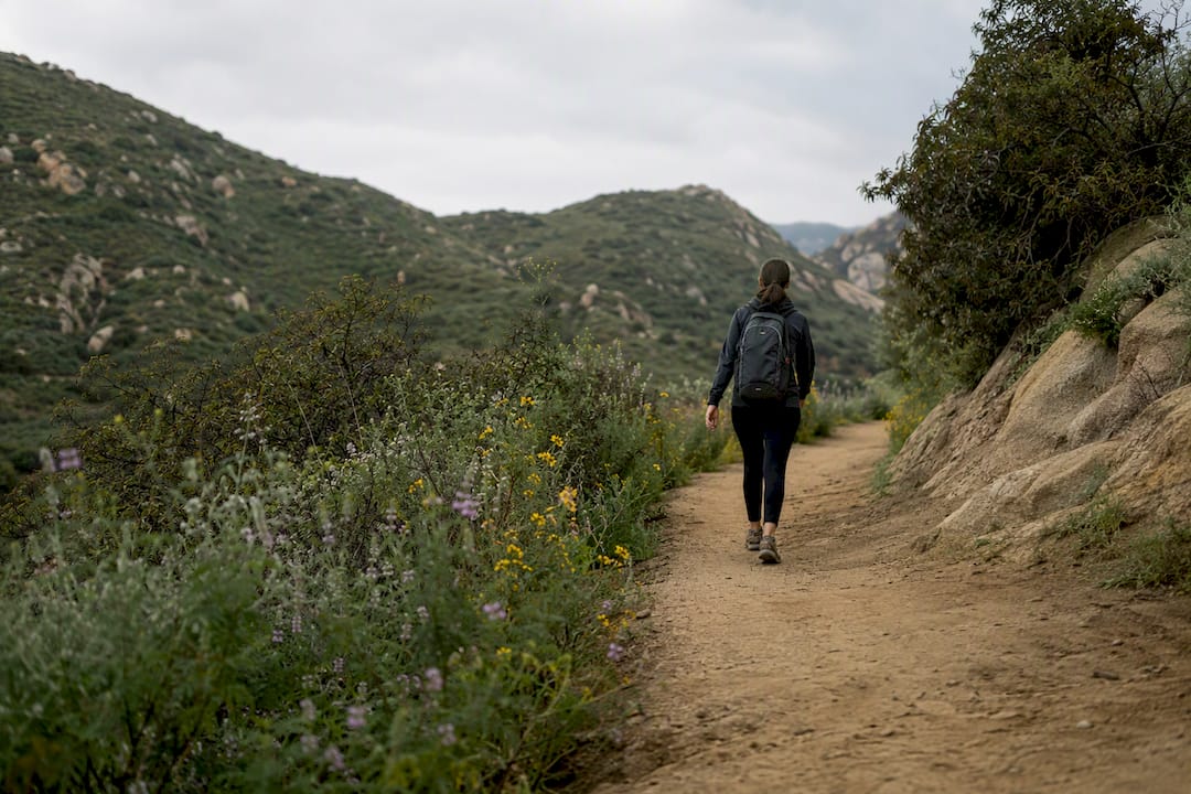
If you want quick city views without much effort, head to Griffith Park (3 to 6 miles, easy to moderate). If waterfalls are the goal, Eaton Canyon or Sturtevant Falls deliver, both easy to moderate and family-friendly. For a serious wilderness river adventure, Bridge to Nowhere is the pick. And if you want to stand on top of something, Mount Baldy gets you above 10,000 feet.
That’s the shortlist. Los Angeles hiking trails span two completely different mountain systems, which is why the “best hike” question doesn’t have one answer. The San Gabriel Mountains to the east hold alpine terrain that tops out over 10,000 feet at Mount Baldy, while the Santa Monica Mountains to the west offer lower, coastal ridge trails like Runyon Canyon and the paths to the Hollywood Sign. Same city, wildly different hikes.
Here’s the quick-reference version before we get into the details:
- Griffith Park — best for quick city views, 3 to 6 miles, easy to moderate
- Runyon Canyon — best for dog walks and sunset views, under 3 miles, easy
- Eaton Canyon Falls — best waterfall for beginners, 3.5 miles, easy to moderate
- Sturtevant Falls — best waterfall with a real forest feel, 3.5 miles, easy to moderate
- Echo Mountain — best ruins-and-views combo, 5.4 miles, moderate
- Malibu Creek State Park — best for varied terrain and shade, 4 to 7 miles, moderate
- Mount Baldy — best alpine summit, 10.7+ miles, hard
Before any of these, check current trail status. Fire damage and seasonal creek flow close sections of the Angeles National Forest every year, sometimes with little warning.
TL;DR:
- Most LA hikes vary greatly in difficulty, with Baldy demanding at least 6 to 9 hours and proper winter gear for snow and ice.
- Trail conditions frequently change due to fires, storms, or maintenance, making it essential to verify alerts before heading out.
- Parking is often the biggest challenge at popular trailheads like Runyon and Griffith, requiring early arrival or alternative drop-off options.
- Waterfalls like Eaton Canyon and Sturtevant Falls are seasonal, flowing best from late winter through spring, depending on rainfall.
- Short trails like Runyon and Eaton Canyon are perfect for quick after-work outings, while Baldy and Bridge to Nowhere suit experienced hikers aiming for longer, strenuous days.
Table of Contents
- Easy Hikes Los Angeles Hikers Can Do With Almost No Planning
- Moderate Hikes Los Angeles Hikers Pick for a Real Workout
- Hard Hikes and Alpine Objectives for Serious Days Out
- How to Pick the Right LA Hike for Your Day
- Checking Trail Status, Closures, and Permits Before You Go
- Getting to Popular Trailheads Without Losing Your Morning to Parking
- What to Pack for LA Trails by Season
- Why Trust SoCal Sights for LA Trail Guidance
- Ready to Explore More of Southern California?
- What I’d Actually Tell a First-Time LA Hiker
- Key Takeaways
- Sources
Easy Hikes Los Angeles Hikers Can Do With Almost No Planning
These are the trails you can do on a Tuesday afternoon after work, or bring visiting relatives to without worrying about anyone bailing halfway up.
1. Griffith Park (Mount Hollywood and Wisdom Tree)
Griffith Park is the default answer to “hikes Los Angeles” for a reason: it’s massive, centrally located, and flexible enough for a 30 minute stroll or a half day loop. The Mount Hollywood Trail runs about 3 miles round trip and takes 1.5 to 2 hours, a moderate climb that rewards you with a rare unobstructed view of the Griffith Observatory and the skyline beyond it. If you want more distance, the Hollywood Sign via Canyon Drive route stretches to roughly 6 miles and 3 to 3.5 hours, and it’s technically moderate rather than easy because the elevation gain, not the mileage, is what gets people breathing hard.
The Wisdom Tree hike up to Cahuenga Peak is a shorter alternate that starts from the top of Lake Hollywood Park and gets you a solitary, wind-bent pine at the summit with a 360 degree view. Parking near the main Fern Dell or Observatory entrances fills up by mid-morning on weekends.
2. Runyon Canyon Park
Runyon is the city’s off-leash hiking spot, and it earns that reputation. The full loop is a little over 3 miles, but most people do the shorter out-and-back to the summit view, which clocks in under 2 miles. It’s genuinely easy in terms of terrain, though the direct route up from the Fuller Avenue entrance has some steep, sun-exposed switchbacks that catch people by surprise.
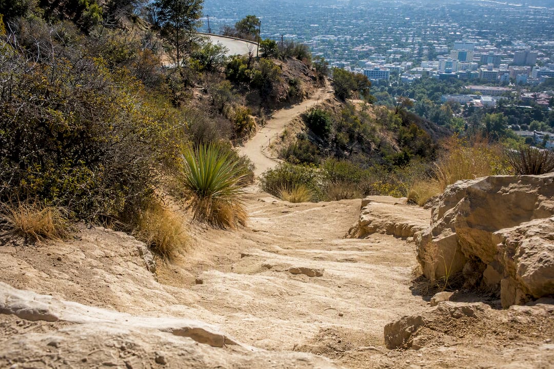
Expect crowds, always. Runyon draws a social crowd of dog owners, joggers, and influencers chasing sunset shots, so if solitude is the goal, look elsewhere. Street parking around the Fuller and Vista entrances is limited and gets ticketed aggressively, so budget extra time to circle the block.
3. Sturtevant Falls and Eaton Canyon Falls
These two waterfall hikes near Los Angeles cover the same need but sit in different canyons. Eaton Canyon Falls in Altadena is about 3.5 miles round trip with mild elevation gain, following a wide, well-shaded creek trail to a 40 foot waterfall. It’s one of the most reliable easy hikes in LA for families with younger kids, though the final approach to the falls involves some rock scrambling that gets slippery when wet.
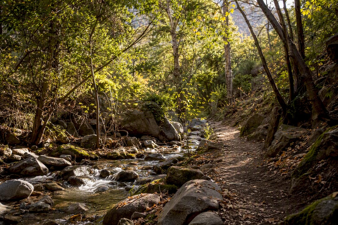
Sturtevant Falls, near Chantry Flat above Arcadia, runs a similar 3.5 miles with a slightly more forested, shaded feel thanks to the oak and alder canopy along Big Santa Anita Canyon. Both waterfalls flow best from late winter through spring; by late summer, expect a trickle rather than a cascade.
Pro Tip: Waterfall flow in Southern California depends entirely on the prior winter’s rainfall. Check a recent trip report before driving out in August or September, since a dramatic photo online might be from six months earlier.
Moderate Hikes Los Angeles Hikers Pick for a Real Workout
Once you’ve done the easy loops, these hikes step up the elevation gain while staying doable in a half day.
1. Echo Mountain (Echo Mountain Ruins)
This is one of the more underrated best hiking trails Los Angeles has to offer, because it combines exercise with actual history. The trail climbs about 1,400 feet over 2.7 miles one way (5.4 miles round trip) from the Sam Merrill Trailhead in Altadena, switchbacking up chaparral slopes to the stone ruins of a former mountaintop resort destroyed by fire in 1900. You’ll pass an old rusted railway car and the remains of a dance hall foundation, plus sweeping views over the San Gabriel Valley on a clear day.
- Distance: 5.4 miles round trip
- Elevation gain: roughly 1,400 feet
- Time: 3 to 4 hours
- Parking: free street parking near the trailhead, fills by mid-morning weekends
2. Malibu Creek State Park
Malibu Creek offers something the eastern canyons don’t: shade, water, and rock formations that feel more Central Coast than Southern California. Moderate routes here run 4 to 7 miles depending on whether you loop out to the old MAS*H filming site or just do the creek trail to Century Lake. The park charges a day-use parking fee, and rangers enforce leash rules strictly since the creek supports sensitive wildlife.
3. Eaton Canyon and Bridge to Nowhere
Beyond the easy falls hike, Eaton Canyon connects to longer routes for hikers wanting more mileage without full alpine commitment. Separately, the Bridge to Nowhere along the East Fork of the San Gabriel River deserves a mention here too, since some hikers treat its 10 mile round trip as a moderate day trip rather than a hard one, depending on pace. Multiple creek crossings mean wet feet are guaranteed, and flow levels after storms can make crossings genuinely dangerous.
- Eaton Canyon and Malibu Creek both close temporarily after heavy rain due to flooding risk
- Bridge to Nowhere requires fording the East Fork multiple times; check flow before committing
- Echo Mountain has minimal shade, so avoid midday starts in summer
Hard Hikes and Alpine Objectives for Serious Days Out
This is where Los Angeles hiking trails stop being casual and start requiring real preparation.
Mount Baldy (Mount San Antonio) is the region’s benchmark summit at 10,064 feet, and it’s genuinely a different category of hike than anything in the Santa Monica Mountains. The standard route via the ski hut trail runs about 10.7 miles round trip with roughly 3,900 feet of elevation gain; the Devil’s Backbone route from the ski lift area is longer but more exposed along a narrow ridge. Most hikers need 6 to 9 hours. Snow and ice typically coat the upper mountain from November through May, and unprepared hikers slipping on the icy summit approach account for a steady stream of mountain rescues every winter.
For those building toward something even bigger, regional guides point to San Gorgonio (11,503 feet, outside LA County proper) as the next benchmark once Baldy feels manageable. The Bridge to Nowhere, at 10 miles with river crossings, also works as a longer training day for hikers building endurance toward alpine objectives.
- Mount Baldy’s parking lot at Manker Flats fills before sunrise on fall weekends
- Winter ascents require microspikes or crampons and ideally an ice axe above the ski hut
- Start Baldy no later than 7:00 AM to avoid summit afternoon thunderstorms in summer
Pro Tip: Don’t attempt Baldy’s Devil’s Backbone in winter without traction gear. The ridge gets a reputation every year for a reason, and it’s not exaggerated.
How to Pick the Right LA Hike for Your Day
Matching the hike to your actual constraints saves you from either an underwhelming stroll or an accidental death march.
Start with three questions: how much time do you have, how much elevation gain can your legs and lungs handle, and what scenery do you actually want? A two-hour window points you toward Runyon or the Eaton Canyon Falls trail. A full day with real fitness behind you points toward Baldy or the Bridge to Nowhere.
- Short on time (under 2 hours)? Runyon Canyon or Eaton Canyon Falls.
- Want a waterfall payoff? Sturtevant Falls or Eaton Canyon, both easy to moderate.
- Want a summit and a workout? Mount Baldy, but only with proper gear and an early start.
- Bringing dogs? Runyon Canyon’s off-leash zones or Griffith Park’s fire roads.
- Want solitude over crowds? Skip Runyon entirely; longer wilderness routes like Baldy or Bridge to Nowhere thin out fast after mile two.
The real trade-off across nearly every trail on this list is crowds versus distance. The easiest, most photogenic hikes near the city center are also the most crowded, while the solitude and dramatic scenery of the San Gabriels demand more mileage and elevation than most casual hikers want to sign up for.
Checking Trail Status, Closures, and Permits Before You Go
Trail conditions in the LA area change fast, and driving 45 minutes to a closed trailhead is a common, avoidable mistake. Fire recovery, storm damage, and routine maintenance close sections of these trails without much advance notice.
Check these before leaving home:
- Angeles National Forest alerts and notices for San Gabriel Mountains closures, including Baldy and Bridge to Nowhere
- LA County’s Trails portal for maps, offline access, and general safety guidance
- Malibu Creek State Park and Topanga State Park pages for park-specific rules and day-use fees
- MRCA park listings for smaller Santa Monica Mountains parks with their own regulations
Closures usually mean one of two things: the trailhead parking lot is gated shut, or a specific section is roped off while the rest stays open. Either way, showing up without checking wastes your morning.
Safety basics that apply across almost every hike here: carry more water than you think you need, watch for rattlesnakes on sun-warmed rocks in spring and summer, never attempt a creek crossing during high flow, and tell someone your planned route and return time before you go.
Getting to Popular Trailheads Without Losing Your Morning to Parking
Parking, not the hike itself, is often the hardest part of a Runyon Canyon or Griffith Park morning. Arriving before 8:00 AM on weekends at Runyon or the Hollywood Sign trailheads is close to mandatory if you want a legal spot.
For the Griffith Observatory area, the DASH Observatory shuttle runs seasonally and removes the parking problem entirely, connecting from Vermont/Sunset in Los Feliz. If you’re rideshare dropping off, use designated drop zones rather than blocking narrow residential streets, since neighbors near Runyon and the Hollywood Sign trailheads deal with real traffic problems and call parking enforcement often. When a lot is full, don’t circle for twenty minutes; nearby alternate trailheads (Fern Dell instead of the main Observatory lot, for instance) usually have similar views with a fraction of the congestion.
What to Pack for LA Trails by Season
Your kit changes more with the season than with the trail difficulty.
- Summer: Carry 2 to 3 liters of water per person, start before 8:00 AM, and wear real sun protection, since shade is scarce on most LA hillsides
- Spring: Watch for wildflower blooms in the Santa Monica Mountains and higher creek flows after winter rain
- Winter: Layer clothing for cold summits, and bring microspikes for anything above 8,000 feet on Baldy
- Every hike: Navigation (offline map or downloaded GPS track), a basic first-aid kit, snacks, and sun protection
- Pack out everything you bring in, stay on marked trails, and give wildlife space, especially in less-trafficked canyons
Why Trust SoCal Sights for LA Trail Guidance
This guide comes from Joshua, a contributor at Socalsights with firsthand knowledge of Southern California’s trail systems and the quirks that don’t show up on a map (which lots fill first, which waterfalls dry up by July).
Socalsights builds its guides through community input, not just static rankings, pulling in real reports from locals who hike these trails regularly. If a trail closes or conditions shift, readers can share updates that keep this guide accurate for the next hiker heading out the door.
Ready to Explore More of Southern California?
Los Angeles hiking is just one slice of what this region offers, and the same instinct that makes a great trail great, something local, a little unpolished, worth the drive, applies to the food spots and day trips around it too. Socalsights curates exactly that: the 100+ SoCal Sights list rounds up hidden gems across the region for anyone planning a weekend beyond the trailhead. If you’re building a full day around your hike, the SoCal Sights Adventure Overview is a solid starting point for pairing a trail with a nearby food stop or unexpected detour.
What I’d Actually Tell a First-Time LA Hiker
Most guides to hikes in Los Angeles treat every trail like it belongs on the same list, ranked purely by popularity. That’s backward. Runyon Canyon and Mount Baldy aren’t competing for the same hiker; they’re solving completely different problems, and the conventional “top 10” format obscures that.
The bigger gap I see is in how casually people treat trail status. Fire recovery and creek flow change conditions here faster than most visitors expect, and skipping the Angeles National Forest alerts page before a San Gabriel Mountains trip is the single most common reason people show up to a locked gate.
If you take one thing from this guide, let it be this: match the hike to your actual fitness and time, not to what looks best in photos. Runyon gives you a great sunset shot in 40 minutes. Baldy will humble you if you show up expecting the same effort level. Know which one you signed up for.
— Joshua
Key Takeaways
Matching your fitness level and available time to the right trail matters more than chasing whichever hike ranks highest on a list.
| Point | Details |
|---|---|
| Match difficulty to goal | Choose Griffith Park or Runyon for quick views, Baldy for a real summit challenge. |
| Waterfall hikes are seasonal | Eaton Canyon and Sturtevant Falls flow best from late winter through spring. |
| Check alerts before driving | Angeles National Forest closures can shut trailheads with little advance notice. |
| Arrive early on weekends | Parking at Runyon and the Hollywood Sign trailheads fills before 8:00 AM. |
| Gear up for Baldy’s winter | Microspikes and layered clothing are necessary above 8,000 feet from November through May. |
Sources
- Hollywood Sign via Canyon Drive trail (AllTrails)
- Angeles National Forest alerts and notices (USFS)
- Trails – Department of Parks and Recreation (Los Angeles County)
- The Best Hikes and Trails in and Around Los Angeles (Modern Hiker)