Month: August 2026

  • Best Bike Paths in Los Angeles: Your Ride-Ready Guide

    Best Bike Paths in Los Angeles: Your Ride-Ready Guide

    If you want to get rolling fast, start with these five routes and grab your maps from BikeLA and the LA County Bikeways Map before you head out.

    Here are the top picks at a glance:

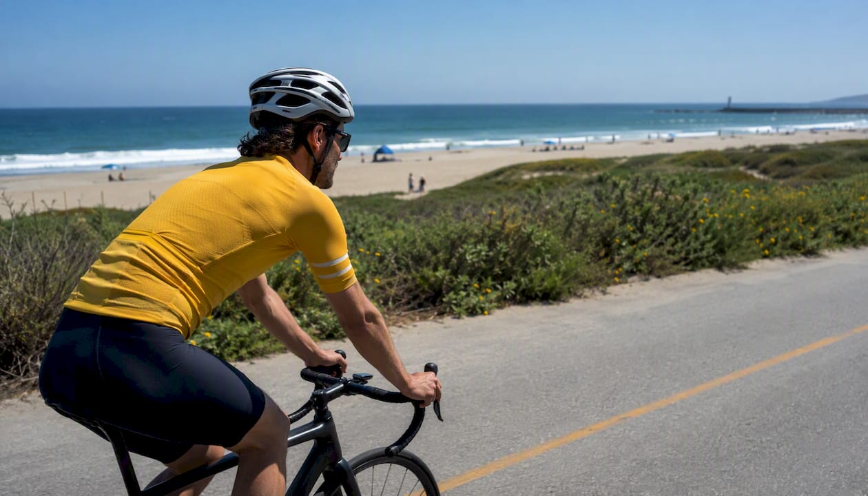
    • Marvin Braude Bike Trail (The Strand): Best for coastal scenery. A paved coastal path hugging the shoreline from Will Rogers State Beach to Torrance Beach.
    • San Gabriel River Bike Trail: Best for long-distance mileage. A long mostly flat, paved trail running from the mountains toward the coast.
    • Los Angeles River Trail: Best for urban multi-use riding. A substantial paved path threading through the city with growing connectivity.
    • Ballona Creek Bike Path: Best for a quick, family-friendly connector. Links Marina del Rey to Culver City with easy access to the coast.
    • Orange Line / G Line Bikeway: Best for transit-connected commuting. Runs parallel to the Metro G Line through the San Fernando Valley.

    For official maps, download the Metro printable PDF or open the interactive overlay at BikeLA, then cross-reference with the LA County Bikeways Map for project updates and closures. Both are free and regularly updated.


    Key Takeaways

    The best bike paths in Los Angeles pair well with official Metro and LA County maps, and matching your trail to your skill level and transit access makes the whole experience smoother.

    Point Details
    Download maps first Grab the BikeLA PDF and open the LA County Bikeways Map before every ride to catch closures.
    Match trail to your goal The Strand for scenery, San Gabriel River for distance, G Line Bikeway for commuting, Ballona Creek for families.
    Check agency closure pages River trails close after rain; coastal paths close for events. Always verify before a long ride.
    Plan transit and parking Metro E and G Lines reach major trailheads; beach lots fill by mid-morning on weekends.
    Report hazards to the right agency LA County Public Works handles river trails; Beaches & Harbors covers most of The Strand.
    Use Socalsights for turn-key routes Curated day itineraries pair trail maps with food stops and local tips for a complete ride plan.

    Table of Contents

    Where do you find official bike path maps for Los Angeles?

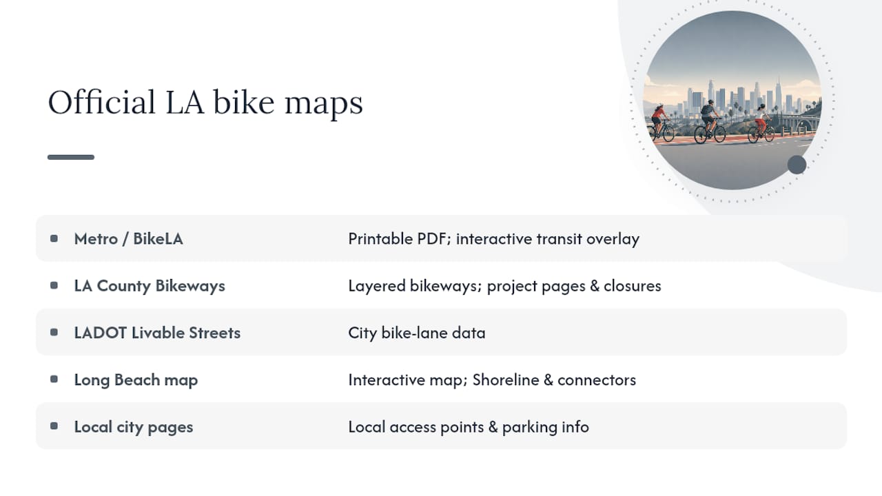
    Getting the right map before your ride saves a lot of guesswork. LA County and the city each maintain separate resources, and knowing which one to pull up makes planning much smoother.

    Metro / BikeLA maps are the best starting point for county-wide planning. The BikeLA map portal offers both a printable PDF and an interactive overlay that shows protected lanes, bike-friendly streets, and Metro rail and bus connections side by side. That transit overlay is genuinely useful if you plan to combine a bike ride with a train leg.

    LA County Bikeways Map (hosted by LA County Public Works) gives you a layer-by-layer view of county-maintained bikeways, plus links to active project pages where you can check for construction closures or upcoming improvements. Bookmark dpw.lacounty.gov/bike/map.cfm for this one.

    LADOT Livable Streets maintains city-specific bike lane data for the City of Los Angeles, which is helpful when your route dips into city-managed streets rather than county-maintained paths.

    Long Beach has its own interactive bike map that covers the Shoreline Pedestrian Bikepath and local connectors. If your ride ends or starts in Long Beach, this is worth opening separately since county maps sometimes miss city-level detail.

    Burbank and other cities often publish local access-point and parking info that county maps skip entirely. Check the individual city park or public works page when your trailhead sits inside a specific city.

    Pro Tip: Download a printable PDF before you leave home, then keep the interactive map open on your phone for real-time navigation. Cell service can drop near river channels and underpasses, so having the offline PDF as a backup prevents a frustrating mid-ride detour.

    Always check the agency’s maintenance or closure page before a long ride. River trail sections close periodically after heavy rain, and coastal paths occasionally shut down for special events.

    Where do you find official bike path maps for Los Angeles? — overview diagram

    The top bike paths in Los Angeles: quick facts for every rider

    TrailLink’s regional guide and the LA County bike path inventory together cover dozens of named routes. The eight below are the ones most riders will actually use, covering everything from beach cruising to serious training mileage.

    Access highlights by trail:

    • Marvin Braude: Parking lots at Will Rogers State Beach, Santa Monica State Beach, and Hermosa Beach. Paid lots fill fast on weekends; arrive before 9 AM or take the Metro E Line to Downtown Santa Monica.
    • San Gabriel River: The Wilderness Park trailhead in Azusa and the Seal Beach end near the Pacific Coast Highway are the most popular entry points. Free parking at both.
    • Ballona Creek: Multiple street-level access points along Jefferson Boulevard and Slauson Avenue. The western end drops you right onto the Marvin Braude coastal path.
    • G Line Bikeway: Every Metro G Line station has a bike path entry point, making this the easiest trail in the county to reach without a car.

    How to plan a ride in LA County

    Planning a ride here is a little different from most cities because the trail network is spread across multiple jurisdictions and the geography ranges from beach to river channel to suburban greenway. A few steps upfront make the whole thing much easier.

    Step 1: Pick your trail and download the map. Use BikeLA for the interactive overlay, then save the relevant PDF section to your phone. For river trails, also check the LA County Bikeways page for any active closures.

    Step 2: Decide how you’re getting to the trailhead. Metro rail and bus reach most major trailheads. Bikes ride free on Metro rail (folding bikes on buses), and most stations have bike lockers or racks. The Metro E Line drops you at Downtown Santa Monica, steps from the Marvin Braude path. The G Line runs parallel to its namesake bikeway the entire length of the San Fernando Valley.

    Step 3: Check parking if you’re driving. Beach lots along The Strand charge fees and fill by mid-morning on weekends. River trail access points often have free street parking, but check posted signs for street-cleaning days and timed restrictions.

    Step 4: Plan your turnaround or endpoint. Many LA trails are out-and-back, so your total mileage is double whatever you ride one way.

    Three sample itineraries to get you started

    1. Family beach loop on The Strand (8–10 miles, 1.5–2 hours): Start at Hermosa Beach Pier, ride north to Manhattan Beach and back. Flat, paved, and packed with snack stops. Arrive by 8:30 AM on weekends to beat the crowds near the pier.

    2. Commuter out-and-back on the San Gabriel River (12 miles, 1–1.5 hours): Start at Wilderness Park in Azusa, ride south to Whittier Narrows Recreation Area, and turn back. Mostly flat with zero traffic interactions. Good for a weekday morning ride before the heat builds.

    3. Training loop linking San Gabriel and Rio Hondo (30–35 miles, 2.5–3.5 hours): Start at Whittier Narrows, ride south on the San Gabriel River Trail toward Seal Beach, then loop back north on the Rio Hondo River Trail. Wind direction matters on this one: a south wind on the way out means a tough return, so check the forecast and start early.

    Pro Tip: Coastal rides on The Strand almost always have an afternoon onshore breeze blowing from the south. Ride south first so the wind is at your back on the way home. Also check for any permitted events at the beach before you go — the Santa Monica and Venice sections can close to cyclists during large events.


    Trail rules, maintenance, and how to report problems

    LA’s bike paths are managed by a patchwork of agencies, and knowing who’s responsible for what stretch saves time when something needs fixing.

    Common rules across most LA County paths:

    • Yield to pedestrians at all times on shared-use paths
    • Keep speeds reasonable in crowded sections (Santa Monica and Venice on The Strand get genuinely chaotic on summer weekends)
    • Dogs must be on a leash on multi-use paths; some sections prohibit dogs entirely
    • Class 1 and Class 2 e-bikes are generally allowed on paved multi-use paths; Class 3 e-bikes (speed pedelecs) may be restricted on some segments
    • Motorized vehicles (other than permitted maintenance vehicles) are prohibited on all paved bike paths
    • Helmets are required by California law for riders under 18; strongly recommended for all riders

    Who maintains what:

    LA County Public Works handles the river trails and county-managed bikeways. The Marvin Braude coastal path falls under LA County Beaches & Harbors for most of its length, though individual city sections (Santa Monica, Hermosa Beach, Redondo Beach) are maintained by those cities. The Ballona Creek path involves both LA County and the City of Los Angeles depending on the segment.

    To report a hazard or request maintenance, go directly to the agency that manages that specific stretch. The LA County Bikeways Map project pages include contact information for county-managed segments. For city-managed sections, the relevant city’s public works or parks department is the right call.

    Pro Tip: When you spot a pothole or a damaged barrier, take a photo with your phone’s location tag on. That makes it much easier to describe the exact spot when you submit a report, and agencies tend to respond faster to reports with precise location data.


    Which Los Angeles bike path is right for you?

    Matching the right trail to your situation saves you from showing up somewhere that doesn’t fit your group or your fitness level. Here’s a quick breakdown:

    • Families with young kids: Ballona Creek Bike Path or the Shoreline Pedestrian Bikepath in Long Beach. Both are short, flat, and paved with minimal road crossings. The Shoreline path in Long Beach is especially relaxed and has the waterfront scenery to keep everyone happy.
    • Beginners: The G Line Bikeway or the Expo Bike Path. Both are wide, paved, and have easy transit access so you can bail at any station if you’ve had enough. No elevation to worry about.
    • Commuters: Expo Bike Path (Westside to downtown) or the G Line Bikeway (San Fernando Valley). Both run parallel to Metro lines, so you can ride one way and take the train back.
    • Long-distance training: San Gabriel River Trail or the Rio Hondo loop. Flat, long, and mostly free of pedestrian traffic compared to the coastal paths. Watch for gaps near Whittier Narrows where the trail briefly goes on-road.
    • Scenic leisure and photography: Marvin Braude Bike Trail. Ocean views the entire way, with iconic spots at Santa Monica Pier, Venice Beach, and the Palos Verdes cliffs in the distance from Torrance Beach. Go on a weekday morning for the best light and the fewest crowds.
    • Urban exploration: Los Angeles River Trail. The river corridor passes Elysian Park, Griffith Park access points, and some genuinely interesting industrial-to-green transitions. Surface quality varies by segment, so check current conditions before a long ride.

    Watch for surface transitions on the LA River and San Gabriel trails where paved sections give way to decomposed granite or gravel near some access points. Road bikes with narrow tires can handle most of it, but it’s worth knowing before you show up on 23mm slicks.


    Why LA’s trails have gaps, and how to ride around them

    One thing that surprises a lot of riders new to LA cycling routes is that the trails don’t always connect cleanly. You’ll be cruising along a beautiful river path and suddenly hit a fence, a construction zone, or a street crossing with no obvious continuation. That’s not a map error. It’s the reality of a network built across dozens of jurisdictions over several decades.

    The Marvin Braude coastal path, for example, briefly goes on-road near Marina del Rey where the path crosses private marina property. The TrailLink route notes flag this section specifically, and it catches first-timers off guard. The fix is simple: follow the on-road connector for about a quarter mile and you’re back on the dedicated path.

    River trails have similar quirks. The Los Angeles River Trail has segments managed by the City of LA, LA County, and in some stretches the Army Corps of Engineers, which means maintenance quality and surface condition can shift noticeably within a single mile. The LA County bike path inventory documents many of these segment-by-segment details, and it’s worth a quick scan before a new route.

    Practical gap fixes:

    • For the Marina del Rey connector on The Strand, use Via Marina or Admiralty Way. Both are low-traffic and well-signed.
    • On the LA River Trail near downtown, Riverside Drive serves as the most common on-road connector between trail segments.
    • When the San Gabriel River Trail gaps near Whittier Narrows, Rosemead Boulevard is the standard street connection.

    Pro Tip: Before any ride longer than 15 miles, pull up the specific trail page on TrailLink and read the route notes, not just the mileage. The notes flag on-road connectors, pedestrian-heavy sections, and surface changes that the official maps often don’t show.

    Socalsights pulls community-reported access tips from local riders who know these connectors firsthand. If you’ve found a better gap fix or a new access point, that kind of local intel is exactly what makes these guides more useful for everyone.


    When is the best time to ride the bike paths in Los Angeles?

    LA’s mild climate means you can ride year-round, but the experience varies a lot by season and time of day.

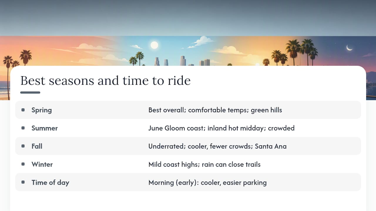
    Spring (March through May) is widely considered the best overall season. Temperatures are comfortable, the hills are green, and the marine layer usually burns off by mid-morning. Coastal paths are busy but not yet at peak summer crowds.

    Summer (June through August) brings the famous “June Gloom,” where the coast stays overcast and cool until late morning. That’s actually great for riding. Inland trails like the San Gabriel River get hot by midday, so early starts (before 8 AM) are worth it. Coastal paths get genuinely crowded on weekends, especially the Santa Monica and Venice sections of The Strand.

    Fall (September through November) is arguably the most underrated time to ride. The marine layer clears, temperatures drop slightly, and the crowds thin out after Labor Day. The Santa Ana winds can pick up in October and November, which creates strong offshore gusts. Riding inland on those days is more comfortable than fighting a headwind on the coast.

    Winter (December through February) is mild by most standards, with daytime highs often in the 60s°F along the coast. Rain is infrequent but can close river trails quickly when it does arrive. The LA River and San Gabriel River channels drain fast, but trail surfaces can stay muddy or debris-covered for a day or two after significant rain. Check the LA County Bikeways Map for closure notices after any storm.

    The best time of day, regardless of season, is early morning. Parking is easier, temperatures are lower, and the coastal light is genuinely beautiful before the beach crowds arrive.

    When is the best time to ride the bike paths in Los Angeles? — overview diagram

    What I keep coming back to about riding in LA

    There’s something about the Marvin Braude path on a Tuesday morning in October that you just can’t replicate anywhere else in the country. The marine layer is still hanging low, the path is quiet, and you can ride from Will Rogers State Beach all the way to Torrance without stopping at a single traffic light. That’s a rare thing in a city this size.

    What I’d love to see more of is community-sourced route intel. The official maps are solid, but they don’t tell you that the parking lot at Hermosa Beach fills by 8:30 AM on a Saturday, or that the connector through Marina del Rey is smoother if you take Via Marina instead of the marked route. If you’ve got a tip like that, a better access point, a gap fix, or a lesser-known trailhead, send it our way. That’s exactly the kind of local knowledge that makes these guides actually useful.


    Curated ride itineraries from Socalsights

    Socalsights puts together curated day itineraries that pair the best LA cycling routes with local food stops, scenic detours, and practical logistics so you’re not piecing it together from five different tabs.
    Socalsights

    Whether you want a full beach-day loop on The Strand with a lunch stop in Hermosa, or a longer river trail ride with a coffee detour in Culver City, the Socalsights guides handle the planning so you can focus on the ride. Check out the 100+ SoCal Sights list for ride-adjacent spots worth building a day around, or grab a Socalsights membership for access to the full library of curated routes and community tips. Head to the site and find the itinerary that fits your next ride.


    Sources

    These are the pages worth bookmarking before your next ride. Use the agency pages for closures and the map portals for planning.

    For closures and maintenance notices:

    For route planning and printable maps:

    For trail discovery and route research:

    Use the agency pages (Beaches & Harbors, LA County Bikeways, Ballona Creek trail page) to check for closures. Use BikeLA and TrailLink for planning and route discovery.
  • Whale Watching in San Diego: Best Tours and How to Choose

    Whale Watching in San Diego: Best Tours and How to Choose

    If you want to book a whale-watching trip in San Diego and skip the research spiral, here are the four operators worth your time right now:

    • San Diego Whale Watch (Mission Bay): Daily departures, a naturalist on board, and a sighting guarantee — free return trip if you don’t spot whales or dolphins. Fares start at moderate prices.
    • Gone Whale Watching San Diego: Small, fast boats with private-charter options. Best for photographers and anyone who wants to cover more water quickly and find whales effectively.
    • Wild Pacific Whale Watch: Comfort-forward vessel with stabilizers and indoor seating. The go-to pick for blue whale season (mid-May through September).
    • City Cruises / Whale Watching by City Cruises: Narrated, museum-affiliated trips that work well for first-timers and families who want the educational angle.

    For peak gray whale season (January and February), book at least two to three weeks ahead. Summer blue-whale trips fill up fast too, especially on weekends.


    Key Takeaways

    Gray whale season in winter and blue whale season in summer are the two main windows that define whale watching in San Diego, and picking the right operator for your goals matters as much as picking the right month.

    Point Details
    Best months for gray whales Peak sightings occur during the annual coastal migration.
    Best months for blue whales The season runs from mid-spring through late summer.
    Sighting guarantee San Diego Whale Watch offers a free return trip if no whales or dolphins are spotted; confirm terms at booking.
    Small vs. large boats Small fast boats cover more water and suit photographers; large vessels offer stability and indoor seating for families.
    Socalsights day planning Socalsights pairs whale-watching departures with curated local itineraries, parking tips, and land-based add-ons.

    Table of Contents

    How do San Diego whale-watching operators compare?

    The table below covers the operators you’ll encounter most often when searching for tours. Prices and policies shift seasonally, so confirm details directly with each operator before booking.

    A few things worth knowing about boat size:

    • Small, fast boats (like Gone Whale Watching’s vessels) cover more water and often reach sightings sooner. The trade-off is a rougher ride and less shelter from wind.
    • Large two-deck vessels (San Diego Whale Watch, City Cruises, Flagship) offer indoor seating, restrooms, and more stability. Families and passengers prone to seasickness generally prefer them.
    • The San Diego Natural History Museum partners with select operators to provide trained naturalists on board. If the educational experience matters to you, ask specifically whether a museum naturalist is on your departure.

    How do you pick the right whale-watching trip for your goals?

    A little upfront thinking saves a lot of post-trip regret. Work through these five questions before you book:

    1. What species do you want to see? Gray whales run December through April. Blue whales show up mid-May through September. If you’re visiting in spring, you may catch the tail end of gray whale migration and the start of blue whale season.
    2. How important is the educational experience? If you want narrated, science-backed commentary, prioritize operators with confirmed naturalist affiliations (San Diego Natural History Museum partnerships are the gold standard locally).
    3. Are you traveling with kids or anyone prone to seasickness? Go with a larger vessel. Stability and indoor seating matter more than speed when you have young kids or a queasy stomach.
    4. Do you want to maximize sighting odds? Small, fast boats like Gone Whale Watching’s cover more ocean per hour. They’re also better for photography because you can position closer and move quickly.
    5. What’s your budget and flexibility? San Diego Whale Watch’s sighting guarantee (free return if no whales appear) is a real safety net for first-timers. Confirm the exact terms at booking since policies vary.

    Questions to ask any operator before you pay:

    • Is the vessel USCG-inspected?
    • Is there a naturalist on board, and what’s their affiliation?
    • What’s the exact refund or rebook policy if weather cancels the trip?
    • Does the boat have indoor seating and a restroom?
    • Where exactly do you depart, and is parking available?

    Red flags to watch for: no safety information listed on the website, vague or missing refund language, no mention of vessel inspection, or departure logistics that don’t match the booking confirmation.


    When is the best time for whale watching in San Diego?

    San Diego is genuinely a year-round destination for marine wildlife, but two distinct migration windows define the calendar.

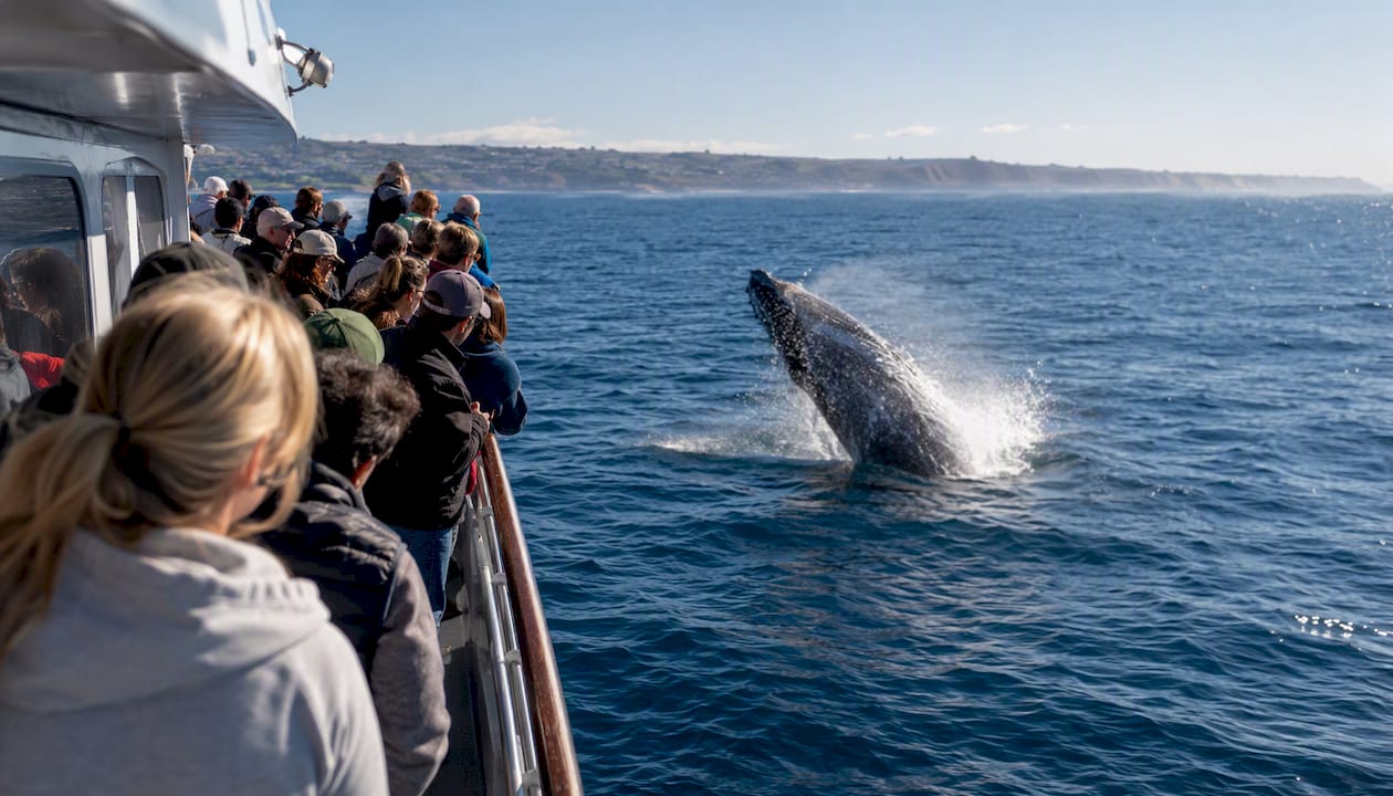
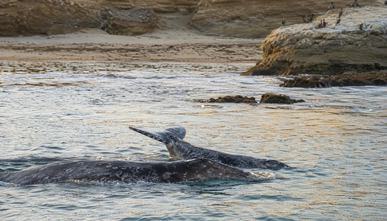
    Gray whale season runs mid-December through April, with January and February delivering the highest concentration of sightings. These are the whales making the longest mammal migration on Earth, traveling between Alaska and Baja California. You’ll see them traveling close to the coast, often in small groups or mother-calf pairs on the return leg in February and March.

    Gray whale mother and calf swimming near shore

    Blue whale season typically opens mid-May and runs through September, tied to krill blooms off the Southern California coast. Blue whales are the largest animals on the planet, and seeing one surface near a boat is genuinely hard to describe. Timing shifts year to year depending on where the krill concentrate, so operators offering dedicated five-hour blue whale trips tend to have better odds during peak mid-summer months.

    Species Typical Months Peak What to Expect
    Gray whale Mid-December–April January–February Coastal migration, mother-calf pairs on return leg
    Blue whale Mid-May–September July–August Deep-water feeding, massive surfacing, tail flukes
    Common dolphin Year-round Spring–summer Large pods, bow-riding, acrobatics
    Minke whale Year-round (sporadic) Winter–spring Solitary, fast-moving, brief surfacing

    Best time of day: Morning trips offer calmer seas and better natural light for photos. Sunset trips trade photo conditions for dramatic skies and often see more active dolphin behavior. If photography is your priority, go morning. If atmosphere matters more, sunset trips are genuinely beautiful.


    Where do San Diego whale-watching tours depart from?

    Knowing your departure point before you book saves real hassle on the day.

    • Mission Bay: San Diego Whale Watch departs here daily. It’s a calm, protected launch point with easy freeway access and paid parking nearby. Operators here can reach productive search areas without long transit times.
    • Embarcadero / Harbor: City Cruises and Flagship Cruises depart from the downtown waterfront. Parking can be tight on weekends; ride-share drop-off is the easier move. The harbor setting is scenic and convenient if you’re already staying downtown.
    • Shelter Island / Point Loma area: Some smaller operators use this launch point. It’s close to open ocean, which shortens the ride to deeper water.
    • Oceanside (North County): Oceanside’s harbor sits close to deep water, which can cut transit time to feeding areas. Worth considering if you’re staying in North County and want to minimize driving.

    Check-in tips: Arrive at least 30 minutes before departure. Most operators close boarding 10–15 minutes before the boat leaves. If you’re driving, budget extra time for parking on weekends during peak season.

    Accessibility: Ask each operator directly about ADA boarding access, accessible restrooms, and seating. Larger vessels generally offer better accessibility than small fast boats. Give operators advance notice of any mobility needs so they can confirm the right departure for you.


    What should you bring on a whale-watching trip?

    Packing right makes a real difference between a great trip and a miserable one.

    • Layers: San Diego mornings on the water are cold, even in summer. A windproof jacket over a fleece is the right combination.
    • Binoculars: Useful even on a boat. Whales surface at varying distances, and binoculars let you track behavior between surfacings.
    • Sunscreen and a hat: Glare off the water is intense, and you’ll be outside for two to five hours.
    • Camera with a zoom lens: A 200mm+ lens gives you usable shots. Phone cameras struggle with distance and motion.
    • Motion sickness remedies: Dramamine or Bonine taken the night before and the morning of departure works better than waiting until you feel sick. Ginger chews are a gentler option for mild sensitivity.

    Pro Tip: Sit or stand near the middle of the boat and keep your eyes on the horizon if you feel queasy. The bow and stern amplify motion. Staying outside in fresh air almost always beats going below deck.

    Common onboard facilities on larger vessels include indoor seating, restrooms, and a snack bar or small galley. Smaller fast boats may have limited or no indoor space. Confirm what’s available before you book, especially if you’re bringing kids or have specific needs.


    Where can you see whales from shore in San Diego?

    Not everyone wants to get on a boat, and honestly, land-based viewing in San Diego can be spectacular during peak migration.

    • Cabrillo National Monument (Point Loma): The Kelp Forest Overlook and Whale Overlook are the two named vantage points here. Binoculars are strongly recommended because gray whales typically transit several tenths of a mile offshore. Mid-January is the sweet spot for sightings. There’s an entry fee for the monument, and mornings offer the best light and calmest conditions.
    • Torrey Pines State Reserve: The blufftop trails give you elevated views over the Pacific. It’s a longer shot than Cabrillo, but the scenery makes it worth the visit even on a slow whale day.
    • Sunset Cliffs Natural Park (Ocean Beach): A dramatic shoreline with multiple elevated viewing points. Best during high migration months (January–February). Free access, easy parking on weekdays.

    Bring the best binoculars you own. Whales at these distances are visible to the naked eye when they blow, but binoculars let you actually watch the behavior.


    How do you watch whales responsibly in San Diego?

    Federal law governs how close you can get to marine mammals, and the rules apply to both boats and kayakers.

    • Do maintain at least 100 yards of distance from whales (300 yards for endangered species like blue whales).
    • Do follow operator instructions immediately if the captain adjusts course for wildlife.
    • Don’t feed, chase, or attempt to touch any marine mammal.
    • Don’t make sudden loud noises or play music near surfacing animals.
    • Do choose USCG-inspected vessels operated by companies that follow NOAA’s marine mammal viewing guidelines.

    Following these guidelines isn’t just about compliance. Whales that feel pressured dive early and move away, which means shorter sightings for everyone on board. Operators who enforce distance rules consistently tend to deliver better experiences because the animals stay at the surface longer.


    What are the typical booking and cancellation policies?

    Policies vary by operator, but here’s what you’ll typically encounter:

    • Weather cancellations: Most operators cancel or reschedule if conditions are unsafe. You’ll usually receive a full refund or a free rebook. Confirm this before paying.
    • Sighting guarantees: San Diego Whale Watch offers a free return trip if no whales or dolphins are spotted. Not every operator matches this, so check the fine print. “Guarantee” can mean a full refund at some companies and a discounted rebook at others.
    • Cancellation windows: Most operators require 24–48 hours’ notice for a full refund. Same-day cancellations often forfeit the fare.
    • Travel insurance: For peak-season bookings (January–February gray whale, July–August blue whale), travel insurance that covers activity cancellations is worth considering, especially if you’re flying in for the trip.

    Pro Tip: Book refundable fares when available during peak season. January and February weekends sell out, and having a refundable ticket gives you flexibility to reschedule around weather without losing money.


    An honest local take on choosing a San Diego whale-watching trip

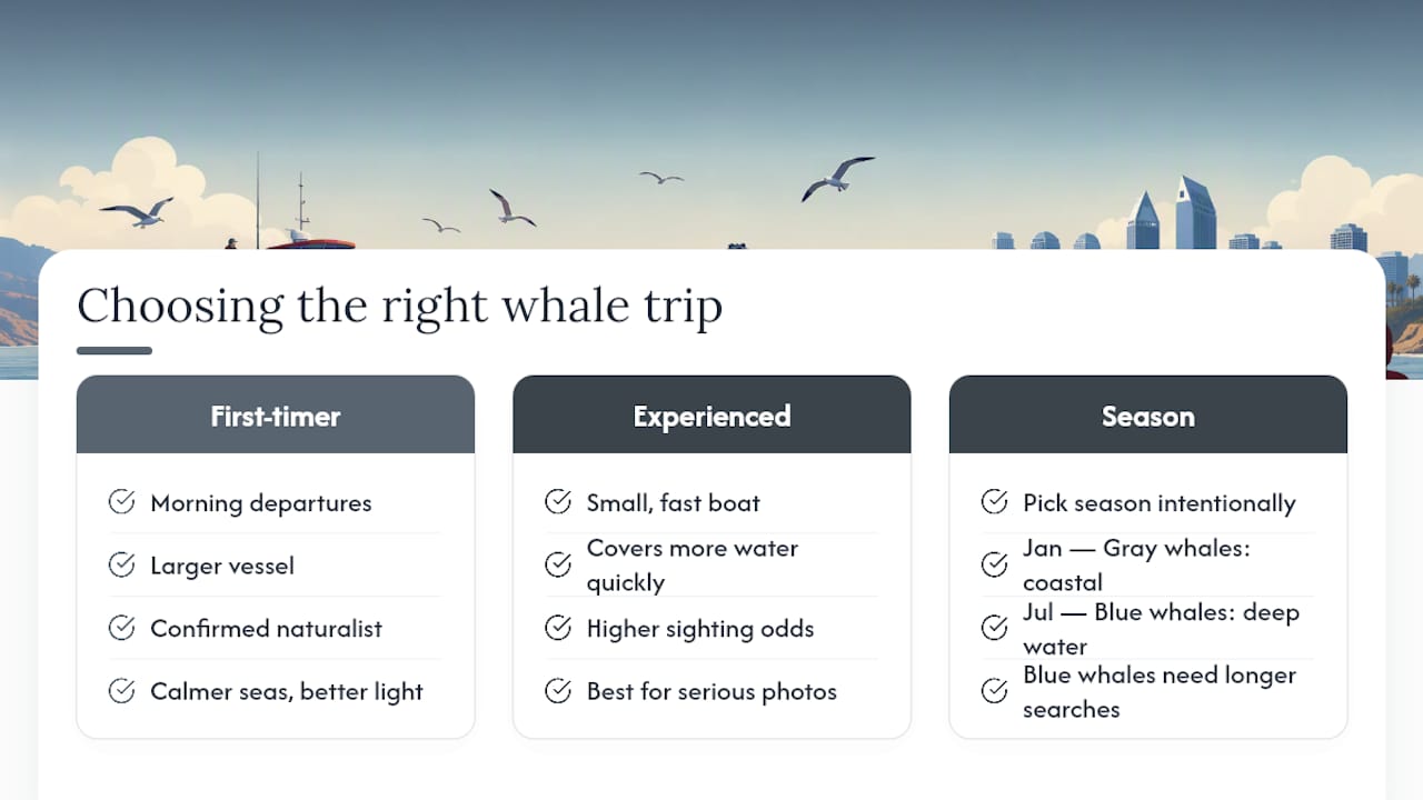
    If I had to send a first-time visitor out on the water tomorrow, I’d point them toward a morning departure on a larger vessel with a confirmed naturalist on board. Calmer seas, better light, and someone explaining what you’re seeing makes the whole experience click in a way that a self-guided trip on a fast boat doesn’t always deliver.

    That said, if you’ve done this before and you want to maximize sighting odds or get serious photos, a small fast boat is genuinely the better tool. Gone Whale Watching’s approach of covering more water quickly is a real advantage when whales are spread out.

    The one thing most people underestimate is how much the season matters. A January gray whale trip and a July blue whale trip are almost different activities. Gray whales are coastal, predictable, and often visible from shore. Blue whales are deep-water animals that require more searching and longer trips. Pick your season intentionally, not just by when you happen to be in town.

    Socalsights curates recommendations like these to help you spend less time researching and more time actually out there.


    An honest local take on choosing a San Diego whale-watching trip — overview diagram

    Plan your San Diego whale-watching day with Socalsights

    Booking a whale-watching tour is just one piece of a great San Diego day on the water. Socalsights puts together curated Southern California day itineraries that pair a morning whale-watching departure with the best nearby lunch spots, parking tips, and land-based add-ons like Cabrillo National Monument, so you’re not piecing it together from five different tabs.

    Socalsights

    You get local knowledge baked in: which departure point has the easiest parking, which spots are worth the detour after your trip, and what the area looks like beyond the tourist trail. Check out the 100+ SoCal Sights guide for the full picture of what Southern California has to offer, and browse the local businesses directory to find operators and spots the big travel sites tend to miss. Ready to plan your day? Start with the Socalsights daycation guide and build your itinerary from there.


    Sources

    Check operator websites directly before departure for live sighting updates, current schedules, and any seasonal changes to pricing or departure times.

  • 18 Romantic Date Ideas in San Diego for Couples

    18 Romantic Date Ideas in San Diego for Couples

    San Diego’s best romantic date ideas span a wide range: a sunset picnic at Sunset Cliffs, a stroll through Balboa Park’s gardens, gondola rides in Coronado, and a harbor cruise along the Embarcadero. The city’s year-round mild weather, dramatic coastline, and walkable neighborhoods make it genuinely one of the easiest places in the country to plan a date that feels special without a lot of effort.

    Here’s a quick-pick list to get you started right away:

    • Balboa Park stroll + picnic — Free, endlessly pretty, great for any pace. No reservation needed; arrive early on weekends for parking.
    • La Jolla sunset at the Cove — Free. Go 30–45 minutes before golden hour for a good spot.
    • Coronado gondola ride — $$. Book at least a week ahead; evening slots fill fast.
    • Harbor cruise / Embarcadero — $$. Tickets available online; sunset departures sell out first.
    • Torrey Pines hike + cliffside picnic — Free (small parking fee). Weekday mornings are quieter and cooler.
    • Sunset Cliffs sunset picnic — Free. Bring a blanket anchor; wind picks up near the edge.
    • Rooftop dinner in the Gaslamp Quarter — $$$. Reserve the table 1–2 weeks out for weekend nights.
    • Rady Shell concert night — $$–$$$. Check the schedule early; popular shows sell out weeks ahead.

    Key Takeaways

    San Diego’s best romantic dates combine the city’s natural scenery with intentional planning — the right spot matters less than showing up fully present for each other.

    Point Details
    Lead with the right vibe Match the date to your energy: scenic and relaxed, active, splurge, or low-cost free options all work well here.
    Book ahead for popular spots Gaslamp restaurants, Rady Shell shows, and gondola rides fill up 1–2 weeks out on weekends.
    Plan for outdoor logistics Check tide charts for tide pools, arrive early for park parking, and bring layers for coastal evenings.
    Make it intentional A tech-free hour and unstructured conversation time turns a fun outing into a genuinely connecting experience.
    Socalsights for local planning The 100+ SoCal Sights guide offers curated San Diego itineraries with neighborhood-level detail to save planning time.

    Table of Contents

    1. The best romantic date ideas in San Diego, covered in detail

    1. Balboa Park: gardens, museums, and a picnic for two

    Balboa Park covers 1,200 acres of gardens, fountains, open lawns, and world-class museums. You could spend a full day here and still not see everything. For a romantic afternoon, pair a walk through the Japanese Friendship Garden with a blanket on the grass near the Botanical Building reflecting pool. The garden is quieter than the main promenade and genuinely peaceful. Admission to the park itself is free; individual museums and the Japanese Friendship Garden charge a small entry fee. Parking fills up on weekend mornings, so aim to arrive before 10 AM or use the off-site lots near Park Boulevard.

    Best time: Weekend morning or late afternoon. Cost: Free to $. Booking tip: No reservation needed for the park; buy museum tickets online to skip lines.

    2. La Jolla Cove and La Jolla Shores at sunset

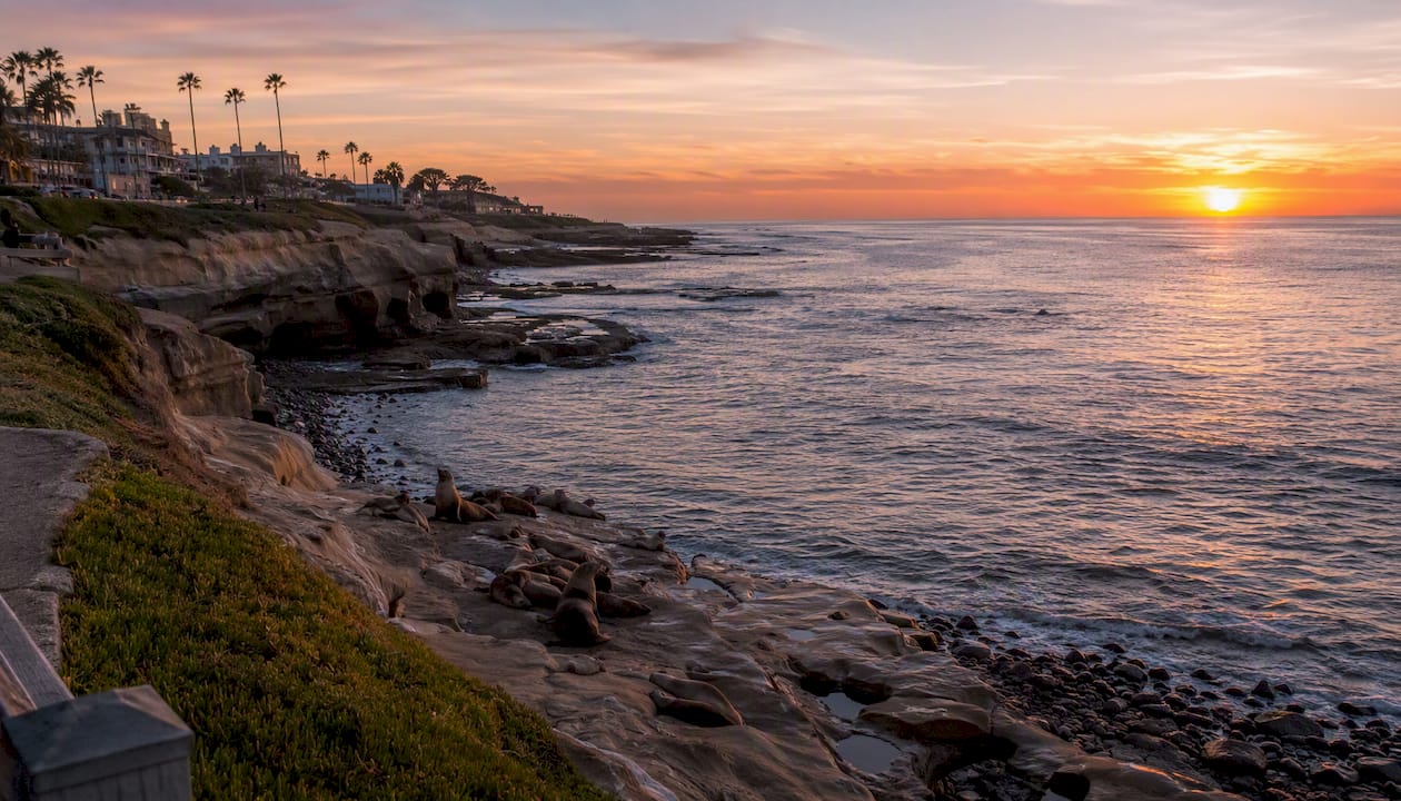
    La Jolla Cove is one of those spots that photographs beautifully but feels even better in person. The sea caves, the barking sea lions, the way the light hits the water at golden hour — it’s hard not to feel a little swept up in it. Walk the coastal path from the Cove south toward Children’s Pool, then grab a table at one of the restaurants along Prospect Street for dinner. La Jolla Shores, just a mile north, is wider and sandier, great if you want to walk barefoot or watch the sun dip below the horizon from the water’s edge.

    Sea lions resting on rocks at sunset in La Jolla Cove

    Best time: 45 minutes before sunset. Cost: Free. Booking tip: Street parking near the Cove is limited; use the pay lots on Prospect Street or arrive early.

    3. Coronado Island: Hotel del Coronado and gondola rides

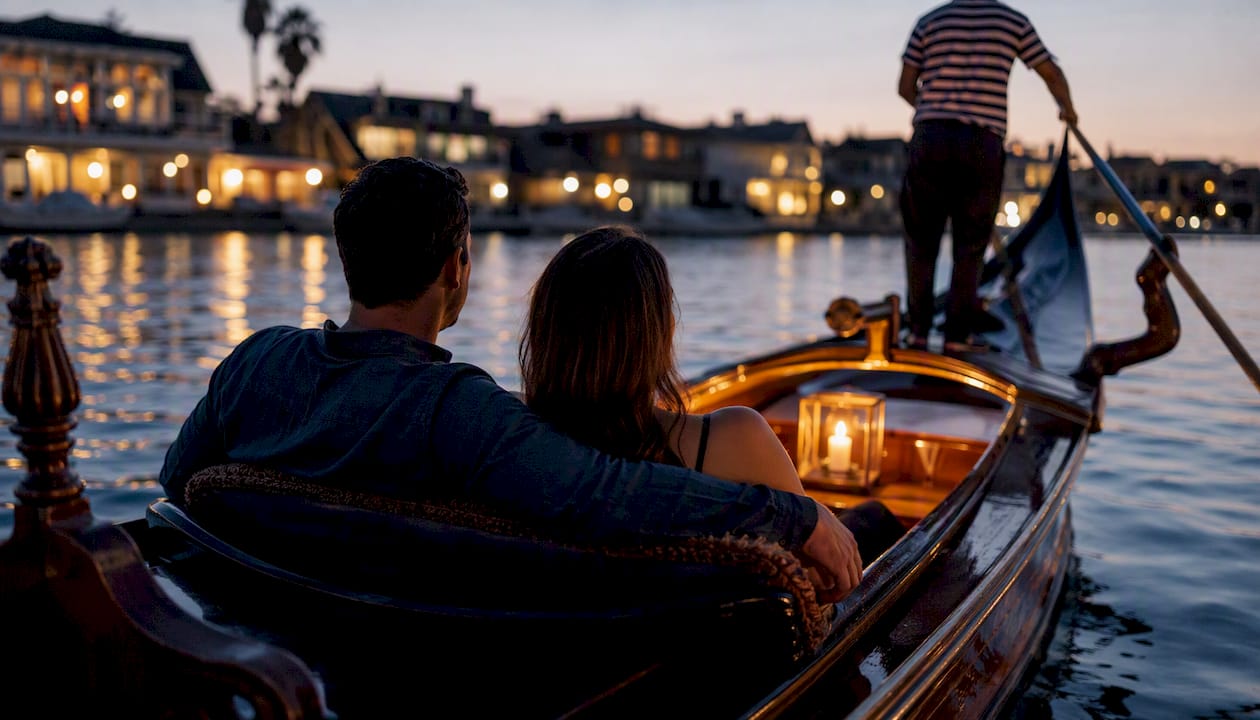
    Coronado has a slow, unhurried feel that most of San Diego proper doesn’t. The Hotel del Coronado is worth a visit even if you’re not staying there — walk the beach in front of it, have a drink at the outdoor bar, and watch the waves. For something more memorable, book a gondola ride through the Coronado Cays. The gondolier sets the mood with music and candles, and the calm waterways make it feel genuinely romantic rather than touristy.

    Candlelit gondola on calm water at sunset

    Best time: Evening gondola rides, late afternoon beach walk. Cost: $$ for gondola; free for the beach. Booking tip: Gondola companies book up fast on weekends; reserve at least a week out.

    4. Sunset Cliffs Natural Park

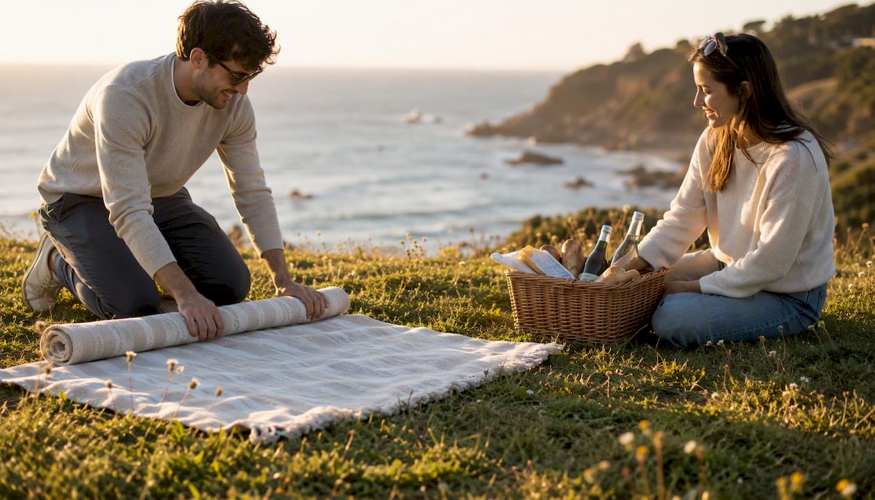
    Sunset Cliffs is exactly what the name promises. The rugged sandstone bluffs along Ocean Beach drop straight into the Pacific, and the sunset views here are among the best in the city. Bring a blanket, a bottle of wine, and something easy to eat. San Diego Magazine notes that elevated picnic spots like this come with real wind, so secure your blanket and keep food covered. The cliffs themselves are beautiful but uneven; stay on marked paths and away from the edge after dark.

    Best time: 30–60 minutes before sunset. Cost: Free. Booking tip: Street parking along Sunset Cliffs Boulevard fills quickly; arrive 30 minutes early.

    5. Torrey Pines State Reserve

    Torrey Pines is a short drive north of La Jolla and offers some of the most dramatic coastal scenery in Southern California. The trails wind through rare Torrey pine trees and end at cliffs overlooking the Pacific. The Guy Fleming Trail is the most accessible and rewards you with sweeping views without a strenuous climb. Pack a picnic for the overlook. The parking lot fills by 9 AM on weekends, so a weekday morning visit is genuinely better.

    Best time: Weekday morning. Cost: Small parking fee ($ per vehicle). Booking tip: No trail reservations needed, but arrive early; the lot has limited capacity.

    6. Harbor cruise and the Embarcadero waterfront

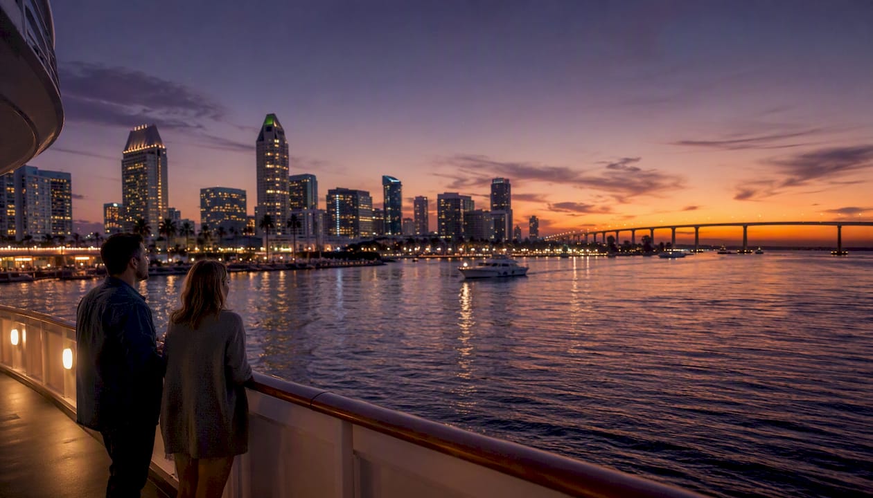
    A sunset harbor cruise from the Embarcadero puts you on the water with views of the downtown skyline, Coronado Bridge, and the naval fleet. Most operators offer 1–2 hour cruises with drinks on board. The USS Midway Museum is right on the waterfront too, and while it’s more of a daytime activity, the aircraft carrier’s scale is genuinely impressive. After a cruise, the Embarcadero is a great place to walk and find a spot for dinner.

    Boat departing sunset harbor cruise with city skyline

    Best time: Sunset departure (typically 5–7 PM depending on season). Cost: $$. Booking tip: Book online 3–5 days ahead; sunset slots sell out first.

    7. Gaslamp Quarter: rooftop bars and romantic dinners

    The Gaslamp Quarter is San Diego’s historic nightlife and dining district, and it earns its reputation. Victorian-era buildings line the streets, rooftop bars offer skyline views, and the restaurant options run from casual to genuinely impressive. For a romantic evening, start with drinks at a rooftop bar, then move to a sit-down dinner. The neighborhood is walkable, which makes it easy to linger without worrying about driving.

    Best time: Friday or Saturday evening. Cost: $$–$$$. Booking tip: Reserve dinner 1–2 weeks ahead for weekend nights; rooftop bars are first-come, first-served.

    8. San Diego Zoo

    The San Diego Zoo is one of the best in the world, and it works surprisingly well as a date. You’re walking, talking, laughing at the animals, and sharing something together for hours. It’s a full-day activity, so plan for 4–6 hours. Buy tickets online in advance to save time at the gate. The zoo’s Skyfari aerial tram gives you a bird’s-eye view of the park and is a fun, slightly giddy moment to share.

    Best time: Weekday morning (cooler, less crowded). Cost: $$–$$$. Booking tip: Purchase tickets online; combo passes with the Safari Park are available.

    9. Rady Shell at Jacobs Park

    The Rady Shell is an outdoor amphitheater on the waterfront in Embarcadero Marina Park South. The San Diego Symphony performs here from spring through fall, and the combination of live music, bay views, and warm evenings is hard to beat. You can bring a blanket and a picnic for the lawn, or upgrade to reserved seating closer to the stage. Pair it with dinner in the Gaslamp beforehand for a full evening.

    Best time: Summer and early fall evenings. Cost: $$–$$$. Booking tip: Popular shows sell out weeks ahead; check the schedule early and book as soon as you decide.

    10. Whale watching and seasonal activities

    Gray whale migration runs roughly December through April, and San Diego is one of the best places on the West Coast to watch it. Several operators depart from the Embarcadero and Point Loma area. It’s a genuinely exciting experience, especially when a whale surfaces close to the boat. Outside whale season, dolphin and sea lion tours run year-round. Dress in layers; the ocean is cooler than the shore.

    Best time: December through April for gray whales. Cost: $$. Booking tip: Book at least a few days ahead during peak season; morning departures tend to have calmer water.

    11. Hot air balloon ride or private sailing charter

    For a date that neither of you will forget, a hot air balloon ride over the North County coastline or a private sailing charter out of San Diego Bay delivers. Balloon rides typically launch at sunrise and last about an hour. Private sailing charters can be booked for a few hours or a full sunset sail. Both are splurge options, but they create the kind of shared memory that sticks.

    Best time: Sunrise for balloons; late afternoon for sailing. Cost: $$$. Booking tip: Reserve at least 1–2 weeks ahead; weather cancellations are common, so check the operator’s rescheduling policy.

    12. Cabrillo National Monument

    Cabrillo National Monument at the tip of Point Loma offers tide pools, a historic lighthouse, and sweeping views of San Diego Bay and the Pacific. The tide pools are accessible only at low tide, so check a tide chart before you go. The Old Point Loma Lighthouse is a short walk from the parking area and worth the stop. It’s a quieter, more contemplative date than the beach crowds, and the views from the monument are genuinely stunning.

    Best time: Low tide for tide pools; late afternoon for views. Cost: $ (National Park pass accepted). Booking tip: Check tide charts in advance; the NPS site has current visitor info.

    13. The Old Globe Theatre in Balboa Park

    The Old Globe is one of the country’s leading regional theaters, and it sits right inside Balboa Park. A show here makes for a classic, memorable date night. The season runs year-round, with productions ranging from Shakespeare to new American plays. Dress is smart casual; the outdoor Lowell Davies Festival Theatre is especially atmospheric on warm evenings.

    Best time: Evening performances, especially summer outdoor shows. Cost: $$–$$$. Booking tip: Buy tickets online well in advance for popular productions; check the schedule at the official site.

    14. Budget-friendly and free date ideas

    Not every great date costs money. San Diego has plenty of free and low-cost options that feel just as special. Free museum days at Balboa Park rotate monthly, outdoor movies pop up in parks and neighborhoods, and the Cabrillo National Monument is covered by the America the Beautiful pass. Farmers markets in Little Italy (Saturday mornings) and Hillcrest (Sunday mornings) are lively, free to browse, and easy to turn into a casual morning date with coffee and fresh food. Local roundups consistently highlight these low-pressure options as some of the best for genuine connection.

    Cost: Free to $. Best for: New couples, low-key mornings, or adding a casual stop to a bigger day.


    Which date fits your vibe?

    Picking the right date is really about knowing what kind of energy you both want. Here’s a quick breakdown:

    Relaxed and scenic (2–4 hours, low effort)

    • Balboa Park stroll and picnic — ideal for couples who want to talk and wander without a schedule.
    • La Jolla Cove at sunset — perfect for new couples or anyone who wants a beautiful, pressure-free evening.
    • Cabrillo National Monument — best for couples who appreciate history, nature, and a quieter crowd.

    Active and adventurous (half-day to full day)

    • Torrey Pines hike — great for outdoorsy couples who want to earn their view.
    • Paddleboarding at La Jolla Shores or Mission Bay — a playful, active option that doesn’t require experience.
    • Whale watching — best for couples who love wildlife and don’t mind a little ocean swell.

    Splurge and luxury (evening, 3–5 hours, book ahead)

    • Private sailing charter at sunset — the most romantic option on this list if budget isn’t a concern.
    • Hot air balloon ride — sunrise launch, champagne landing, unforgettable.
    • Rooftop dinner in the Gaslamp followed by a harbor cruise — a full evening that covers all the bases.

    Low-cost and free (flexible timing)

    • Sunset Cliffs picnic — bring your own food and drinks, zero cost, maximum atmosphere.
    • Little Italy Farmers Market — Saturday morning, free to browse, great for foodies.
    • Free museum days at Balboa Park — check the monthly schedule and plan around it.

    Evening-only / nightlife (starts at 7 PM or later)

    • Gaslamp Quarter rooftop bar hopping followed by dinner — best for couples who like a lively scene.
    • Rady Shell concert on the waterfront — the most atmospheric evening option in the city.
    • The Old Globe for a show in Balboa Park — classic, cultured, and genuinely impressive.

    Practical planning tips to make your date actually work

    The difference between a great date and a frustrating one is usually logistics. A few things worth knowing before you go:

    • Reservations matter more than you think. Popular Gaslamp restaurants fill up 1–2 weeks out on weekends. Rady Shell shows and gondola rides in Coronado sell out even faster. Book as soon as you decide.
    • Parking at parks fills early. Torrey Pines’ lot is often full by 9 AM on weekends. Balboa Park’s main lots get busy by mid-morning. Arrive early or use overflow lots.
    • Check tide charts for tide pool visits. Cabrillo National Monument tide pools are only accessible at low tide. The NPS site has current conditions.
    • Wind is real at elevated spots. At Sunset Cliffs and Kate Sessions Park, San Diego Magazine recommends securing blankets with weights and keeping food covered. It’s not dramatic, but it’s worth planning for.
    • Layer up for the coast. Even in summer, ocean breezes drop the temperature noticeably after sunset. A light jacket makes the difference between staying and leaving early.
    • Rideshare for Gaslamp nights. Parking in the Gaslamp Quarter on weekends is expensive and stressful. Uber or Lyft in and out is genuinely easier.

    Cost ranges at a glance:

    • Free / $: Park picnics, beach walks, farmers markets, free museum days
    • $$: Harbor cruises, zoo tickets, whale watching, Rady Shell lawn seats
    • $$$: Private sailing, hot air balloon, rooftop dinner, gondola + dinner combo

    Pro Tip: For harbor cruises and Rady Shell tickets, check availability on Tuesday or Wednesday for the coming weekend — that’s when last-minute inventory often appears and when you can still get decent seats without paying premium prices.


    Make the date intentional, not just entertaining

    A San Diego relationship expert at SD Relationship Place makes a point that’s easy to overlook: intentional date nights do more for a relationship than spontaneous ones, because they signal that the connection is worth protecting. The goal isn’t just to have fun — it’s to create space for each other.

    Three practical ways to make that happen, each with a San Diego example:

    • Set a technology boundary. Agree before you leave that phones go away for at least the first hour. A tech-free sunset at La Jolla Cove, where there’s genuinely nothing to do but watch the light change and talk, is one of the easiest ways to make this feel natural rather than forced.
    • Choose novelty over comfort. Trying something neither of you has done before creates a shared experience that’s harder to replicate with a familiar dinner spot. Paddleboarding at La Jolla Shores, a hot air balloon ride, or even a cooking class at Urban Kitchen Group all qualify.
    • Build in a low-pressure debrief. End the date somewhere quiet — a blanket at Balboa Park, a walk along the Embarcadero — where conversation can happen naturally without a waiter hovering. Local relationship experts consistently note that pairing experiential dates with unstructured time afterward is what turns a fun evening into a meaningful one.

    Intentional date nights help couples move beyond routine and build real emotional connection. The goal isn’t a perfect evening — it’s showing up fully present for each other. Pair a new experience with a few minutes of genuine conversation, and you’ve already done the most important thing.


    Romantic spa and wellness experiences in San Diego

    San Diego has a solid range of spa and wellness options that work well as couple experiences. The Spa at Estancia La Jolla offers couples massages in a hacienda-style setting with garden views. The L’Auberge Del Mar spa is another well-regarded option, with ocean-view treatment rooms and a relaxed coastal atmosphere. For something more accessible, many hotels along Mission Bay and in Coronado offer couples packages that include access to pools, hot tubs, and treatment rooms without requiring an overnight stay.

    If you want to keep it active, a couples yoga class or a guided meditation session at one of the city’s wellness studios is a quieter alternative to a full spa day. Hillcrest and North Park both have independent wellness studios that offer drop-in classes. It’s a low-key, genuinely connecting way to spend a morning before heading out for brunch.


    How to customize your date based on what you both love

    The best date is the one that actually fits both of you, not just the most popular option on a list. A few ways to think about it:

    For active couples: Start with a morning hike at Torrey Pines or a paddleboard session at La Jolla Shores, then reward yourselves with a long lunch at a La Jolla restaurant with an ocean view. The physical activity creates a natural shared energy that carries into the rest of the day.

    For foodies: The Little Italy Farmers Market on Saturday morning is a great starting point — browse, taste, and pick up ingredients for a picnic. Follow it with a reservation at one of the neighborhood’s Italian restaurants for dinner. Alternatively, a cooking class at Urban Kitchen Group turns the meal itself into the activity.

    For art and culture lovers: Balboa Park is the obvious anchor. Pair a visit to the Institute of Contemporary Art San Diego with an evening show at The Old Globe for a full cultural day. Both are within easy distance of each other, and the park’s gardens make a natural transition between the two.

    For couples who want something low-key: A Sunday morning at the Hillcrest Farmers Market, followed by a slow walk through Balboa Park and a picnic near the Botanical Building, is genuinely one of the most pleasant ways to spend a few hours in this city. No reservations, no pressure, just time together.


    Late-night romantic spots in San Diego

    San Diego isn’t a city that shuts down early, and there are real options for couples who want to extend the evening past dinner.

    The Gaslamp Quarter stays lively well past midnight, and rooftop bars like those along Fifth Avenue offer skyline views that look best after dark. For something quieter, the Embarcadero waterfront is beautiful at night — the lights of Coronado Bridge reflecting on the bay, almost no crowds after 10 PM, and a long walkable stretch with benches and water views.

    Little Italy’s Piazza della Famiglia is another good late-night option. The neighborhood quiets down after the dinner rush, but the piazza itself stays pleasant for a walk or a late dessert. Several gelato and coffee spots stay open until 10 or 11 PM.

    For couples who want a proper late-night activity, some harbor cruise operators offer evening cruises that depart at 8 or 9 PM. The city looks completely different from the water at night, and the cooler air makes it feel like a different experience than a daytime cruise.


    What I’ve learned about planning dates in San Diego

    San Diego has a way of making dates feel easier than they actually are to plan. The weather helps, the scenery does a lot of the work, and there’s enough variety that you can almost always find something that fits the mood. But the dates that actually land — the ones you both talk about afterward — tend to share one thing: they were planned with the other person specifically in mind, not just picked from a list.

    The spots in this guide are genuinely worth your time. But the real move is pairing the right experience with the right moment. A sunset at La Jolla Cove hits differently on a first date than it does on a fifth anniversary. A hike at Torrey Pines is perfect for one couple and completely wrong for another. Knowing which one fits you is the actual planning work.

    Socalsights exists to make that easier. The guides here go deeper than a generic list — they’re built around real local knowledge, neighborhood-by-neighborhood, with the kind of detail that saves you from showing up at a parking lot that’s been full since 8 AM.


    Socalsights has the curated guides to help you plan it right

    Planning a great date in San Diego takes more than a list of spots. It takes knowing which version of each experience is worth your time, what to pair together, and how to avoid the logistical headaches that turn a good idea into a stressful evening.

    Socalsights

    Socalsights’ 100+ SoCal Sights guide covers San Diego and the wider Southern California region with curated picks, neighborhood itineraries, and local tips you won’t find in a generic travel roundup. One sample itinerary worth trying: a sunset picnic at Sunset Cliffs followed by rooftop drinks and dinner in the Gaslamp Quarter. It’s a two-part evening that covers scenery, food, and atmosphere without requiring a car between stops. Browse the full SoCal Sights adventure overview to find the itinerary that fits your style, then book, pack, and set the phone aside.


    Sources

    Official sites for hours, tickets, reservations, and conditions:

  • Best Photo Spots in Los Angeles: 10 Instagram-Ready Locations

    Best Photo Spots in Los Angeles: 10 Instagram-Ready Locations

    Los Angeles is one of the most photogenic cities on the planet, and the best photo spots in Los Angeles are spread across neighborhoods that each have their own visual personality. The top 10 must-shoot locations are: **Hollywood Sign, Griffith Observatory, LACMA/Urban Light, Santa Monica Pier, Venice murals, Downtown LA (Walt Disney Concert Hall, The Broad, Arts District)

    • Rodeo Drive/Beverly Hills, Getty Center, Angel Wings mural, and the Venice Beach boardwalk.** Here’s a quick-hit timing guide to get you started:

    • Hollywood Sign — early morning (7–9 AM) for soft light and fewer hikers

    • Griffith Observatory — sunset or blue hour for the skyline glow

    • LACMA/Urban Light — blue hour (20–30 minutes after sunset) when the lamps are lit

    • Santa Monica Pier — golden hour, facing west for the Pacific backdrop

    • Venice murals — mid-morning on weekdays before tour groups arrive

    • Downtown LA/Arts District — golden hour for warm tones on glass and steel

    • Rodeo Drive — early morning (before 9 AM) for empty streets and clean storefronts

    • Getty Center — late afternoon for architecture in warm light

    • Angel Wings mural — weekday mornings for shorter lines

    • Venice Beach boardwalk — late afternoon for street performers and long shadows

    For a neighborhood loop, pair Griffith Observatory with the Hollywood Walk of Fame in one morning, then hit LACMA and Rodeo Drive in the afternoon. Save Santa Monica and Venice for a separate beach day. The single best crowd-avoidance tip: visit any of these spots on a Tuesday or Wednesday, and you’ll have noticeably more breathing room.

    Key Takeaways

    Los Angeles’s best photo spots reward early arrivals and neighborhood-grouped routes far more than a scattered, all-day sprint across the city.

    Point Details
    Go early, go weekday Most spots are significantly less crowded before 10 AM on Tuesday through Thursday.
    Blue hour is the move at LACMA Urban Light’s lamp columns photograph best 20–30 minutes after sunset when the sky still holds color.
    Griffith is three shots in one Plan for a telephoto Sign shot, a mid-range skyline, and a wide architectural frame in one visit.
    Permits matter for commercial work Personal photography on public streets needs no permit; commercial shoots and drones require FilmLA clearance.
    Socalsights maps save planning time Curated GPS-ready routes and timing guides are available through a Socalsights membership.

    Table of Contents

    What makes the Hollywood and Griffith area so good for photos?

    The Hollywood and Griffith cluster is the most efficient photo stop in the city. You get three completely different shots within a short drive of each other, and the light at this elevation is genuinely beautiful at both ends of the day.

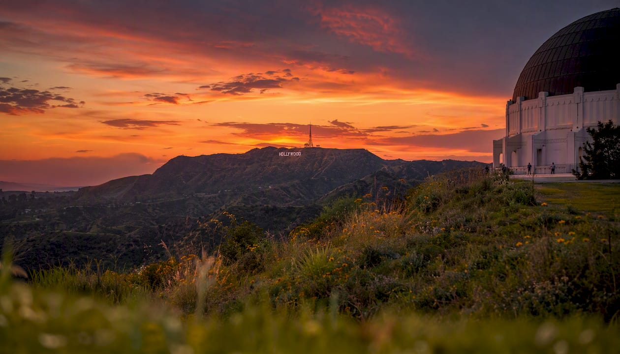
    Griffith Observatory is the anchor. Experienced local photographers treat it as a multi-setup location — plan for three distinct shots: a telephoto compression of the Hollywood Sign from the east lawn, a mid-range skyline view looking south toward Downtown, and a wide architectural shot of the observatory dome itself. Tripods are allowed on the exterior terraces for personal use, but drones and lighting rigs are prohibited, so leave the drone at home.

    Parking at the Observatory fills up fast on weekends. The Observatory’s own lot is free but limited; overflow parking is available along Western Canyon Road, and the DASH Observatory bus runs from Los Feliz on weekends for a flat fare. Weekday mornings before 10 AM are the sweet spot for open parking and thinner crowds.

    The Hollywood Walk of Fame rewards a different approach. Shoot along Hollywood Boulevard early, before the tourist foot traffic picks up around 10 AM. Get low for a wide-angle shot that puts a star in the foreground with the theater marquees behind it. The Dolby Theatre and TCL Chinese Theatre facades are strong standalone subjects too.

    Pro Tip: For the Hollywood Sign, a 200mm or longer telephoto lens from the Griffith Observatory east lawn compresses the distance beautifully. A wide-angle from the same spot captures the full skyline sweep. Bring both if you can.

    For the Beachwood Canyon viewpoints, drive up Beachwood Drive and park near the canyon entrance. The sign reads closer to than from the Observatory, and the surrounding hills give the shot a more intimate, neighborhood feel.

    The Westside: Getty Center, LACMA, and Rodeo Drive

    The Westside packs three very different visual styles into one afternoon if you sequence them right.

    Getty Center sits on a hilltop above Brentwood and the architecture alone is worth the trip. The travertine terraces, the central garden, and the canyon views all photograph beautifully in late afternoon light. Parking at the Getty structure costs $20 per car (cash or credit), and admission to the museum is free. Plan at least 90 minutes to move through the key outdoor photo spots without rushing. The garden’s circular pool and the terraced overlooks facing the Pacific are the two strongest compositions.

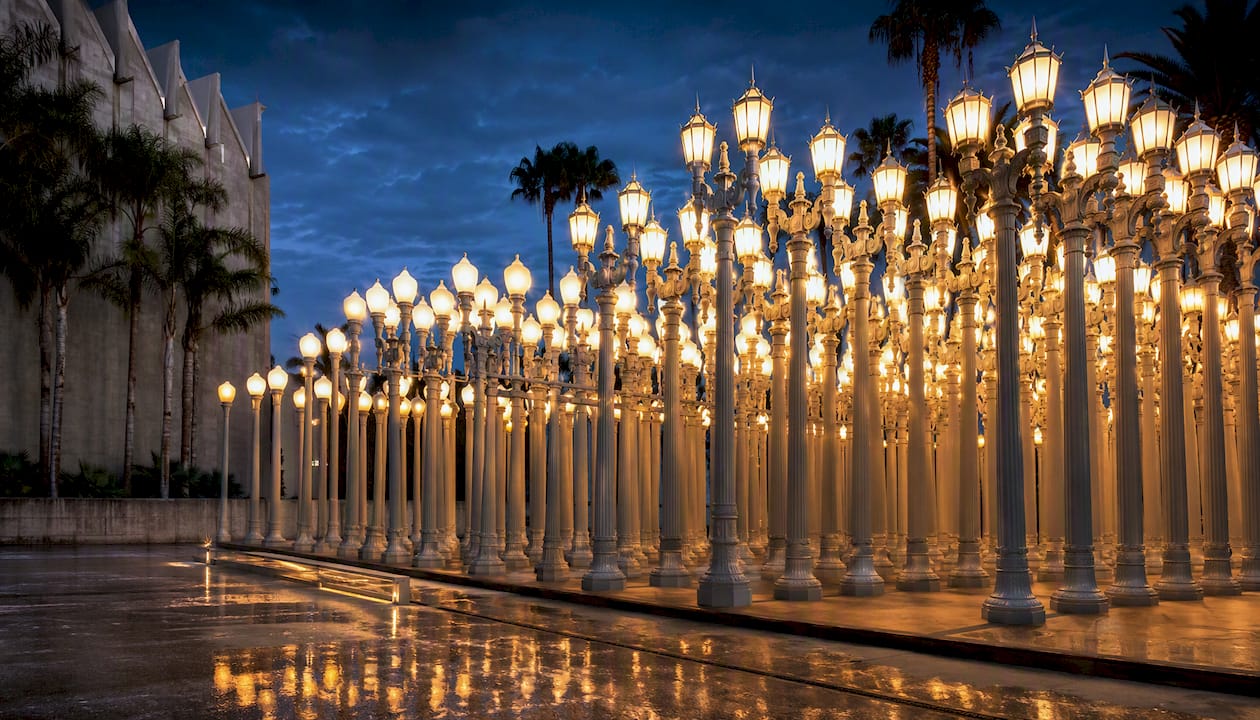
    LACMA’s Urban Light is one of the most recognizable photography locations in Los Angeles. The installation of many restored antique street lamps is best photographed at blue hour, roughly 20–30 minutes after sunset, when the lamps are fully lit and the surrounding sky still holds color. During the day, the columns read flat and crowded. At blue hour, they glow. Plan a short stakeout rather than a quick pop-in — you’ll want to wait for pedestrian gaps to get a clean frame. LACMA’s parking garage is on Spaulding Avenue and costs around $10–$15 depending on duration.

    Illuminated Urban Light lamp columns at twilight

    Rodeo Drive in Beverly Hills is all about the storefronts, the palm-lined median, and the luxury brand signage. Shoot before 9 AM on a weekday and you’ll have the street almost to yourself. A 35mm or 50mm lens keeps the proportions natural and lets the architecture breathe. This is a public street, so casual photography is fine. Commercial shoots on private property (inside stores, on private plazas) require permission from the property owner.

    Pro Tip: At LACMA’s Urban Light, position yourself low and slightly off-center to create a leading-line effect through the lamp columns. A 24–35mm lens works well here.

    Santa Monica and Venice: beaches, piers, and murals you’ll want to frame

    The beach corridor from Santa Monica to Venice is one of the most visually layered stretches in Southern California. You can walk the whole thing in a couple of hours and hit a dozen distinct photo moments along the way.

    Here’s a suggested walking route that connects the key spots:

    1. Santa Monica Pier — Start at the pier’s western end, where the Route 66 terminus sign sits above the Pacific. Shoot the Ferris wheel from the south side of the pier for a clean silhouette at golden hour. The reflection on wet sand at low tide adds another dimension.
    2. Palisades Park overlook — Walk north along Ocean Avenue to Palisades Park. The bluff views looking south toward the pier and the Santa Monica Mountains are underrated and rarely crowded.
    3. Venice Boardwalk — Head south along the beach path. The boardwalk’s street performers, murals, and muscle beach equipment make for candid, energetic shots. Late afternoon light hits the west-facing walls perfectly.
    4. Abbot Kinney murals — Turn inland to Abbot Kinney Boulevard for painted shop facades and gallery walls. This stretch changes frequently, so what you find is often a surprise.
    5. Venice Sign — The iconic arched sign over Windward Avenue is a quick stop. Shoot from the south side of the canal for a reflection shot if the water is calm.

    Gear note: sea glare is real here. A circular polarizing filter cuts the reflection off wet sand and water and makes colors pop. Beach wind can shake a lighter tripod, so weigh it down or shoot handheld with a faster shutter speed. The sun sets directly over the Pacific from this stretch of coast, which means golden hour is genuinely golden.

    Downtown LA and the Arts District: architecture and murals worth the drive

    Downtown LA rewards photographers who are willing to move around. The buildings are dramatic, the murals are dense, and the light bouncing off glass and steel creates compositions you won’t find anywhere else in the city.

    • Walt Disney Concert Hall (111 S Grand Ave) is the most architecturally striking building in the city. The stainless steel panels reflect the sky and surrounding buildings in ways that change by the minute. Shoot from Grand Avenue for the full facade, or get close and abstract the curves. Morning light from the east hits the panels first; late afternoon wraps the south face in warm tones.
    • The Broad sits directly across Grand Avenue and its plaza and entrance areas offer distinctive modern-architecture shots that are popular with photographers. The honeycomb exterior (“The Veil”) creates strong texture in direct light. The plaza is public and open during museum hours.
    • Arts District murals run through the streets east of the 101 freeway, particularly along Traction Avenue, Hewitt Street, and the surrounding alleys. These walls change regularly, so use StreetArtCities to check current mural locations before you go.

    Access and safety: most Arts District shooting happens on public sidewalks and streets, which is fine. Avoid shooting in private parking lots or loading docks without permission. For evening shoots, stick to the main corridors on Traction and Mateo Street, which stay active into the evening. Parking is easier on weekends when the commercial lots open to the public.

    For architecture, a wide-angle lens (16–24mm) handles the scale of Disney Hall and The Broad. For murals, a 35–50mm keeps the proportions natural and flatters portrait subjects standing in front of the walls.

    The best mural and street-art walls to put on your list

    Los Angeles has more murals per square mile than almost any other American city, and a handful of walls have become genuine Instagram landmarks.

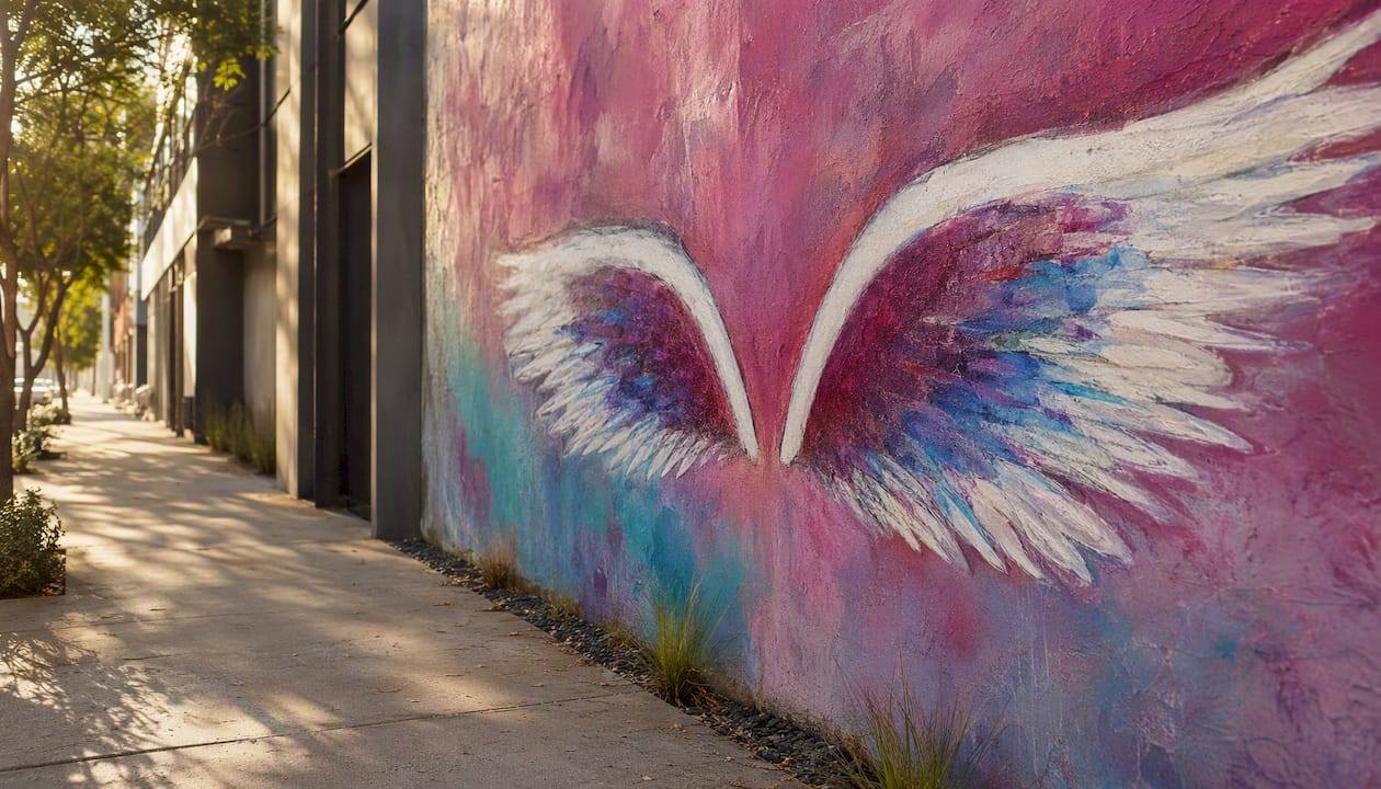
    The Angel Wings mural by Colette Miller (originally painted in 2012 and replicated across the city) is the most requested photo-wall in LA. The original is in Hollywood, but versions appear in other neighborhoods too. Go on a weekday morning before 10 AM to avoid a line. Stand about 10–12 feet back with a 35–50mm lens so the wings frame your subject without distortion.

    Angel Wings mural in Hollywood at morning

    The Rainbow Crochet mural and similar textile-style walls in the Arts District attract a different crowd. These walls photograph best in soft, overcast light when the colors read evenly without harsh shadows.

    For mural portraits generally, the formula is simple: give your subject space to breathe within the frame, use a slightly longer focal length (50–85mm) to compress the background, and shoot in the hour after sunrise or the hour before sunset when the light is directional but not harsh.

    Pro Tip: Always credit the artist when you post a mural photo. Tag the artist’s handle if you can find it, and check StreetArtCities for artist attribution before you publish.

    Crowd management at busy walls is mostly about timing. The Angel Wings and similar high-traffic spots are genuinely quiet before 9 AM on weekdays. Weekends after 11 AM are the hardest to shoot cleanly.

    What you need to know about LA mural history and photo permits

    Los Angeles has one of the richest mural traditions in the United States, rooted in the Chicano art movement of the 1960s and 1970s. Greater Los Angeles contains thousands of murals, and that tradition has been shaped by community programs, political expression, and neighborhood identity in ways that make these walls more than backdrops. Understanding that context makes your photos more intentional.

    The City of LA’s Mural Ordinance (2013) created a legal framework for registering murals on private property and established protections for what the city calls “Vintage Original Art Murals.” The Department of Cultural Affairs runs the Citywide Mural Program, which handles registration and conservation. If you’re shooting a mural and want to verify its status or find the artist, the DCA is the right starting point.

    For personal photography, shooting murals on public streets and sidewalks is generally fine with no permit required. For commercial shoots (paid work, advertising, film/TV), you typically need permission from the property owner and may need a City of LA film permit depending on the scope of the shoot. Drone photography is prohibited in Griffith Park and at the Observatory, and many other city parks have similar restrictions. Check the LA City Film Office (FilmLA) for current permit requirements before any commercial or drone shoot.

    A practical note: respect private property. If a mural is on the side of a business, don’t block the entrance or set up equipment without asking. Most business owners are happy to let you shoot if you’re polite about it.

    How to plan a photo walk through LA’s best spots

    A little planning goes a long way when you’re trying to hit multiple photo spots in one day. Here’s how to structure it.

    Half-day route (Hollywood/Griffith cluster): Start at Griffith Observatory at 7 AM for the Hollywood Sign shot in morning light. Move to the east lawn for the skyline. Drive down to Hollywood Boulevard by 9 AM for the Walk of Fame before the crowds arrive. Done by noon.

    Full-day route (Westside + beach): Hit Rodeo Drive at 8 AM, then drive to LACMA for a daytime architecture shot. Spend the afternoon at the Getty Center. End at Santa Monica Pier for golden hour, then walk south to Venice for the boardwalk and murals. Blue hour at Urban Light on the way back.

    Timing grid for key spots:

    Gear checklist:

    1. Wide-angle lens (16–24mm) for architecture and pier shots
    2. Standard zoom (24–70mm) for street scenes and murals
    3. Telephoto (70–200mm) for Hollywood Sign compression from Griffith
    4. Circular polarizing filter for beach and water shots
    5. Sturdy tripod for blue hour and low-light work
    6. Extra batteries (cold mornings drain them faster)
    7. Lens cloth for sea spray and dust

    Quick composition reminders: Use leading lines (lamp columns at LACMA, the pier railing at Santa Monica) to pull the eye through the frame. Layer foreground, midground, and background at Griffith for depth. Leave negative space around mural subjects so the art reads clearly. Shoot vertical for Instagram, horizontal for everything else.

    What I actually think about shooting in LA

    Los Angeles rewards the photographers who slow down. The temptation is to hit every spot on a list in one day, but the best shots I’ve seen from this city come from people who spent an hour at one location instead of fifteen minutes at six.

    My honest recommendation: if you only have one morning, go to Griffith Observatory on a Tuesday or Wednesday before 8 AM. The parking is easy, the light is extraordinary, and you’ll have the east lawn almost to yourself. That telephoto shot of the Hollywood Sign with the city below it is one of the most satisfying frames you can make in Southern California, and it’s free.

    The Arts District is the spot most visitors underestimate. The murals there are denser, more varied, and more artistically interesting than the viral walls that get all the attention. Spend a couple of hours walking Traction and Hewitt with no agenda and you’ll find things that don’t show up on any list.

    One local timing detail worth knowing: the Observatory parking lot opens at 10 AM on weekdays but the grounds are accessible earlier on foot from the trail off Western Canyon Road. That’s how you get the sunrise shot without competing for a parking spot.

    Socalsights has the curated photo-walk maps you need

    Planning a photo day in LA from scratch takes real time, and the difference between a good shoot and a great one is usually knowing exactly where to stand and when to show up. Socalsights puts that local knowledge into curated photo-walk guides and printable maps built specifically for Southern California, so you spend your morning shooting instead of searching.

    Socalsights

    The Socalsights Adventure Overview covers GPS-ready routes, insider timing notes for golden and blue hour at each major spot, and crowd-avoidance windows that locals actually use. A Socalsights membership gets you access to the full library of SoCal guides, updated regularly as new murals go up and spots change. Head to the membership page and pick the route that fits your next shoot.

    Sources

    These are the authoritative resources worth bookmarking before you head out.

    Consult official museum pages and the LA City Film Office (FilmLA) directly for the most current hours, permit fees, and any temporary access restrictions before your shoot date.

  • Unique Things to Do in Los Angeles: 15 Offbeat Picks

    Unique Things to Do in Los Angeles: 15 Offbeat Picks

    If you want the most authentic, immediately bookable unique things to do in Los Angeles right now, start here: Sloomoo Institute on Fairfax (ticketed, ~$38+), Bu Tea Den in DTLA (RSVP-only, ~$25), World of Illusions in Hollywood (ticketed, ~$30+), Spies Among Us in Little Tokyo (ticketed, phone-driven), The Last Bookstore in DTLA (free to browse), and Hollywood Forever Cemetery (free or ticketed for events).

    • Sloomoo Institute, West Hollywood/Fairfax: A sensory slime playground for adults and kids alike. Book timed entry online; prices start around $38.
    • Bu Tea Den, DTLA: A hidden speakeasy serving curated tea and fortune-telling. RSVP required (~$25); the address arrives only after you book.
    • World of Illusions, Hollywood: Four connected attractions under one roof. Walk-in or book online; combined visits typically take about an hour to an hour and a half.
    • Spies Among Us, Little Tokyo: A phone-driven spy adventure across a real neighborhood. Ticketed; meet your “handler” at the downtown meeting point.
    • The Last Bookstore, DTLA: A labyrinthine used bookstore with a secret art vault upstairs. Free to enter; open daily.
    • Hollywood Forever Cemetery, Hollywood: A working cemetery that doubles as a concert and film-screening venue. Free to walk; ticketed for events.

    Add these to Google Maps and plan a half-day or full-day route before you read on.

    Key Takeaways

    Los Angeles rewards the people who plan around RSVP-only and immersive local experiences rather than the standard tourist circuit.

    Point Details
    Book RSVP spots early Bu Tea Den and similar venues release slots in small batches; book 5–7 days ahead for weekends.
    DTLA is the best car-free hub The Last Bookstore, Spies Among Us, Smorgasburg, and Bu Tea Den are all Metro-accessible from one station cluster.
    Combine stops by neighborhood Pairing two or three nearby picks (World of Illusions + Crimes of Passion, or Last Bookstore + Grand Central Market) maximizes your day without extra transit.
    Seasonal events sell out fast Cinespia and Día de los Muertos at Hollywood Forever book weeks in advance; check venue pages as soon as dates drop.
    Socalsights curates the routes Socalsights groups offbeat LA stops into downloadable guides with timing and booking tips built in.

    Table of Contents

    Unique things to do in Los Angeles, grouped by what you’re into

    Los Angeles has hundreds of unusual attractions, but knowing which category fits your mood makes planning a lot faster. Here’s how the best offbeat picks break down.

    Immersive and interactive museums

    Sloomoo Institute (West Hollywood/Fairfax): You design your own slime at a DIY bar stocked with 8 textures, 40 colors, 60 scents, and 120 charms, producing over 4 million possible combinations. The vibe is equal parts nostalgia and sensory overload, and it draws as many adults on a Saturday night as it does families on a Sunday afternoon. Timed entry; book online in advance.
    Cost: ~$38+ | Neighborhood: Fairfax/West Hollywood

    Hands mixing colorful slime at DIY bar

    World of Illusions, Hollywood: Four connected experiences at one Hollywood address: the Museum of Illusions, the Upside Down House, the Giant’s House, and Smash It (yes, you get to break things). Plan for 60–90 minutes. Walk-in is possible, but booking ahead skips the line.
    Cost: ~$30+ | Neighborhood: Hollywood Blvd

    Crimes of Passion Interactive: This is a “doing” museum, not a looking one. Visits involve spending a couple of hours completing integrated puzzles and social tasks woven into the storyline. Timed entry; book online.
    Cost: $20–$50 | Neighborhood: Los Angeles

    Pro Tip: Book the first entry slot of the day at any of these venues. Crowds are thinner, lighting is better for photos, and staff tend to be more engaged with early groups.

    Oddities, curiosities, and hidden history

    The Last Bookstore, DTLA: The ground floor is a beautiful-used bookstore. The upstairs is something else entirely: a maze of book tunnels, art installations, and a horror section tucked behind a curtain. Free to enter, and you could spend an hour just wandering.
    Cost: Free | Neighborhood: DTLA

    Book tunnel inside The Last Bookstore

    Hollywood Forever Cemetery, Hollywood: This is a working cemetery, but it’s also one of the most culturally rich spots in the city. Celebrities are buried here alongside elaborate mausoleums, and the grounds host Cinespia outdoor film screenings and Día de los Muertos celebrations. Walking the grounds is free; events are ticketed.
    Cost: Free (grounds) / Ticketed (events) | Neighborhood: Hollywood

    Griffith Observatory, Los Feliz: The observatory itself is free to enter, and the views of the city and the Hollywood Sign from the grounds are genuinely hard to beat. The Samuel Oschin Planetarium shows require a ticket (~$10). Go on a weekday evening for the best experience without the weekend crowd.
    Cost: Free (grounds) / ~$10 (planetarium) | Neighborhood: Los Feliz

    Atlas Obscura’s LA roundup lists 240+ unusual spots if you want to go deeper into the city’s oddities.

    Pro Tip: Pair The Last Bookstore with a walk through the nearby Grand Central Market for a low-cost, high-character DTLA afternoon.

    Secret food, tea rooms, and speakeasies

    Bu Tea Den, DTLA: This is the most genuinely unusual food-and-drink experience in Los Angeles right now. It operates as an RSVP-only speakeasy with Automated Fortune-Telling Machines™, curated tea service, and a live projection that adds your personal paisley to the wall. Your ~$25 reservation covers tea, a personalized printed fortune, and that paisley moment. The exact address is shared only after you book, which is standard practice for venues like this.
    Cost: ~$25 | Neighborhood: DTLA

    Fortune-telling machine and tea set in speakeasy

    Smorgasburg LA, DTLA/ROW DTLA: Every Sunday, this outdoor market draws dozens of local food vendors selling everything from Japanese-Peruvian fusion to experimental desserts. It’s free to enter; bring cash and an appetite. The crowd is local and the food is genuinely good.
    Cost: Free entry / Food costs vary | Neighborhood: ROW DTLA

    Pro Tip: For Bu Tea Den, RSVP as soon as you see an open slot. Weekday afternoon sessions book out days in advance, and the venue releases new slots in small batches.

    Offbeat outdoor escapes and lesser-known hikes

    Runyon Canyon’s lesser-used north entrance (Fuller Ave): Most hikers enter from the south on Fuller Ave and turn back at the ridge. Walk the full loop to the north entrance on Mulholland Drive and you’ll lose most of the crowd within ten minutes. Free, open daily.
    Cost: Free | Neighborhood: Hollywood Hills

    Elysian Park’s hidden trails: LA’s oldest park has a network of trails that most visitors never find because the main entrance draws people to the baseball stadium. The park’s interior trails near the Police Academy road are quiet, shaded, and genuinely feel like a different city.
    Cost: Free | Neighborhood: Echo Park/Elysian Park

    Pro Tip: Both of these parks get crowded on weekend mornings. Hit them before 8 AM or after 4 PM for a noticeably quieter experience.

    Neighborhood-led discoveries

    Spies Among Us, Little Tokyo: A phone-driven immersive spy game that plays out across the actual streets of Little Tokyo. You follow clues, meet “agents,” and complete missions at real locations in the neighborhood. It’s one of the most creative ways to actually experience a neighborhood rather than just walk through it. Ticketed; start at the designated downtown meeting point.
    Cost: $20–$50 | Neighborhood: Little Tokyo/DTLA

    The Arts District mural walk, DTLA: The Arts District has some of the most photographed street art in the country, but the best pieces are on the side streets off Traction Ave and Mateo St, not the main drag. No ticket needed; just walk.
    Cost: Free | Neighborhood: Arts District, DTLA

    Pro Tip: Combine Spies Among Us with a post-game meal in Little Tokyo. Marugame Monzo and Daikokuya are both within easy walking distance of the game’s meeting point.

    Sample itineraries for different kinds of days

    These are realistic, tested combinations. Each one accounts for LA traffic and the time these venues actually take.

    1. Half-day sensory + market (Saturday morning, DTLA)

    • 9:00 AM: Start at The Last Bookstore when it opens. Give yourself 45–60 minutes to explore the upstairs vault.
    • 10:15 AM: Walk five minutes to Grand Central Market for breakfast from one of the vendors (Eggslut, Sticky Rice, or a classic egg sandwich from Ana Maria’s).
    • 11:30 AM: Head to Smorgasburg LA at ROW DTLA (Sundays only; swap for the Arts District mural walk on other days).
    • 1:00 PM: Done. No car needed for this loop; it’s all walkable from the Pershing Square Metro station.

    Accessibility note: The Last Bookstore’s upstairs vault has stairs and tight passages; the ground floor and Grand Central Market are wheelchair accessible.

    2. Full-day immersive loop (Hollywood to DTLA)

    • 10:00 AM: World of Illusions on Hollywood Blvd (book the first slot). Plan 90 minutes.
    • 12:00 PM: Lunch on Hollywood Blvd or grab something quick and rideshare to DTLA (~15 minutes without traffic).
    • 1:30 PM: Crimes of Passion Interactive (book in advance; plan 2–3 hours).
    • 4:30 PM: Walk to The Last Bookstore (10 minutes on foot from most DTLA spots).
    • Evening: Optional Bu Tea Den reservation if you booked ahead.

    Car or rideshare needed between Hollywood and DTLA. Parking on Hollywood Blvd is metered and fills by 11 AM on weekends.

    3. Date night with a secret speakeasy

    • 6:00 PM: Griffith Observatory at dusk. The city lights coming on below the observatory is one of the best free views in LA. Grab a planetarium show ticket if you want (~$10).
    • 8:00 PM: Rideshare to DTLA for your Bu Tea Den reservation. You’ll have received the address after booking.
    • 9:30 PM: Wrap the night in the Arts District; several bars and restaurants stay open late.

    This itinerary works best Tuesday through Thursday when Bu Tea Den slots are more available and Griffith is less crowded.

    4. Family-friendly unique day (low-cost)

    • Morning: Griffith Observatory (free grounds, free parking on weekdays before 10 AM).
    • Midday: Elysian Park trails near the north end of the park.
    • Afternoon: The Last Bookstore (free entry; kids love the upstairs maze).
    • Evening: Hollywood Forever Cemetery grounds walk if there’s a Cinespia screening.

    Total cost: $0–$20 depending on planetarium tickets and food. Stroller-friendly at Griffith and the cemetery grounds; the bookstore’s upstairs is not stroller-accessible.

    Best rainy-day itinerary: World of Illusions, then Crimes of Passion Interactive, then The Last Bookstore. All indoor, all in different neighborhoods, all bookable in advance.

    Practical planning: tickets, transport, and what to bring

    Ticketing patterns

    Most of the genuinely unique experiences in LA fall into one of three booking categories:

    • RSVP-only with address withheld: Bu Tea Den. Book as early as possible; the address arrives by email after confirmation.
    • Timed-entry ticketed: Sloomoo Institute, World of Illusions, Crimes of Passion Interactive. Book online 3–7 days ahead for weekend slots; weekday slots often open closer to the date.
    • Walk-in or free: The Last Bookstore, Griffith Observatory grounds, Hollywood Forever Cemetery, Elysian Park, the Arts District mural walk, Smorgasburg LA.

    For immersive, limited-entry experiences, booking 5–7 days ahead is the safe window for weekends. Weekday morning slots at places like Sloomoo and World of Illusions are often available with 24–48 hours’ notice.

    Transport

    You do not need a car for a DTLA-focused day. The Pershing Square and Little Tokyo/Arts District Metro stations put The Last Bookstore, Grand Central Market, Smorgasburg, Spies Among Us, and Bu Tea Den all within walking distance of each other.

    Hollywood is a different story. Parking on Hollywood Blvd fills fast on weekends; rideshare drop-off is easier. For a Hollywood-to-DTLA day, rideshare between the two hubs costs roughly $15–$25 each way depending on time of day.

    Griffith Observatory has limited parking; the DASH Observatory bus runs from Los Feliz Blvd and Vermont Ave and is a much easier option on weekends.

    Cost ranges at a glance

    Cost Band What’s included
    Free Griffith Observatory grounds, The Last Bookstore, Hollywood Forever Cemetery (grounds), Elysian Park, Arts District mural walk, Smorgasburg entry
    Under $20 Griffith planetarium show (~$10), most food at Smorgasburg
    $20–$50 Bu Tea Den (~$25), Spies Among Us, Crimes of Passion Interactive, World of Illusions (~$30+)
    Over $50 Sloomoo Institute (~$38+ per person, higher with DIY add-ons); group bookings at immersive venues

    What to bring

    • Comfortable shoes for any itinerary involving the Arts District, Little Tokyo, or Griffith trails
    • Valid ID for Bu Tea Den and any speakeasy-style venue
    • A charged phone for Spies Among Us (the whole game runs on your device) and for digital tickets at timed-entry venues
    • Cash or card at Smorgasburg (most vendors take both, but cash moves faster)

    Local insider tactics for finding and booking the best spots

    The most interesting experiences in LA are rarely the ones with the biggest billboards. Locals find them through venue newsletters, neighborhood-specific Instagram accounts, and community Discord servers tied to arts districts and food scenes. If you’re not already following the Arts District BID and Little Tokyo Service Center accounts, start there.

    Why venues withhold addresses: Bu Tea Den and similar RSVP-only spots share the exact address only after booking. This isn’t just mystique; it controls capacity, prevents walk-ins from disrupting the atmosphere, and keeps the experience feeling genuinely exclusive. It’s standard practice for speakeasy-style and secret art lounges across the city.

    The scale of customization at Sloomoo is worth understanding. The DIY bar’s combination of 8 textures, 40 colors, 60 scents, and 120 charms produces over 4 million possible slime combinations. That’s not a marketing number; it’s a genuine reflection of how much creative latitude the experience gives you, which is why it works for adults as much as kids.

    Pro Tip: Book the first available slot of the day at any timed-entry venue. You get the freshest setup, the smallest crowd, and the most attentive staff. For RSVP-only spots like Bu Tea Den, Tuesday and Wednesday afternoon slots are the easiest to land and the quietest to enjoy.

    Two tactics locals use consistently:

    • Sign up for venue newsletters directly. Sloomoo, World of Illusions, and Crimes of Passion all release new dates and limited slots via email before they appear on third-party booking sites.
    • For Spies Among Us, check the booking page on Monday mornings. New weekly slots tend to go live at the start of the week, and Little Tokyo is significantly less crowded on weekday afternoons.

    TripAdvisor’s LA attractions index shows hundreds of mainstream options, which is useful for one thing: knowing what everyone else is doing so you can plan around it.

    Seasonal and event-based unique activities in LA

    Some of the best unique things to do in Los Angeles only exist for a few weeks a year. These are worth planning a trip around.

    Cinespia at Hollywood Forever Cemetery (May through October): Outdoor film screenings projected onto the mausoleum wall, with DJs, food trucks, and a crowd that genuinely dresses for the occasion. Tickets sell out weeks in advance for popular titles. Check the Cinespia website directly for the season schedule.

    Día de los Muertos at Hollywood Forever (November 1–2): One of the largest and most visually spectacular Día de los Muertos celebrations in the country. Altars, live music, traditional dance, and art installations fill the cemetery grounds. Ticketed; book as soon as the event is announced.

    Smorgasburg LA seasonal pop-ups: Beyond the regular Sunday market, Smorgasburg hosts themed seasonal editions around the holidays and summer. Follow their Instagram for dates; these pop-ups often feature vendors not in the regular rotation.

    The LA County Fair (Pomona, late August through late September): It’s technically outside the city, but the LA County Fair at the Fairplex in Pomona is one of the most genuinely weird and entertaining annual events in Southern California. Deep-fried everything, livestock competitions, carnival rides, and live concerts. Tickets are available online; parking is a flat fee on-site.

    Haunted hayrides and Halloween pop-ups (October): LA goes hard for Halloween. The Los Angeles Haunted Hayride at Griffith Park and various immersive horror pop-ups around the city run through October. These sell out fast; check venue pages in September.

    Rose Bowl Flea Market (second Sunday of each month): Not strictly seasonal, but the scale of this market changes dramatically in spring and fall when the weather is best. Over 2,500 vendors selling vintage clothing, furniture, art, and oddities. Admission is $20 for general entry; early-bird entry (before 7 AM) costs more but gives you first access.

    What most LA travel guides get wrong

    The conventional advice for visiting Los Angeles is to pick a neighborhood and stay in it. Silver Lake for the cool factor, Venice for the beach, Hollywood for the landmarks. That logic makes sense for a first trip, but it’s exactly what keeps people from finding the genuinely interesting stuff.

    The experiences that stick with you in LA are almost always the ones that require a little friction: an RSVP you had to plan for, a neighborhood you had to rideshare to, a bookstore vault you had to climb stairs to find. The city rewards the people who treat it like a puzzle rather than a checklist.

    The other thing most guides underestimate is how well the DTLA-to-Little Tokyo corridor works as a single day. You can hit The Last Bookstore, Spies Among Us, Grand Central Market, and Bu Tea Den in one loop without a car, and each of those experiences feels completely different from the last. That’s rare in a city where most “unique” recommendations are just variations on the same Instagram backdrop.

    My honest take: skip the Hollywood Walk of Fame on your first visit and spend that two hours at Crimes of Passion Interactive instead. You’ll have more to talk about at dinner.

    Socalsights has the curated routes ready for you

    Planning a day around offbeat LA spots takes longer than it should, mostly because the best ones aren’t grouped anywhere useful. Socalsights fixes that with ready-made hidden-gems guides built around real neighborhoods, real timing, and real local knowledge.

    Socalsights

    Each guide groups hand-picked stops by neighborhood and interest, with estimated timing, booking tips, and the kind of insider context that saves you an afternoon of research. Whether you’re planning a solo DTLA loop, a date night with a speakeasy stop, or a family-friendly day that doesn’t feel like a tourist checklist, Socalsights has a curated route that fits. Browse the full collection and pick your next offbeat day in LA.

    Sources

  • Joshua Tree Stargazing: Best Spots & Night Planning

    Joshua Tree Stargazing: Best Spots & Night Planning

    Joshua Tree stargazing is as good as it gets in Southern California. Head to one of the four NPS-designated viewing lots—Quail Springs, Hidden Valley, Cap Rock, or Ryan Mountain—for easy, legal access. For the darkest skies, drive east to Pinto Basin Road or Cottonwood Campground, where the Coachella Valley light dome fades behind the mountains.

    Three things to do right now before you go:

    • Check moon phase and weather. A new moon night with low wind and no clouds is the gold standard. Even a half-moon washes out the Milky Way.
    • Pick your spot. The four designated lots work great for most visitors. If you want deeper darkness, aim for the east side of the park.
    • Pack the essentials. Red headlamp, warm layers (desert temps drop fast after sunset), at least two liters of water per person, and a fully charged phone.

    Two rules you cannot skip: stay close to your vehicle in designated parking-area stargazing zones, and no overnight camping in parking lots.

    Pro Tip: Download an offline star map app like SkySafari or Stellarium before you leave home. Cell service is spotty inside the park, and you will want it the moment you look up.

    Key Takeaways

    Joshua Tree’s International Dark Sky Park designation, combined with its high-desert elevation and east-side darkness, makes it one of the best stargazing destinations in the American Southwest — plan around a new moon, head east for the darkest skies, and use red light only.

    Point Details
    Best dark-sky locations Pinto Basin Road pullouts and Cottonwood Campground are the darkest spots in the park.
    NPS vehicle rule Stay within 20 feet (6 meters) of your vehicle in all four designated stargazing lots.
    Milky Way season The core is visible March through September; peak viewing runs April through August.
    Night-vision protection Eyes need 20–30 minutes to adapt; one white light resets the clock entirely.
    Socalsights planning The Socalsights adventure guide offers curated pullouts, packing lists, and itineraries built around NPS rules.

    Table of Contents

    Why Is Joshua Tree Such a Great Place to Stargaze?

    Joshua Tree National Park holds an International Dark Sky Park designation, a recognition given by DarkSky International to places that actively protect night-sky quality and limit artificial light. That designation is not just a badge — it signals real darkness, real stars, and a park that enforces lighting standards.

    The high-desert setting does a lot of the work. Elevation across the park ranges from roughly 1,000 feet near Cottonwood to over 5,000 feet near the Wonderland of Rocks. Higher elevation means thinner air, lower humidity, and fewer atmospheric particles scattering light. The result is a sky that feels almost three-dimensional on a clear night.

    That east-west gradient matters when you are planning. The west entrance near Twentynine Palms and the south entrance near Cottonwood Springs both face different light-pollution sources. NPS notes that growing nearby communities pose an ongoing threat to the park’s dark skies, which is why visitor behavior — keeping lights off, using red filters — directly supports the park’s designation.

    Key conditions that make Joshua Tree nights exceptional:

    • Low average humidity compared to coastal Southern California
    • Wide, flat horizons in the basin areas that let you see the Milky Way arc from edge to edge
    • Minimal tree canopy blocking the sky (the Joshua trees themselves are short enough to frame, not block, the view)

    Where Are the Official NPS Stargazing Spots in Joshua Tree?

    The National Park Service designates four parking areas specifically for stargazing. Each has its own character, and knowing the differences helps you pick the right one for your night.

    Quail Springs

    Located along Park Boulevard in the western section, Quail Springs is one of the more accessible lots. It sits at a moderate elevation with open sightlines to the south and west. Restrooms are not available directly at this lot, so plan accordingly. The western sky here can show some glow from the Coachella Valley, but the overhead and northern views are excellent.

    Hidden Valley

    Hidden Valley parking area is one of the most popular spots in the park during the day, which means it can get busy at night too. The surrounding rock formations create a natural amphitheater effect — you feel enclosed by boulders while the sky opens above you. Restrooms are available nearby. This is a solid pick if you want atmosphere along with your stars.

    Boulders framing starry sky at Hidden Valley

    Cap Rock

    Cap Rock sits near the center of the park and offers a wide, flat parking area with good all-sky views. The iconic balanced rock formation makes for a striking foreground in photos. Restrooms are available here. Accessibility is relatively good, with a paved loop trail nearby that is manageable for most visitors.

    Ryan Mountain

    The Ryan Mountain parking area gives you access to one of the park’s best elevated viewpoints. The lot itself is a fine stargazing spot, and if you want to hike up Ryan Mountain (about 1.5 miles one way), the summit view at night is remarkable — though hiking in the dark requires a headlamp and careful footing. No restrooms at this lot.

    NPS rule for all four lots: stay within 20 feet (6 meters) of your vehicle while stargazing in designated areas. Service animals are permitted; pets must be on a leash no longer than six feet and are restricted to paved areas and parking lots.

    Lot Restrooms Accessibility Best Sky Direction Notes
    Quail Springs No Moderate Overhead, north Some western glow
    Hidden Valley Yes (nearby) Good Overhead Rock formations, popular
    Cap Rock Yes Best of four All-sky Paved loop nearby
    Ryan Mountain No Moderate All-sky Hike option for summit views

    Pro Tip: Arrive at least 30 minutes before full dark to get your bearings while you can still see the ground. Tripping over a curb in the dark is a real way to end a night early.

    What Are the Darkest Stargazing Spots in Joshua Tree?

    If the designated lots feel too crowded or you want a noticeably darker sky, the east side of the park is where to go. NPS specifically calls out Pinto Basin Road (the stretch between Cholla Cactus Garden and Cottonwood Spring) and Cottonwood Campground as having the least traffic and some of the park’s darkest conditions.

    Dark Pinto Basin Road under starry sky at night

    The reason is simple geography. Pinto Basin sits in a low valley surrounded by mountains that block the Coachella Valley glow to the west. Drive the Pinto Basin Road after dark and you will notice the sky getting progressively darker as you head south. Safe pullouts along this road offer wide-open basin views with almost no artificial light on the horizon.

    Cottonwood Campground, near the south entrance, is the farthest point from Palm Springs and sits at a lower elevation with a broad southern horizon. Campers here regularly report seeing the Milky Way reflected in the quiet of the basin.

    Location Darkness Level Access Best For
    Pinto Basin Road pullouts Darkest in park Paved road, pullouts Milky Way, wide-field views
    Cottonwood Campground Very dark South entrance, paved Overnight campers
    Cholla Cactus Garden Dark Paved lot Foreground photography

    A few safety points for roadside pullouts:

    • Pull completely off the road and turn off all vehicle lights before your eyes start adjusting.
    • No roadside overnight camping is permitted — pullouts are for viewing, not sleeping.
    • Watch for other vehicles on Pinto Basin Road; it is a two-lane road with limited lighting.
    • Stay aware of your surroundings; the desert floor has loose rock and cactus close to the road edge.

    Can You Camp Overnight for Better Stargazing?

    Yes, and it is one of the best ways to experience the Joshua Tree night sky. The park has nine campgrounds, and staying overnight means you can watch the sky shift from dusk through the early morning hours when the Milky Way is often at its most dramatic position.

    Cottonwood Campground is the top pick for darkness. Its south-entrance location puts it furthest from the major light domes, and the open desert around it gives you unobstructed views in nearly every direction. Reservations are recommended, especially on weekends and during peak season (fall and spring).

    Other campgrounds worth considering:

    • Jumbo Rocks — large, spread-out sites with great rock formations for framing shots
    • White Tank — smaller and quieter, good for a more solitary experience
    • Belle Campground — no hookups, first-come first-served, and relatively uncrowded

    For the absolute darkest experience, backcountry camping in the park’s wilderness areas is an option. You need to register at a backcountry board before heading out, carry all your own water (there is none in the backcountry), and have solid navigation skills. This is not a casual option — it is for prepared backpackers who want to sleep under a sky with zero nearby light sources.

    Entrance fees apply regardless of how you enter. If the fee station is unstaffed when you arrive at night, you can pay online or at a self-pay kiosk. The park never fully closes, but fee collection is always required.

    Pro Tip: Book Cottonwood Campground well in advance for new moon weekends in April, May, and August. Those nights fill up fast once the astronomy community notices the calendar.

    How Do You Protect Your Night Vision (and Everyone Else’s)?

    This is where most first-timers accidentally ruin their own experience. NPS guidance is clear: it takes 20–30 minutes for your eyes to fully adapt to darkness. One flash of white light resets that clock entirely.

    The fix is simple. Use a red-mode headlamp or cover your flashlight with red cellophane or tape. If you need to check your phone, drop the brightness to minimum and consider a red-filter app. Keep the phone in your pocket as much as possible.

    Other etiquette and safety points:

    • Watch your step. Cacti and uneven ground are everywhere, and they are invisible in the dark without a light.
    • Wear closed-toe shoes. Sandals are a bad idea in Joshua Tree at any hour, but especially at night.
    • If you attend a public star party with telescopes, do not touch the eyepiece or nudge the mount — let the operator handle adjustments to keep alignment for everyone.
    • Pets must stay on a leash; emotional-support animals follow the same rules as pets in the park.

    Light pollution from growing communities near the park is an ongoing conservation issue. Every visitor who keeps lights off and uses red filters is directly helping protect the park’s dark-sky designation and the nocturnal wildlife that depends on natural darkness.

    When Is the Best Time to See the Milky Way at Joshua Tree?

    The Milky Way core is visible roughly March through September, with the peak window running April through August. Outside those months, the core sits below the horizon during the hours when the sky is fully dark.

    Moon phase matters as much as the calendar month. A new moon night in May will show you far more than a full moon night in July. Plan your trip around the new moon window — typically a five-to-seven-day stretch each month when the moon rises and sets before the sky gets fully dark.

    1. March and April — The Milky Way core rises in the southeast before midnight. Orion dominates the western sky early in the evening. Temperatures are mild, making these months ideal for long sessions.
    2. May and June — Core visibility improves dramatically. The Summer Triangle (Vega, Deneb, Altair) climbs higher each week. Nights are warm enough to sit outside comfortably without heavy layers.
    3. July and August — Peak Milky Way season. The core arcs high overhead around midnight. The Perseid meteor shower peaks in mid-August and is one of the most reliable annual shows — plan for a new moon Perseid night if you can.
    4. September — The core starts to drop earlier. Still excellent viewing, and crowds thin out after Labor Day.
    5. December — The Geminid meteor shower peaks mid-month and is actually one of the strongest showers of the year. The Milky Way core is gone, but the Geminids are worth a cold night in the desert.

    Other showers to note: the Lyrids in late April and the Quadrantids in early January both produce reliable activity, though neither matches the Perseids or Geminids in peak rate.

    What Camera Settings Work Best for Astrophotography at Joshua Tree?

    You do not need a professional setup to get a great shot of the Joshua Tree night sky. A camera with manual controls, a wide-angle lens, and a sturdy tripod will get you there.

    Start with these settings and adjust from there:

    Setting Starting Point Why
    Aperture widest available aperture Lets in the most light
    ISO 1600–3200 Brightens the sensor without overexposing
    Shutter speed 20–25 seconds Captures stars before they trail
    Focus Manual, set to infinity Autofocus fails in the dark
    White balance 3200–4000K Keeps sky color natural

    NPS photography guidance recommends a tripod, manual settings, and patience. Those three things cover 90% of what separates a blurry phone snap from a real astrophoto.

    Gear checklist:

    • Sturdy tripod (lightweight travel tripods wobble in desert wind)
    • Remote shutter release or use your camera’s 2-second timer
    • Wide-angle lens (24mm or wider is ideal)
    • Spare batteries (cold nights drain them faster than you expect)
    • Red-filter headlamp so you can adjust settings without ruining your adaptation

    Pro Tip: Change only one setting at a time between shots. If you adjust ISO and shutter speed simultaneously, you will not know which change made the difference. Small, single adjustments teach you the camera faster than any tutorial.

    For phone photographers, Night Mode on recent iPhone and Pixel models can produce surprisingly good results. Lock the phone to a tripod, use the longest Night Mode exposure available, and avoid touching the screen during the shot.

    Are There Guided Stargazing Programs at Joshua Tree?

    Yes, and they are worth checking before your visit. The National Park Service runs ranger-led night-sky programs throughout the year, typically scheduled around new moon periods. Check the NPS events calendar or stop by a visitor center when you arrive — programs are posted there and sometimes fill up quickly.

    The park also hosts an annual Night Sky Festival, a multi-day event that brings together astronomers, rangers, and the public for telescope viewing, talks, and guided walks, according to various local event listings. Dates vary by year, so check the NPS site for current scheduling.

    Sky’s the Limit Observatory, located in Twentynine Palms just outside the park, is the most established local partner for guided observing. They host public star parties and educational programs, and their volunteers are genuinely enthusiastic about sharing the sky with newcomers.

    Benefits of joining a guided event:

    • Access to large telescopes you would not bring yourself
    • Expert identification of planets, nebulae, and star clusters
    • A social experience that solo viewing cannot replicate

    The trade-off is flexibility. Guided events run on a fixed schedule, and you are sharing the space with a group. If you want to linger at a specific spot or move around the park freely, DIY viewing gives you that freedom. For first-timers, though, a ranger program or Sky’s the Limit session is a genuinely great way to start.

    If you want to connect with local astronomy groups before your trip, California astronomy meetups are a good resource for finding organized viewing events and communities near you.

    Pro Tip: If you attend a public star party, ask the telescope operator what they are pointing at before you look. Knowing you are about to see Saturn’s rings or the Andromeda Galaxy makes the moment land completely differently.

    What Do You Need to Know Before You Go?

    A few logistics that catch visitors off guard, especially on night visits.

    The park entrance fee is $35 per vehicle (as of 2026), and it covers seven days. If you arrive after the fee station closes, pay at a self-pay kiosk or online through Recreation.gov. The park never fully closes, but the fee is always required.

    Cell service is limited to nearly nonexistent in most of the park. Download offline maps (Google Maps offline, Gaia GPS, or AllTrails) before you leave. Tell someone your plan — where you are going, which lot or campground, and when you expect to be back.

    Pre-visit checklist:

    • At least two liters of water per person (more in summer)
    • Food and snacks for the full visit
    • Warm layers and a wind layer (desert nights cool fast, even in summer)
    • Closed-toe shoes
    • Red headlamp and a backup light source
    • Fully charged phone and a portable battery pack
    • Offline maps and a star chart or app
    • Emergency contact plan

    Road conditions can change. Pinto Basin Road and the park’s interior roads are generally well-maintained, but check the NPS site for closures before heading out. Some roads require high-clearance vehicles.

    Socalsights Curated Picks: Three Pullouts and Sample Itineraries

    Here are three safe, legal pullouts that offer excellent dark-sky views without requiring off-road driving or backcountry access.

    • Pinto Basin Road, south of Cholla Cactus Garden — Wide pullout with a flat basin view to the south and east. Minimal traffic after 9 PM. Bring a blanket and face south for the Milky Way core.
    • Cap Rock parking area — The paved lot and nearby rock formations make this one of the most comfortable spots for a casual night out. Great for groups and families.
    • Cottonwood Spring Road pullout (near south entrance) — Darker than most western-side options, with a wide southern horizon. Combine with a Cottonwood Campground stay for a full night.

    Single-night itinerary: Arrive at the south entrance by 7 PM. Drive to Cottonwood Campground to set up. Head to a Pinto Basin Road pullout by 8:30 PM. Watch the sky darken fully by 9 PM, then spend two to three hours with the Milky Way. Return to camp by midnight.

    Weekend itinerary: Night one at Hidden Valley (arrive Friday afternoon, set up at a nearby campground, stargaze from the lot). Night two at Cottonwood (drive east Saturday afternoon, camp, and use Pinto Basin Road pullouts for the darkest views of the trip).

    Community tips: park parallel to the road so your headlights point away from other viewers when you leave. Keep your setup compact and close to your vehicle. Pack out everything you bring in.

    Pro Tip: Check local Southern California activity guides for daytime activities to pair with your stargazing night — Joshua Tree has excellent hiking, rock climbing, and roadside art installations worth seeing before the sun goes down.

    For more curated SoCal ideas beyond the park, the 100+ SoCal Sights list is a good place to keep exploring.

    What a Single Night Under Joshua Tree’s Sky Actually Feels Like

    I want to be honest with you about something most guides skip. The rules — the 20-foot limit, the red light, the no-camping-in-lots rule — feel like bureaucratic fine print until you are actually standing in the dark at Cap Rock at 10 PM with the temperature dropping and the Milky Way arcing directly overhead. Then they make complete sense.

    The red light rule is not about compliance. It is about the 25 minutes you spent letting your eyes adjust, and not wanting to lose that. The moment someone nearby flicks on a white flashlight, the whole sky seems to dim. You feel it physically.

    The temperature drop is real and fast. I have watched visitors in shorts start shivering by 9:30 PM in what felt like a warm evening. Layers are not optional — they are the difference between staying out until midnight and retreating to your car at 9.

    The single most important thing to remember: use red light only, give your eyes 20–30 minutes to adapt, and stay close to your vehicle in designated areas. Everything else is details.

    Plan Your Joshua Tree Night Sky Adventure with Socalsights

    Socalsights takes the guesswork out of planning a Joshua Tree stargazing night by putting curated local knowledge in one place. Instead of piecing together NPS pages, moon calendars, and campground availability separately, you get a focused guide built around real Southern California experience.

    Socalsights

    What the Socalsights Joshua Tree guide gives you:

    • Curated pullout locations with safety notes and darkness rankings
    • A quick-check packing list you can screenshot before you leave
    • Sample one-night and weekend itineraries built around NPS rules
    • Moon-phase planning cues so you pick the right night

    All recommendations follow NPS guidelines. Nothing in this guide encourages off-road driving, illegal camping, or any behavior that harms the park or other visitors.

    Ready to plan your night? Browse the Socalsights adventure overview and find your next Southern California experience.

    Sources

    Official and authoritative resources used in this guide:

  • Anza Borrego Wildflowers: Your Complete Viewing Guide

    Anza Borrego Wildflowers: Your Complete Viewing Guide

    Yes, Anza Borrego wildflowers are putting on a real show right now. Following regional winter storms, California State Parks confirmed a moderate-to-strong bloom across Anza-Borrego Desert State Park in 2026, with localized displays that range from spectacular to quiet depending on exactly where you stand. The desert doesn’t bloom uniformly — it blooms in patches, and knowing which patches to hit makes all the difference.

    Your top spots to visit right now:

    • Henderson Canyon Road — dense sand verbena and dune evening primrose; arrive before 9 AM or after 4 PM for the primrose
    • Di Giorgio Road — reliable desert sunflower and verbena carpets along a paved, easy-access route
    • Palm Canyon trailhead (Borrego Springs) — good mix of species within a short walk; accessible parking
    • Culp Valley — quieter, higher elevation, and often blooming when lower elevations have already peaked

    Before you leave home, do these three things:


    Key Takeaways

    The single most important thing to know: Anza-Borrego wildflower displays in 2026 are real and worth visiting, but they are localized, not park-wide, so checking a live report within 48 hours of your visit is non-negotiable.

    Point Details
    Check live sources first Use the ABF wildflower map and BorregoWildflowers.org within 48 hours of your visit for current conditions.
    Best road to start with Henderson Canyon Road consistently delivers dense sand verbena and dune evening primrose; arrive before 9 AM.
    Bloom timing is rain-dependent Peak season ranges from mid-February to mid-March in most years, but annual moisture and temperature patterns determine exact timing and duration.
    Protect what you came to see Stay on roads and pullouts; stepping into flower fields damages the plants and seeds for future seasons.
    Socalsights desert guides The Socalsights daycation page offers ready-made Southern California desert itineraries for every visitor type.

    Table of Contents

    How to check live Anza Borrego wildflower bloom status

    Not all bloom reports are created equal. A social media post from three weeks ago tells you almost nothing about what’s flowering today, because a single warm week can push a peak display into rapid decline. You want date-stamped, location-specific reports from people who were actually there.

    Here are the sources worth trusting, ranked by how current and specific they tend to be:

    Anza-Borrego Foundation (ABF): The ABF wildflower page is the gold standard. Volunteer flower scouts submit field notes with dates, GPS-referenced locations, and species lists. The interactive map layer shows pins for recent sightings, and the Foundation updates it regularly during peak season. Cross-referencing two or three scout reports from the same week gives you a reliable picture.

    BorregoWildflowers.org: This site publishes ongoing bloom reports with species-by-location breakdowns and road-condition notes. It’s particularly useful for figuring out which roads are passable after rain and which specific washes are showing color.

    tchester.org bloom reports: Paul Chester’s 2025–2026 bloom report archive documents trip-by-trip observations with species counts. Early-2026 reports logged dozens to nearly two hundred species in bloom across individual hikes, which illustrates just how much site-level variation exists within the same park on the same day.

    iNaturalist: Filter observations by location (Anza-Borrego Desert State Park) and date range (last 7–14 days) to see what’s been photographed and identified recently. The map layer shows exactly where each observation was recorded.

    California State Parks: The parks.ca.gov wildflower page posts park-level bloom status and links to official maps. It’s broader than the ABF or BorregoWildflowers reports but useful for a quick sanity check.

    One thing worth understanding: microclimates inside Anza-Borrego vary dramatically. A canyon on the park’s west side might be at peak while a wash five miles east is already past. Park interpreters and botanists caution against expecting a uniform, park-wide superbloom — even in a strong year, the displays are localized. Real-time local reports beat any seasonal generalization.

    Pro Tip: Set a bookmark for the ABF wildflower page and check it the morning you plan to leave. Scout updates posted within 24–48 hours are far more reliable than anything published a week prior, especially once temperatures start climbing in March.


    Maps to use before and during your visit

    Getting lost in Anza-Borrego is easier than it sounds. The park covers over 600,000 acres, cell signal is patchy at best outside Borrego Springs, and some of the best flower roads are unsigned dirt washes. Load your maps before you go.

    Getting the right maps:

    1. ABF Interactive Wildflower Map — Go to the Anza-Borrego Foundation wildflower page and open the interactive map. It shows volunteer-reported bloom locations as pins with dates and species notes. Zoom in on Henderson Canyon Road and Di Giorgio Road first.
    2. ABDNHA Printable Flower Map — The Anza-Borrego Desert Natural History Association (ABDNHA) publishes a downloadable PDF flower map at abdnha.org. Print it before you leave. It shows named roads, washes, and key pullouts — invaluable when your phone dies.
    3. iNaturalist Map Layer — On the iNaturalist app or website, search “Anza-Borrego Desert State Park,” switch to the map view, and filter by date (last 14 days). Each pin represents a photographed, identified observation. Tap any pin to see the species, date, and exact coordinates.
    4. Google Maps or Gaia GPS offline tiles — Before leaving home, download offline map tiles for the Borrego Springs area. Gaia GPS is especially useful for backcountry roads because it includes USGS topo layers and lets you drop custom waypoints.

    Offline navigation tips:

    • Screenshot the GPS coordinates for key pullouts (Henderson Canyon Road flower fields, Di Giorgio Road at S22, Fish Creek Wash entrance) and save them to your phone’s notes app
    • Note which roads require high clearance — some washes are only accessible in dry conditions
    • Tell someone your planned route before heading into remote areas; the park has limited ranger coverage on backcountry roads

    Safety note: Roads like Fish Creek Wash and Split Mountain can flood quickly after rain and may be impassable for standard vehicles. Always check road conditions through the BorregoWildflowers.org report or the park visitor center before driving into washes.


    Best spots for viewing Anza Borrego desert flowers

    Every location below has its own personality. Some are easy paved-road drives you can do in flip-flops; others reward the extra effort with fewer crowds and more unusual species. Here’s what to expect at each one.

    Henderson Canyon Road Flower Fields

    This is the most reliably photogenic spot in the park during a good bloom year. Henderson Canyon Road hosts dense stands of desert sand verbena, dune evening primrose, and desert sunflower, often carpeting the sandy flats on both sides of the road. The road is paved and accessible to all vehicles. Arrive before 9 AM to catch the dune evening primrose fully open — it closes in the heat of midday. Parking is along the road shoulder; weekends fill up fast, so a weekday morning visit is worth the effort.

    Close-up of wildflowers along Henderson Canyon Road

    Di Giorgio Road

    Running south off Highway 78, Di Giorgio Road offers another reliable concentration of sand verbena and desert sunflower. The surface is paved and flat, making it one of the most accessible routes for families and visitors with limited mobility. Pullouts along the road let you step out and photograph without hiking. This road tends to be slightly less crowded than Henderson Canyon on peak weekends.

    Palm Canyon trailhead (Borrego Springs)

    The Palm Canyon trailhead sits just outside Borrego Springs and gives you a mix of desert floor species within the first half-mile of the trail. You’ll find brittlebush, desert sunflower, and occasional lupines near the trailhead parking area. The trail itself is moderate (roughly 3 miles round trip to the palm grove), but the flower viewing starts immediately. Wheelchair-accessible viewing is available near the parking area and along the first flat section of the trail.

    Pro Tip: The trailhead parking lot fills by 8 AM on busy weekends. If you arrive after 9 AM on a Saturday, park along the road and walk in — it adds maybe five minutes and saves a lot of frustration.

    Culp Valley

    At roughly 3,400 feet elevation, Culp Valley blooms later than the desert floor and often shows color when lower elevations have already peaked. Expect phacelia, lupines, and desert apricot. The road to Culp Valley is paved (S22/Montezuma Grade), and there’s a small primitive campground. It’s a genuinely quieter alternative when Henderson Canyon is packed.

    Fish Creek Wash

    Fish Creek is a high-clearance, four-wheel-drive route through a dramatic canyon. During a strong bloom year, the wash floor can show desert lilies, sand verbena, and brittlebush. The payoff is real, but so is the commitment: the road is a sandy, rocky wash that requires a capable vehicle and should not be attempted after rain. Check road conditions before you go.

    Wildflowers blooming in rocky Fish Creek Wash canyon

    Montezuma Grade and Split Mountain

    Driving up Montezuma Grade (S22) on the way to or from Culp Valley gives you sweeping views of the desert floor below, often carpeted in yellow and purple during peak bloom. Split Mountain Road (off Highway 78 near Ocotillo Wells) leads into a geological wonderland with wildflowers in the wash and canyon walls. Both routes are scenic drives worth building into a two-day itinerary.

    Ocotillo Wells and Imperial Sand Dunes area

    The Ocotillo Wells State Vehicular Recreation Area sits on the park’s eastern edge and shows a different character than the main park. Dune evening primrose and sand verbena thrive in the sandy substrate here. The area is also popular with off-road vehicles, so expect noise and activity on weekends. Early weekday mornings are the quietest.

    • Wheelchair access: Di Giorgio Road pullouts, Henderson Canyon Road shoulder, and the Palm Canyon trailhead flat section offer the most accessible viewing without hiking
    • Crowd tip: Weekday visits between Tuesday and Thursday consistently see lighter traffic than Saturday and Sunday, especially during peak bloom weeks

    Common species to expect and when they bloom

    Knowing what you’re looking at makes the whole experience richer. Here’s a quick rundown of the species you’re most likely to encounter, along with rough bloom windows and ID cues.

    Species Color Typical Bloom Window Quick ID Tip
    Desert sand verbena (Abronia villosa) Purple/pink February–April Low-growing, sticky stems; clusters of small tubular flowers
    Dune evening primrose (Oenothera deltoides) White February–April Large white flowers; open in cool hours, close midday
    Desert sunflower (Geraea canescens) Bright yellow February–May Tall, upright; classic sunflower shape with rough leaves
    Desert lily (Hesperocallis undulata) White February–April Tall stalk; wavy-edged leaves; fragrant
    Brittlebush (Encelia farinosa) Yellow February–May Silvery-gray leaves; yellow daisy-like flowers on bare stems
    Parish’s poppy (Eschscholzia parishii) Yellow-orange March–May Smaller than California poppy; feathery blue-green leaves
    Lupine (Lupinus spp.) Purple/blue February–April Palmate leaves; pea-flower spikes
    Ocotillo (Fouquieria splendens) Red-orange March–June Tall spiny canes; bright red flower clusters at tips

    A few things worth knowing about timing and behavior:

    • Dune evening primrose is a night bloomer. The flowers open in the cool of evening and early morning, then close as temperatures rise. Photographers and observers should plan early or late visits to catch them fully open.
    • Desert lily tends to bloom earlier in the season and can be missed if you visit in late March or April during a warm year.
    • Ocotillo blooms later than most annuals and often shows red flower clusters well into spring, even when the annual carpet has faded.
    • Brittlebush is one of the most forgiving species — it blooms reliably across a wide range of conditions and is often the last thing still showing color.

    For field identification, the iNaturalist app’s camera-based ID feature works well for common desert species. The Jepson eFlora (online) and the Audubon Society Field Guide to California are solid references for deeper ID work.

    The 2025–2026 season illustrated just how much site-level variation exists: individual trip reports documented dozens to nearly two hundred species in bloom on single hikes, depending on location and timing within the season.


    How to visit responsibly and stay safe

    The desert looks tough, but it’s genuinely fragile. A single footstep through a patch of sand verbena can crush dozens of seedlings. Here’s how to enjoy the flowers without wrecking them for the next person — or the next decade.

    Essential safety checklist:

    1. Water: Carry at least one gallon per person per day. The desert is dry and deceptively warm, even in February and March.
    2. Sun protection: Sunscreen, a wide-brim hat, and UV-blocking sunglasses. Desert sun reflects off sand and hits harder than you expect.
    3. Footwear: Closed-toe shoes for any trail or wash walking. Sandals are fine for paved-road viewing.
    4. Navigation: Download offline maps before leaving Borrego Springs. Don’t rely on cell signal in the backcountry.
    5. First aid kit: Basic kit plus blister care. Cholla cactus spines are a real hazard on desert trails.

    Leave No Trace rules for wildflower viewing:

    • Stay on established roads, trails, and designated pullouts. Stepping into flower fields to get a better photo kills the plants you came to see.
    • Never pick flowers. It’s illegal in the state park and removes seeds that would otherwise germinate next season.
    • Pack out all trash, including food scraps. Ravens and coyotes associate human food with humans, which creates problems for both.
    • If you’re photographing, use a telephoto lens rather than walking into a display to get close.

    Vehicle and road notes:

    • Paved roads (Henderson Canyon, Di Giorgio, S22/Montezuma Grade) are accessible to all vehicles.
    • Sandy washes (Fish Creek, parts of Ocotillo Wells) require high clearance and ideally four-wheel drive.
    • After significant rain, washes can flood and remain impassable for 24–48 hours. Check conditions before driving into any wash.
    • Park in designated pullouts or on the road shoulder where it’s wide enough. Driving off-road to park damages vegetation.

    Regulatory notes: Drones require a permit in California State Parks and are generally not allowed over sensitive natural areas. Pets must be on a leash at all times and are not permitted on most backcountry trails. Collecting plants, rocks, or animals is prohibited.


    Sample itineraries from Borrego Springs

    Whether you have one day or two, here’s a practical framework to work from. Adjust based on the current bloom report before you leave.

    One-day drive-and-walk itinerary:

    • 6:30 AM: Leave Borrego Springs heading west on Henderson Canyon Road. Catch dune evening primrose fully open in the cool morning air. Spend 45–60 minutes here.
    • 8:00 AM: Drive south to Di Giorgio Road. Walk the road shoulder for desert sunflower and verbena. Easy, flat, no hiking required.
    • 9:30 AM: Head to Palm Canyon trailhead. Walk the first mile of the trail for brittlebush, lupines, and desert sunflower. Return before midday heat.
    • 11:30 AM: Lunch in Borrego Springs (Christmas Circle area has a few options).
    • 1:00 PM: Drive S22 up Montezuma Grade for sweeping views of the desert floor. Stop at Culp Valley if you want a quieter, higher-elevation alternative.
    • 3:30 PM: Return to Henderson Canyon Road for late-afternoon light and a second look at the primrose as it reopens.

    Two-day option:

    • Day 1: Follow the one-day itinerary above, then camp at Borrego Palm Canyon Campground or stay in Borrego Springs.
    • Day 2 morning: Drive to Fish Creek Wash (high-clearance vehicle required) for desert lilies and a less-visited canyon experience. Check road conditions the night before.
    • Day 2 afternoon: Head to Ocotillo Wells for dune evening primrose in sandy substrate. Look for ranger-led programs at the visitor center — the park occasionally schedules wildflower walks during peak season.

    Pro Tip: Fuel up in Borrego Springs before heading to Fish Creek or Ocotillo Wells. Gas stations are sparse east of town, and you don’t want to be calculating range on a remote wash road.

    For families and limited-mobility visitors: Di Giorgio Road and the Henderson Canyon Road shoulder are the most accessible options. Both are paved, flat, and require no hiking. The Palm Canyon trailhead parking area also offers good viewing without committing to the full trail.


    Why bloom timing varies and how long displays last

    The flowers don’t read the calendar. They respond to rain, temperature, and seed bank conditions that shift every year — sometimes every week. Understanding the basic mechanics helps you set realistic expectations.

    Wildflower season in Anza-Borrego generally runs from late winter into early spring, with peak blooms most often falling between mid-February and mid-March, though timing can shift substantially depending on the year. A wet October and November followed by warm January temperatures can push the peak earlier. A dry fall followed by February rains can delay it. And once temperatures consistently hit the mid-80s, many annuals shift energy from flowering to seed production, shortening the display window fast.

    The seed bank is the key variable. Desert annuals can lie dormant for years, waiting for the right combination of moisture and temperature to germinate. A single good rain year doesn’t guarantee a superbloom — the seeds need the right timing, the right soil temperature, and the right follow-up conditions. Park interpreters and botanists emphasize that a true superbloom requires a specific alignment of robust rainfall and favorable temperatures, and even in strong years, displays are typically localized rather than park-wide.

    Blooms also unfold in waves. Early-season species like desert lily and sand verbena often peak in February, while brittlebush and Parish’s poppy can carry color into April. A two-day visit will almost always reveal more variety than a single-day snapshot.

    • A hot spell in late February or early March can collapse a peak display within days
    • Subsequent rain after an initial bloom can trigger a second wave of germination in some areas
    • Higher-elevation spots like Culp Valley tend to bloom later and hold color longer than the desert floor

    Pro Tip: If you’re visiting in late March and worried you’ve missed the peak, head uphill. Culp Valley and the Montezuma Grade corridor often show color two to three weeks after the desert floor has faded.


    How to follow community reports and contribute your own observations

    The bloom-tracking community around Anza-Borrego is genuinely active and generous. Here’s how to plug in and give back.

    Following live reports:

    • iNaturalist: Go to inaturalist.org, search “Anza-Borrego Desert State Park,” and switch to the map view. Filter by date (last 7 days works well during peak season) to see recent observations. Each pin shows the species, date, photo, and coordinates. The iNaturalist calendar and observation layers update in near-real time as community members upload sightings.
    • ABF volunteer scouts: The Anza-Borrego Foundation coordinates a network of volunteer flower scouts who submit field notes during bloom season. You can follow their updates on the ABF website and social channels.
    • BorregoWildflowers.org: Check the bloom report page for species-by-location updates and route notes. This site also aggregates community reports.
    • Local Facebook groups: Search “Anza-Borrego wildflowers” on Facebook. Several active groups post daily photos and location updates during peak season. Quality varies, but the volume of recent posts gives you a quick read on current conditions.

    Submitting your own observations:

    • Download the iNaturalist app before your visit. When you photograph a flower, tap “Observe,” upload the photo, and let the AI suggest an ID. Confirm or correct it, add a location, and submit.
    • Be specific with location notes. A pin dropped at the exact pullout where you saw a species is far more useful than a general “Henderson Canyon Road” tag.
    • Ethics note on geotagging rare plants: For sensitive or rare species (desert lily populations, rare orchids), consider withholding the precise GPS coordinates in your public post. iNaturalist has an “obscure location” setting for exactly this purpose. Dense foot traffic to a rare plant location can damage it quickly.
    • To send updates directly to the ABF or BorregoWildflowers.org, check each site’s contact page for submission instructions during bloom season.

    How this guide was put together

    This guide draws on a combination of official park sources, community science platforms, and field-observer reports cross-checked for consistency and recency.

    Primary sources consulted:

    On-the-ground bloom reports and media coverage were cross-checked against each other before publication. Where sources disagreed on species timing or road conditions, the more conservative, date-stamped field report was used.

    A note on prediction: No guide can tell you exactly what will be blooming when you arrive. Desert conditions shift fast. Check at least two live sources (ABF and BorregoWildflowers.org) within 48 hours of your visit, and treat any report older than one week as background context rather than current fact.


    What I’d tell a friend heading out there this week

    The thing most visitors get wrong about Anza-Borrego is treating it like a theme park with a guaranteed show. The desert doesn’t owe you a superbloom. But here’s what I’ve found: even in a “moderate” year, if you show up at Henderson Canyon Road before 8 AM on a weekday, you’ll see something that stops you in your tracks. The light is low, the primrose is wide open, and there’s a good chance you’ll have the road mostly to yourself.

    My honest local tip: skip the Instagram-famous pullouts on Saturday afternoon and drive out to Culp Valley instead. The elevation means cooler air, different species, and a fraction of the crowd. Phacelia and lupines up there can be stunning well into late March when the desert floor has already gone quiet.


    Plan your SoCal desert adventure with Socalsights

    Anza-Borrego is one of Southern California’s most rewarding day trips, and Socalsights has the curated resources to help you make the most of it. From printable SoCal itineraries covering the best desert drives to a full SoCal adventure overview with activity picks for every type of traveler, Socalsights cuts through the noise so you spend less time planning and more time out there.

    Socalsights

    Whether you’re a first-timer figuring out which road to take or a returning visitor looking for a quieter canyon, the Socalsights guides give you locally sourced, specific recommendations you won’t find in a generic travel roundup. Head to the Socalsights daycation page to find a ready-made desert day trip plan built around your timeline.


    Sources

  • The Best Coffee in Los Angeles: A Neighborhood Guide

    The Best Coffee in Los Angeles: A Neighborhood Guide

    For a reliably excellent LA coffee experience, start with Intelligentsia Coffee in Silver Lake, Sightglass Coffee in Hollywood, and Go Get Em Tiger. Each anchors a different part of the city and a different style of drinking: precision espresso, full roastery immersion, and neighborhood-first warmth.

    Here are the top picks at a glance:

    • Intelligentsia Coffee (Silver Lake) — technically precise espresso and curated single-origin beans; the standard-bearer for LA specialty coffee
    • Sightglass Coffee (Hollywood) — a full roastery-cafe with V60 pour-overs, patio seating, and all-day food; ideal for long stays
    • Go Get Em Tiger — community-focused, multiple locations, and consistently excellent across every visit
    • République — the best pastry-plus-espresso pairing in the city, full stop
    • Soro Coffee — DTLA’s standout for rare-origin sourcing and barista education

    Quick selector: Need a workspace? Go to Sightglass. Want the best single pour-over? Intelligentsia or Ondo Coffee. Planning a brunch date? République. Chasing a photo-ready drink? Alfred Coffee or Junia Cafe. Curious about rare origins? Soro Coffee.

    Shop Neighborhood Best For Vibe Price Band
    Intelligentsia Coffee Silver Lake Precision espresso Focused, minimal $$
    Sightglass Coffee Hollywood Roastery + workspace Spacious, airy $$
    Go Get Em Tiger Multiple All-day neighborhood cafe Warm, welcoming $$
    République Mid-City Pastry + espresso Elegant, sit-down $$$
    Soro Coffee DTLA Rare-origin tasting Community-driven $$

    Key Takeaways

    Los Angeles’s best coffee shops are defined by neighborhood culture and specialty preparation style, not by a single universal ranking.

    Point Details
    Start with your need Choose workspace, pour-over, pastry, or cultural specialty first, then filter by neighborhood.
    Neighborhood shapes the experience Arts District, Silver Lake, and DTLA offer the most walkable crawl options with distinct cafe cultures.
    Cultural range is the real draw Vietnamese egg coffee, Korean-style cafes, and precision pour-overs coexist across the city.
    Timing changes everything Arriving before 9 AM on weekends avoids lines at viral spots and secures the best pastries.
    Socalsights for the full picture The platform pairs coffee shop picks with neighborhood itineraries and local intel across Southern California.

    Table of Contents

    What makes the best coffee shops in Los Angeles worth visiting?

    Los Angeles has one of the most culturally layered coffee scenes in the country. Eater LA’s editors point out that the city’s cafe culture spans Korean-style dessert cafes, Vietnamese egg coffee (cà phê trứng), Einspänners, and precision single-origin pour-overs, and the neighborhood you pick often determines which style you encounter. That diversity is the whole point.

    The 12 shops below are organized by neighborhood so you can plan a visit or a crawl without backtracking across the city.

    Arts District and DTLA

    Soro Coffee earns its reputation through direct-sourcing relationships with farmers and a genuine commitment to barista education. The menu rotates around rare origins, and the shop hosts community events and certification classes. If you want to understand where your coffee comes from, this is the place to start.

    Tasting rare coffees at specialty cafe

    Document Coffee Bar is a sleek, design-forward spot that draws a creative crowd. The espresso program is tight, the seating is comfortable, and the natural light makes it one of the more pleasant places to open a laptop in DTLA.

    Cognoscenti Coffee (and its sibling, Cognoscenti Coffee Bar) brings a serious, no-frills approach to specialty brewing. Both locations prioritize the cup over the aesthetic, which is exactly what precision-focused drinkers want.

    Stagger Coffee and ORA Urban Cafe round out the DTLA options with neighborhood-friendly vibes and approachable menus.

    Why we picked Soro Coffee: Cross-referenced across multiple local guides and validated by its own sourcing transparency, it’s the clearest example of a DTLA shop that treats coffee as a craft and a community practice simultaneously.

    Hollywood and Silver Lake

    Sightglass Coffee (Hollywood) is the largest footprint on this list. The on-site roasting operation, V60 pour-over program, patio, and all-day food menu make it genuinely suited for a two-hour work session or a leisurely weekend morning. It’s not the most intimate experience, but the breadth is hard to match.

    Spacious Hollywood coffee roastery and patio

    Intelligentsia Coffee (Silver Lake) is where LA’s specialty coffee culture took root. The espresso is technically precise, the single-origin selections rotate regularly, and the staff can actually explain the difference between a washed Ethiopian and a natural Guatemalan without making you feel like a tourist.

    Dinosaur Coffee and Highlight Coffee are Silver Lake neighborhood staples with loyal regulars and a more casual, drop-in energy.

    Alfred Coffee leans hard into its visual identity. The drinks are trend-driven and photo-ready, the interiors are styled within an inch of their lives, and the lines on weekends reflect that. Worth a visit for the experience; not the place for a quiet pour-over session.

    Westside (Venice, Culver City, Santa Monica)

    Menotti’s Coffee Stop in Venice has been a neighborhood anchor for years. The espresso is reliable, the outdoor seating fills up fast on sunny mornings, and the walk to the beach afterward is genuinely one of the better free things to do in Los Angeles.

    Hooked Venice brings a coastal, easy-going energy with specialty drinks that lean creative without being gimmicky.

    Coffee for Sasquatch is a Culver City favorite with a playful name and a serious approach to its menu. The space is small but the regulars are devoted.

    Bulletproof Cafe caters to the health-conscious Westside crowd with its signature butter coffee and low-toxin sourcing philosophy.

    Koreatown, Mid-City, and East LA

    Junia Cafe is the matcha destination on this list. The seasonal pour-overs and kitchen-driven pastry program make it a genuine brunch-cafe hybrid, and the photo appeal is real without feeling manufactured.

    Mandarin Coffee went viral for a reason. The drinks are distinctive and the aesthetic is sharp, but expect lines after peak social media moments. Going on a weekday morning cuts the wait significantly.

    Paisita Cafe brings Latin American warmth to its neighborhood with drinks that reflect the owner’s heritage.

    Café Santo and Trung Nguyên Legend Café represent the city’s Vietnamese and Latin coffee traditions respectively. Trung Nguyên is the place to try a proper Vietnamese egg coffee in LA.

    République sits in Mid-City and functions as much as a bakery as a cafe. The laminated pastries are worth the trip alone, and the espresso holds its own alongside them.

    Valley, Pasadena, and Altadena

    Civil Coffee in Highland Park has built a loyal following with a community-first approach and a clean, well-executed espresso program.

    Andante Coffee Roasters in Pasadena is a quieter, more contemplative option. The roasting operation is small-batch and the pour-overs are patient and precise.

    Patria Coffee Roasters and House Roots Coffee serve the Valley with neighborhood-focused menus and reliable quality.

    Federal Coffee and Little Lunch Coffee + Snacks are practical, well-regarded stops that prioritize good coffee alongside light food.

    Beach neighborhoods and other standouts

    Verve Coffee Roasters brings its Santa Cruz roots to multiple LA locations with a balanced, approachable roast profile that works across brew methods.

    Blue Bottle Coffee (multiple LA locations) delivers consistent light-roast, single-origin pour-overs in minimalist spaces. The standardization is a feature, not a bug, if you want to know exactly what you’re getting.

    Maru Coffee is a quiet neighborhood gem that emphasizes craft over spectacle. The minimalist ambiance and precise pour-overs make it a good choice for a focused solo visit.

    Ondo Coffee operates a dual-level space with a slow-bar menu and single-origin pour-overs. Small-group visits work especially well here.

    Yala Coffee stands out for its creative signature drinks and family history. The preparations are distinctive and the photo-forward menu draws a curious crowd.

    Urth Caffé is the classic LA choice for a full-food brunch paired with organic coffee. Multiple locations, reliable quality, and a menu deep enough for a long sit.

    10 Speed Coffee, The Assembly, Ostrich Farm, Laidrey, Series A, Be Bright Coffee, Jurassic Magic, South LA Cafe at the Hollywood Bowl, Obet & Del’s Coffee, Nam Coffee Shop, Good Friend, Picnic Coffee, Stereoscope Coffee Company, Quat Coffee, Bohemian House Of Espresso and Chai, Heavy Water, Olive and James Cafe, Philz Coffee, and Destroyer LA each serve their neighborhoods with distinct personalities. Philz is the chain for those who want a fully customized, pour-to-order cup. Destroyer LA in Culver City pairs its coffee with one of the most interesting small-plate menus in the city.

    Pro Tip: The 2026 local guide from Mariana in LA flags that viral popularity can create long lines and limited seating at smaller spots. Arriving 30 minutes before a shop’s listed opening time on weekends often means you walk straight in.


    How do you pick the right Los Angeles coffee shop for your visit?

    The single best heuristic: choose by primary need first, then filter by neighborhood. Trying to optimize for everything at once is how you end up driving 20 minutes to a shop that’s closed for a private event.

    Criteria checklist before you go:

    • Seating and workspace: Large roastery-cafes like Sightglass offer ample seating and reliable Wi-Fi. Smaller specialty bars often have limited chairs and no Wi-Fi by design.
    • Menu depth: If you want food with your coffee, République, Urth Caffé, and Junia Cafe all run real kitchen programs. Most pure specialty bars do not.
    • Roastery on-site: Sightglass and Intelligentsia both roast on-site or nearby. If buying retail beans matters to you, confirm before visiting.
    • Specialty preparations: Vietnamese egg coffee (Trung Nguyên), Korean-style dessert drinks (Junia, Mandarin), and precision pour-overs (Intelligentsia, Ondo, Maru) are not interchangeable. Know which style you want.
    • Accessibility and parking: Street parking in Silver Lake and DTLA is genuinely difficult. Metro’s A Line and B Line reach several neighborhoods on this list. Venice and the Westside are easier by car but harder by transit.
    • Price band: Most specialty shops run within a moderate price range for specialty drinks. Urth Caffé and République skew higher when you add food.

    Use-case quick match:

    Need Best type of shop Example picks
    Work all day Large roastery-cafe with Wi-Fi Sightglass, Document Coffee Bar
    Best single pour-over Small specialty bar, slow-bar menu Ondo, Maru, Intelligentsia
    Pastry + coffee brunch Bakery-cafe hybrid République, Junia Cafe
    Photo-ready drinks Trend-driven, styled interiors Alfred Coffee, Mandarin Coffee
    Rare origins or classes Direct-source specialty cafe Soro Coffee
    Quick neighborhood espresso Neighborhood anchor Go Get Em Tiger, Civil Coffee

    Pro Tip: Ask about the pastry drop time when you arrive. République and Junia Cafe both receive fresh baked goods in the morning, and the best items sell out by mid-morning on weekends.


    Which coffee shop fits your specific need?

    • Best for working all day: Sightglass Coffee (Hollywood). The patio, ample indoor seating, and all-day food menu make it genuinely suited for a full workday. Arrive before 9 AM on weekdays to claim a table.
    • Best pour-over: Ondo Coffee or Maru Coffee. Both run slow-bar programs with single-origin selections and the patience to brew them correctly.
    • Best pastry pairing: République. The laminated pastries and espresso are a combination the rest of the city hasn’t matched.
    • Best for a date: Junia Cafe or Destroyer LA. Junia for a bright, photogenic brunch; Destroyer for something more intimate and food-forward.
    • Best photo-ready drink: Alfred Coffee or Mandarin Coffee. Both are styled for sharing, though Mandarin’s lines can be long after a viral moment.
    • Best roastery experience: Sightglass Coffee or Intelligentsia. Sightglass for the full immersive visit; Intelligentsia for the tightest technical espresso program.
    • Best late-morning neighborhood stop: Go Get Em Tiger. Multiple locations, consistent quality, and a welcoming vibe that doesn’t require you to know the difference between a ristretto and a lungo.
    • Best Vietnamese coffee: Trung Nguyên Legend Café. The egg coffee is the real thing, not a trend-chasing approximation.
    • Best scenic walk afterward: Menotti’s Coffee Stop in Venice. Grab your drink and walk to the beach. One of the genuinely free activities in Los Angeles that pairs perfectly with a good cup.

    Three neighborhood coffee crawls worth planning

    Local neighborhood guides consistently point out that Arts District, Silver Lake, and DTLA are the most walkable clusters for a coffee crawl. Three to five stops within a compact area, scheduled around pastry drop times and slow-bar windows, is the format that works best.

    Crawl 1: Arts District and DTLA (best for a Saturday morning)

    Best for anyone who wants to combine specialty coffee with LA’s most interesting urban neighborhood.

    1. Soro Coffee (start here, 8–9 AM) — Order a single-origin pour-over and ask about the current featured origin. Budget 30–40 minutes. Street parking on Traction Avenue is manageable before 9 AM.
    2. Document Coffee Bar (10-minute walk) — Espresso or a cortado. The space is designed for lingering, but keep it to 20 minutes to stay on schedule.
    3. Cognoscenti Coffee (short ride or 15-minute walk) — The third stop is where you slow down. Order whatever the barista recommends on the slow bar.

    Total time: roughly 2.5 hours. Metro’s A Line (Little Tokyo/Arts District station) makes this crawl car-free if you’re coming from the Westside.

    Accessibility note: DTLA sidewalks are generally wheelchair-accessible; confirm individual shop layouts before visiting.

    Crawl 2: Silver Lake and Echo Park (best for a Sunday afternoon)

    Best for the reader who wants precision espresso and a neighborhood walk between stops.

    1. Intelligentsia Coffee (Silver Lake) (start at noon) — Order a single-origin espresso and take a seat at the bar. The staff conversation is part of the experience.
    2. Dinosaur Coffee (10-minute walk) — A more casual, neighborhood-anchor stop. Good for a drip coffee and a breath of Silver Lake air.
    3. Highlight Coffee (short walk) — End here with something simple. The neighborhood energy at this hour is relaxed and worth absorbing.

    Total time: roughly 2 hours. Street parking near Sunset Junction is difficult on Sundays; the Metro 2 bus runs along Sunset Boulevard.

    Pro Tip: Silver Lake’s specialty bars tend to get their busiest between 10 AM and 1 PM on weekends. Starting at noon means the first rush has cleared and baristas have more time for conversation.

    Crawl 3: Hollywood and Mid-City (best for a weekday morning)

    Best for visitors who want the full roastery experience plus the city’s best pastry in one morning.

    1. Sightglass Coffee (Hollywood) (start at 8 AM) — Order a V60 pour-over and take a patio table. The roastery-cafe format is designed for a 45-minute stay, not a quick grab.
    2. Alfred Coffee (short drive or rideshare, 15 minutes) — A mid-morning pick for a trend-driven drink and a look at the interior. Keep it brief.
    3. République (10-minute drive) — Arrive by 10:30 AM before the best pastries sell out. Order a cortado and whatever laminated pastry is left.

    Total time: roughly 3 hours. This crawl requires a car or rideshare; parking near République on Wilshire is metered but usually available on weekdays.

    Accessibility note: Sightglass and République both have step-free entrances. Alfred Coffee locations vary; check the specific location before visiting.

    Griffith Observatory is a short drive from the Hollywood crawl if you want to extend the morning into one of the genuinely free attractions in Los Angeles. Note that food and drinks are not permitted inside the building, so finish your coffee before heading up.


    How we selected these coffee shops

    Editorial curation for this guide combined neighborhood sampling, cross-referencing across top local guides (Eater LA, Filter Notes, EatDrinkLA), and direct review of each shop’s own sourcing and menu pages.

    Selection criteria:

    • Quality and transparency of bean sourcing (direct trade, single-origin, roastery relationships)
    • Specialty preparation programs (pour-over, slow bar, espresso precision)
    • Neighborhood representation across the city’s distinct cafe cultures
    • Consistency across multiple local guide appearances
    • Practical accessibility (transit options, parking, wheelchair access where confirmed)
    • Signature drink or preparation that distinguishes the shop from a generic cafe

    Shops that appeared consistently across Eater LA, Filter Notes, and EatDrinkLA formed the editorial shortlist. Shops with a single viral moment but no sustained local reputation were noted but not elevated to top picks.

    This guide was last updated in 2026. Hours, menus, and ownership change. If you find a closure or a significant change at any shop listed here, the Socalsights community welcomes updates through the site’s submission page.

    Pro Tip: Before visiting any shop on this list, check its Instagram page. Most LA specialty cafes announce seasonal menu changes, holiday hours, and temporary closures there before updating their Google listing.


    Getting around: parking, transit, and accessibility

    Los Angeles coffee culture is spread across a large city, and getting to the right shop without a frustrating commute takes a little planning.

    By car: DTLA and Silver Lake have the most difficult street parking. Paid lots near the Arts District run $5–$15 depending on time of day. Hollywood and Mid-City have metered street parking that’s manageable on weekdays. Venice and the Westside are easier to park in but slower to drive to from the east side.

    By Metro: The A Line (Blue) and B Line (Red) connect downtown to Hollywood and beyond. Silver Lake is best reached by the Metro 2 or 4 bus along Sunset Boulevard. The Expo Line reaches Culver City and Santa Monica, putting Verve, Coffee for Sasquatch, and Menotti’s within reach without a car.

    Wheelchair access: Larger roastery-cafes (Sightglass, Urth Caffé, Blue Bottle) generally offer step-free access and accessible restrooms. Smaller specialty bars vary significantly. Calling ahead or checking Google Maps accessibility filters before visiting is the most reliable approach for any specific shop.

    Bike: Silver Lake, Echo Park, and the Arts District are all reasonably bikeable. The LA River bike path connects several neighborhoods and makes a coffee crawl by bike a genuinely appealing option on a clear morning.


    What the LA coffee scene gets right that most guides miss

    The conventional advice for finding the best coffee in Los Angeles is to follow the roasters. Go where the beans are good, the logic goes, and everything else follows. That’s not wrong, but it misses what actually makes an LA coffee experience memorable.

    The city’s real strength is its cultural range. A Vietnamese egg coffee at Trung Nguyên Legend Café and a precision V60 at Intelligentsia are both excellent, but they’re excellent in completely different ways. Treating them as interchangeable options on a ranked list flattens the thing that makes LA’s coffee scene worth exploring in the first place.

    Most roundups also underweight the neighborhood variable. Where you drink matters as much as what you drink. A cortado at Menotti’s tastes different when you’re about to walk to the beach. A slow pour-over at Ondo Coffee hits differently in a quiet dual-level space than the same coffee would in a loud, crowded room.

    The shops worth returning to are the ones that understand their neighborhood and serve it accordingly. Soro Coffee in DTLA isn’t just a good coffee bar; it’s a community anchor that happens to source exceptional beans. Go Get Em Tiger isn’t just consistent; it’s genuinely warm in a way that a technically superior but colder shop can’t replicate.

    If you’re planning a visit, pick one neighborhood and go deep rather than chasing the top-rated shop in every corner of the city. The crawl format works precisely because it lets the neighborhood do some of the work.


    Socalsights has the local intel you won’t find on a generic list

    Finding the best cafes in Los Angeles is one thing. Knowing which ones are worth the drive from your hotel, which neighborhoods pair well with a coffee crawl, and what else to do while you’re there is a different kind of knowledge entirely.

    Socalsights

    Socalsights is built for exactly that. The platform curates hidden gems, local food spots, and ready-to-use itineraries across Southern California, so you’re not piecing together a day from five different tabs. Whether you’re a visitor planning your first LA morning or a local looking for a new neighborhood to explore, the SoCal Sights adventure overview gives you a starting point that’s already been vetted by people who actually live here. Browse the 100+ SoCal Sights list to find what pairs well with your coffee crawl, or submit your own favorite spot to the community.


    Sources

  • Fun Activities Near Me: Your Local Guide for 2026

    Fun Activities Near Me: Your Local Guide for 2026

    Discover Fun Activities That Match Your Interests, Group Size, and Budget in Southern California

    Southern California is packed with exciting activities for every type of adventurer, whether you’re looking for outdoor fun, indoor entertainment, or family-friendly experiences. The key to planning a memorable day is proximity, group compatibility, and budget-conscious choices. Here’s how to make the most of your time and money while exploring SoCal’s best sights.


    1. What Fun Outdoor Activities Can I Find Near Me?

    Outdoor activities are often the easiest and most affordable way to enjoy your local area. From parks and beaches to scenic drives and outdoor events, there’s something for everyone.

    • Parks and Trails: Most city and county parks offer free entry. Look for dog-friendly paths, stroller-accessible loops, and picnic areas for a relaxing day out.
    • Beach Access: Public beaches are free to enter, with parking fees being the main cost. Arrive early or use public transit to save money.
    • Outdoor Events: Local governments often host free concerts, farmers’ markets, and movie nights in parks. Check your city’s event calendar for seasonal options.
    • Scenic Drives: A short drive to a viewpoint or overlook is a cost-effective way to enjoy stunning views with any group size.

    Pro Tip: Seasonal planning is crucial. A beach walk in July feels completely different from one in January. Check for free outdoor events in spring and fall, as these seasons often feature community programs .


    2. Which Indoor Activities Are Great for Rainy Days or Cooler Seasons?

    When the weather doesn’t cooperate, indoor activities can keep the fun going. Many options are budget-friendly and cater to a wide range of interests.

    • Museums with Interactive Exhibits: Many science and children’s museums offer free admission on specific weekday mornings. Check local government calendars for these hidden gems.
    • Bowling Alleys: Bowling is a timeless activity that works for all ages. Weekday rates are often cheaper than weekends.
    • Art Studios with Drop-In Sessions: Pottery and painting studios let you create something unique without needing a reservation.
    • Escape Rooms: Perfect for groups of 4–8, escape rooms are engaging and fit neatly into a two-hour time block.
    • Cultural Centers: Many offer free or discounted admission days that are rarely advertised outside their own websites .

    Pro Tip: Call ahead to confirm hours, especially on weekdays or during off-peak seasons. Nothing ruins a day faster than showing up to a locked door.


    3. How to Find Interactive and Self-Paced Family-Friendly Activities Near Me

    Family outings are most enjoyable when kids can explore at their own pace. Structured tours often create stress, so opt for activities that allow flexibility.

    • Community Scavenger Hunts: These month-long events often involve local businesses and offer free game cards with prizes like gift cards or books.
    • Nature Centers and Botanical Gardens: These venues provide self-guided exploration with plenty of visual interest for kids.
    • Local History Walks: Many cities publish free self-guided walking tour maps, which are great for kids who enjoy puzzles and stories .

    Pro Tip: The best family outings are those where kids lead the way. When parents stay curious alongside them, the experience becomes genuinely fun for everyone.


    4. What Are Budget-Friendly Fun Activities and How to Maximize Value Near Me?

    Planning a fun day doesn’t have to break the bank. Categorizing activities by price bands helps you stay within budget while maximizing enjoyment.

    Price Band Typical Activities Money-Saving Strategy
    Under $10 Park visits, beach walks, events Go on weekdays and bring your own food.
    Under $30 Museum entry, bowling, art studios Use free admission days or community discounts.
    Under $50 Escape rooms, indoor climbing Book as a group to split costs.
    Under $100 Go-karts, cooking classes Pair with a free outdoor stop to balance the day.

    Pro Tip: Hidden costs like parking, equipment rentals, and food can double the listed price. Plan ahead to avoid surprises .


    5. How to Effectively Discover and Plan Local Activities Near You

    Finding great activities near you doesn’t have to be overwhelming. With the right tools and strategies, you can plan a memorable day in just 15 minutes.

    • Use Location Filters Aggressively: Start with a 5-mile radius and expand only if necessary. Staying close saves time and transit costs.
    • Check Community Calendars: City and county websites often list free events like outdoor concerts and art fairs that don’t appear in general search results.
    • Cross-Reference Reviews: Look for venues with a high number of recent, detailed reviews to ensure quality.
    • Ask Locals Directly: Neighborhood apps and community Facebook groups often surface hidden gems that algorithms miss .

    Pro Tip: Weekday mornings are the least crowded and often the cheapest time to visit most venues. If your schedule allows, aim for Tuesday through Thursday mornings.


    Key Takeaways for Planning Fun Activities Near You

    • Proximity Cuts Costs: Staying within your commute radius saves time and money.
    • Match Activities to Your Group: Families thrive with self-paced options, while couples and solo adventurers enjoy trails and cultural venues.
    • Layer Paid and Free Activities: Combining one paid experience with a free outdoor stop creates a full day of variety without overspending.
    • Flexibility is Key: Adjusting your schedule to off-peak times can transform your experience.

    Why SoCal Sights is Your Go-To Resource

    SoCal Sights curates the best local experiences across Southern California, offering insider knowledge that helps you skip the tourist traps and discover hidden gems. Whether you’re a local or a visitor, their platform makes it easy to plan a day you’ll actually remember.

    Ready to explore? Check out SoCal Sights and start planning your next adventure today!